| 1 | 13 |
|
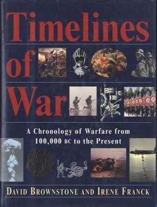
authors: Browstone, David M. ()/Franck, Irene (): - Timelines of war : a chronology of warfare from 100,000 B.C. to the present (1994) [Little, Brown and Company; Boston/New York/Toronto/London; p.562; 29cm] -> - Van Tijen Home/Amsterdam: |
Displaying time in a list, or a succession of horizontal strips, is something that can quiet easily be translated into book pages, but combing the factor of time with the factor of space is less easy. In my opinion Brownstone and Franck did not succeed, though their basic concept of displaying time horizontal in rows and representing space vertically in columns, with each column grouping a few world areas, was a good start. As not the whole world has been at war at all time, blank spaces appear where there is no event, so no text, but as the text length of historical event needed to be described vary, there is no great meaning in blank parts on a page. Also, for practical reasons, the width of the text column varies and so the meaning of space in the columns gets an unnecessary extra layer by having wider and smaller columns.
It is clear that some kind of visual statistic material with icons or simple bars could have been used in combination with text to make this half success book into something good. You may study the basic concepts of Otto Neurath and his 'isotype' system and try to imagine how his ideas could have been applied to this book.
29-11-2003 - 08-01-2004 tj.
linking theatres of war through time
War continues to be one of humankind's chief occupations and preoccupations; we celebrate the end of the Cold War and the emergence of a score of newly freed nations in a huge territory that stretches from the Danube to the Pacific, and see civil wars break out in Bosnia and Georgia, resurgent wars in Angola and Rwanda, growing insurrection in northern India, and continuing low-level wars and lew threats of war in scores of other countries. War continues to be endemic, a long, continuing worldwide plague that in our time of nuclear, chemical, and biological weaponry can very well end in destroying the human race. Yet it is also one of humankind's most enduring activities; to be chronicled, studied, dissected, and reduced to its elements so that it may be better understood and better controlled, even though the creation of a world fully at peace may be very difficult for some time to come.
Timelines of War is a chronology of the wars, revolutions, battles, leaders, and weapons that have played such an enormous role in human history, from Megiddo, the rise of Assyria, the siege of Troy, and the century-long Chinese-Hun war 2,000 years ago to the massive world wars, revolutions, and superpower conflicts that have dominated the life of our century; and from Alexander, Caesar, Genghis Khan, Napoleon, Shaka, Elsenhower, and Schwarzkopf to Salamis, Cannae, Waterloo, Gettysburg, Ypres, Normandy, and Iraq. Also included are landmarks in the development and introduction of weapons, and war-related developments in science, technology, and medicine. Peace is to some extent covered, as well, in the form of a considerable number of treaties, such international organizations as the League of Nations and the United Nations, and key peace movements.
Timelines of War is organized chronologically, from the earUest to the most recent times. In early sections, entries are grouped into time periods, such as centuries and later lecades. Then, from 1700 on, the information is carried year-by-year. The work is also organized geographically, in four parallel columns lined up across each two-page spread, so that the reader can link or compare events and people across the whole world in any given period.
With this organization, all the theaters of war can be linked chronologically and geographically, as for example during the Napoleonic Wars or the two 20th-century world wars, or earlier during the Greco-Persian Wars, the Roman-Carthaginian Wars, or the Mongol conquests. Similarly, this organization provides a fascinating look at four-centuries-long European invasion and conquest of the Americas, the centuries-long European conquests of Africa and much of Asia, and the long struggle for dominance in Europe.
[pi, preface; Browstone (1994) Timelines of war]

| 1 | 4 |
|
authors: Chalk, Frank (1937-)/Jonassohn, Kurt (): - The history and sociology of genocide : analyses and case studies (1990) [Yale University Press; New Haven, CT [etc.]; p.461; 24 cm] -> - University Library Amsterdam: H91-366 - Erasmus University Library Rotterdam: 662 G 13 - Amazon.com product information with digital facsimile of: cover, colophon, chapters, intro-pages, excerpt, index, back-cover http://www.amazon.com/... |
The problem of what should be labeled genocide or not come well to light in the introduction of the book. The authors choose for instance to exclude the victims of mass aerial bombardments in the Second World War, be they British, German or Japanese, which leaves at least one million people whose death have purposely been planned out of the 'genocidal picture'. The book has been published in 1990 and since we have been made to understand that genocide is not only something that needs to be done or instigated by states or state associated authorities. The Rwanda killings may have been led and provoked by the medium of radio, but a great part of the population have participated in the actual killing without having access to modern weapons at all. When there is a wish to kill anything goes... be it with bare hands, household or agricultural appliances or the 'ecological' way of Cambodian killing of bashing the heads of small victims against a tree by swinging them by their feet...
We tend to be focussed by the notion of 'weapons of mass destruction' and we should fear these for sure, but let us not forget that not modern machinery is the cause of all evil, but humans themselves; the 'human machinery' that build great walls and pyramids has used that manual capacity for mass killing as well.
01-12-2003 - 08-01-2004 tj.
with the intent to destroy
We have considered the utility of coining a new term and have rejected this possibility partly because we have not been able to think of an adequate alternate term and partly because the term genocide is by now so widely accepted. For the purposes of our research we have adopted the following definition: - Genocide is a form of one-sided mass killing in which a state or other authority intends to destroy a group, as that group and membership in it are defined by the perpetrator. - The terms of this definition require some comment. We start with a form of one-sided killing because we want to emphasize that there are many forms of_ mass killings and that we are proposing to deal with only one of them. We emphasize one-sided to indicate that we are dealing with cases in which there is no reciprocity; while the perpetrator intends to wipe out the victim group, the latter have no such plans. The term mass killing is meant to denote those cases in which all of the members of a group were labeled as victims, notwithstanding the fact that historically the extermination of 100 percent of a victim group is very rare. A distinction must be made here between the intent to destroy all of the members of a victim group and the empirical methods by which this may be achieved. We mean to exclude from consideration here those cases of mass killing, massacres, riots, and so forth that had a lesser aim, no matter how objectionable such cases are. The term one-sided mass killing is also essential in order to exclude from our analysis the casualties of war, whether military or civilian. When countries are at war, neither side is defenseless. Although individually the civilians may be defenseless, they are part of the group or nation that is at war. In our analysis, the group is the operable unit of analysis because we are concerned with the behavior of groups rather than individuals. Although our case materials include genocides that occurred during or after a war, these are not to be interpreted as exceptions because they do not concern the victims of combat.
[p.23-24, The conceptual framework...; Chalk (1990) The history and sociology of genocide]
genocide definition that excludes civilian victims
efinition of genocide also excludes civilian victims of aerial bombardment in belligerent states. In this we differ from Jean-Paul Sartre and Leo Kuper. Kuper writes, "I cannot accept the view that. . . the bombing, in time of war, of such civilian enemy populations as those of Hiroshima, Nagasaki, Hamburg, and Dresden does not constitute genocide within the terms of the (UN) convention" (Kuper 1981,1985). We base our dissenting position on the fact that in this age of total war belligerent states make all enemy-occupied territory part of the theater of operations regardless of the presence of civilians. Civilians are regarded as combatants so long as their governments control the cities in which they reside. This practice was started by the Italians and the Germans, and it "became the practice of both sides in World War II. It seems unfair to single out the Allies for their bombings without mentioning Guernica and Warsaw, Rotterdam dam and Brest, and Rouen and London. On the other hand, the rules of war clearly entittle enemy civilians living in territory occupied by the victor to certain protections, including freedom from arbitrary killing, which would seem to place the Nazi killing of Jews, Gypsies, and others in a quite different category from wartime bombings. In taking this view, we find ourselves in agreement with Telford Taylor, who has written, (Hiroshima and Nagasaki, Hamburg and Dresden) were certainly not "genocides" within the meaning of the Convention, which limits genocide to "acts committed with intent to destroy . . . a national, ethnical, racial or religious group, as such." Berlin, London and Tokyo were not bombed because their inhabitants were German, English or Japanese, but because ' they were enemy strongholds. Accordingly, the killing ceased when the ended and there was no longer any enemy.
[p24-25, The conceptual framework...; Chalk (1990) The history and sociology of genocide]
excluded victims
o the extent that a group of people has been targeted by the perpetrator, it is of crucial importance to these victims whether membership has been defined by the perpetrator as voluntary or as ascribed. Thus, individual Armenians sometimes could have saved themselves by converting to Islam, whereas the Nazis defined Jews in racial laws that left no room for individual decisions to opt out. Because our definition leaves open the nature of the victim group, it allows the inclusion of groups that were excluded from the UN Convention. Further, it allows the inclusion of groups that had not previously been considered under the UN Convention as potential victim groups (for example, the retarded, the mentally ill, and homosexuals, as in Nazi Germany, or city dwellers in Pol Pot's Cambodia) and groups that have no existence outside a perpetrator's imagination (for example, demonic witches in Western Europe and "wreckers" and "enemies of the people" in Stalin's Russia), but whose fate was no less tragic, for all that.
[p.25-26, Conceptual framework...; Chalk (1990) The history and sociology of genocide]
the authority to kill
'Genocides are always performed by a state or other authority. In the twentieth century, the perpetrator is almost always the state because authority and power are highly centralized and the modem means of communication are so efficient that such centralization can be effectively imposed. The addition of 'or other authority' was found necessary to deal with some cases in which the perpetrator was a local authority other than the state.
[p.26, Conceptual framework...; Chalk (1990) The history and sociology of genocide]
vague or ambiguous terminology
A more serious problem is raised by the moral loading attached to the term. Western liberalism, as it has developed since the Enlightenment, raises the issue of moral relativism in historical and comparative studies. Thus, we take it for granted today that we are all against genocide whenever and wherever it occurred. But this obscures our knowledge of how it was perceived by contemporaries. In some societies, it was perceived as cruel and harsh punishment, even by the standards of the day In other societies, it was fatalistically accepted as the fate of the losers and the weak. There were even societies in which it was seen�at least by the perpetrators�as the just and justified outcome of previous actions. But since the late Middle Ages, it has increasingly been thought of as inconsistent with the values and attributes of a fully human society. This inconsistency has resulted until recently in what we have called the collective denial of the prevalence of genocidal events; that is, the ignoring of these events in historical reporting or their glossing over by the use of vague or ambiguous terminology. From the perspective of the victims, the most prevalent perception seems to have been a fatalistic acceptance that is hard to understand in the post-Holocaust era with its increasing emphasis on equality and human rights. Our current existential, or even future-oriented, Zeitgeist makes it difficult to appreciate the bullishness of values and living conditions and the acceptance of inequality throughout most of human history. Life was short, disease was rampant, and food, clothing, and shelter were almost always problematic�even at a minimal level. In many cultures, improvements were not looked for or expected in this life, but rather in the afterlife or in another incarnation. Thus, the terrible things that happened to people were accepted as being in the nature of life in this "vale of tears."
[p.27, Conceptual framework...; Chalk (1990) The history and sociology of genocide]
have the city vanish from the very sight...
Sennacherib reached the limits of despotic willfulness when, in 689 B.C. he made up his mind to erase rebellious Babylon from the face of the earth. Having forced his way into the city, he slaughtered the inhabitants one by one, until the dead clogged the streets. Private dwellings were methodically destroyed. The towered temple of E-saglia was toppled into the Arachtu canal. Finally, water was diverted into the city, and streets, squares, and houses were drowned in the artificial flood. Even then Sennacherib's lust was not appeased. He would have the city vanish, at least symbolically, from the very sight of mankind. To this end he caused loads of Babylonian earth to be loaded on boats and carried to Tilmun, where they were scattered to the four winds.
[p.59, On cases from antiquity, quoting Ceram, 306; Chalk (1990) The history and sociology of genocide]
no report of failures
Are we to take such information at face value? In the case of Assyria most of it comes from inscriptions, many of which were so placed that they were unlikely to be read by ordinary mortals, that is, on the foundations of buildings or high up on the face of a mountain. Some archeologists have argued that such official inscriptions were meant to be personal reports of the king to Assur. Like some contemporary administrators, they reported their achievements, but not their failures and even falsified their reports by tuning failures into achievements. Perhaps the most noteworthy example of this kind of reporting comes to us from Egyptian history: it concerns the purported victory of the Egyptians under Ramses II over the Hittites. The report was widely accepted as factual until the lost capital of the Hittites was discovered in the nineteenth century, and evidence surfaced that it was really the Hittites who had won. Much later, following their last war the capital of the Hittites was not only destroyed but also burned. As a result, the clay tablets in their archives were baked and thus well preserved for posterity. These records were eventually deciphered and found to contain not only the Hittites' version of the battle, but also copies of the peace treaty signed with Egypt, Scholars now agree that the Egyptian version of the battle was probably written even before it took place because it was unthinkable that a court historian would report that Ramses should have lost a battle. In fact, following their victory, it was the Hittites who wrote the first "modem" peace treaty. This treaty considered the two warring empires as equals and even included an exchange of prisoners, an unprecedented sign of mutual respect. Indeed, the treaty was so successful that it resulted in seventy-five years of peace between the Hittites and the Egyptians.
[p.59-60, ON CASES FROM ANTIQUITY; Chalk (1990) The history and sociology of genocide]
we really need an archeology of genocide
The evidence for genocide in antiquity is circumstantial, inferential, and ambiguous, and it comes to us exclusively from the perpetrators. We believe that genocide was a relatively common event, for the following reasons:
(1) whole empires and peoples have disappeared, and it seems very unlikely that all of them could have disappeared in a short time solely through enslavement and/or assimilation; (2) the reports of extreme cruelty (judged by modem standards) and of extermination are common enough to suggest that such events were not considered to be extraordinary; (3) the religions of most societies in antiquity, as different as they were in other respects, commanded their adherents to exterminate certain groups of nonbelievers or enemies; and (4) since the nineteenth century a great many destroyed cities have been excavated without producing evidence of what happened to their populations; many of these sites are hills, or tels, representing a succession of cities built on the same site, each one built after the previous one had been destroyed. Hardly any of them seem to produce information about what happened to their population - which reinforces the thought that we really do need an archeology of genocide.
[p.64, ON CASES FROM ANTIQUITY; Chalk (1990) The history and sociology of genocide]
the success of the inquisition till today
While the very success of the Inquisition did inestimable damage to the Church, its methods of terror and persecution have been used and abused up to the present day. These methods were not only new, but also so successful that the have been copied by totalitarian regimes ever since. The main features of these methods are:
l. Making the denunciation of fellow citizens an obligation that takes precedence over ties of family and kinship; 2. Extracting confessions by imprisonment and torture; 3. Making the naming of fellow conspirators an essential part of confessions; 4. Defining the retraction of extorted confessions as a relapse and therefore a proof of guilt; and 5. In some cases, separating the proof of heresy or opposition from the execution of the penalty. The Inquisition handed over its convicted heretics to the secular arm for punishment just as, hundreds of years later, during Stalin's purges of the Communist party, party members were often deprived of their membership and then handed over to the NKVD for punishment.
[p.114-115, The Albigensian crusades and the Knights of the Temple; Chalk (1990) The history and sociology of genocide]

| 1 | 9 |
|
author: Elliot, Gil (1931-): - Twentieth century book of the dead (1972) [Allen Lane The Penguin Press; London; p.242] -> - University Library Amsterdam: UBM: H 73-96 - Erasmus University Library Rotterdam: 427 B 20 - University of Hawaii: Rummel 'Democide' web-site (reference & comment by the expert on statistics of human violence R.J. Rummel on Gil Elliot. ) http://www.hawaii.edu/... - Air & Space Power Chronicle web-site (Article published in "Aerospace Power Journal - Fall� 2001" quoting Elliot.) http://www.airpower.maxwell.af.mil/... - London School of Economics: Center for the Study of Global Governance (Public Lecture by Carla Del Ponte, Prosecutor, International Criminal Tribunal for the Former Yugoslavia given at the London School of Economics on 20 October 2003; she makes a reference to Gil Elliot's book and notes "until recently, one stood a much better chance of being tried for the murder of one person than for the massacre of thousands.") http://www.lse.ac.uk/... |
Why all the specialist in the world have not been able to write such a global overview of human violence and have left the task to a non specialist and outsider? It may be that they kept swimming in seas of conflicting facts and lacked the courage to make statements, come to conclusions on the basis of uncertainties, because there is no other way (one has to get out of the water to see the sea). At many instances in the book the author can only use sarcasm when he contrasts his attempts to make a "simple view of the whole" with the rules and etiquette of the learned world. He dares to speak, in this context, about "significance of life", "love and sex" and his own "feelings about death" ("these are not nuts for the learned squirrel" p.14).
Elliot does not limit himself to the big number game of macro violence, he contrasts it with sampled stories of individuals. constructed from a variety of sources. So we get to know in a series of almost literary sketches, personalities like 'the European soldier in the First World War', 'a Russian civilian in the Second World War', the story of a Chinese man in the total war machine, and what happens to a Polish Jew in the machine of death.
It was almost thirty years ago that I did read Elliot's book for the first time and it learned me to widen my perspective on war and other forms of human violence to shift my focus from the apparent death instruments of guns and bombs to the much greater killer effects of disruption of social structures, famine, people dying while being transported... I made me read local Dutch history in a different way, putting in focus the 22 thousand deaths in the Netherlands during the Second World war in what has been misnamed as 'de hongerwinter' (the hunger-winter) but lasted much longer, even till after 'liberation' in 1945 (as a comparison: the German bombardment of the city of Rotterdam in 1940 costs 886 lives; and the real big number of a 100 thousand Jews from the Netherlands killed, 72% of an estimated 140.000!).
Elliot uses the model of a pyramid to visualize the number of victims produced by human violence: at the small top acts of war like bombing and shelling; next executions, massacres and reprisals; next industrial extermination methods, mainly used against Jews; and at the wide base the greatest numbers, dying of immediate privation during attack and siege and at the very bottom the even greater dealdy effects of long term deprivation (p.58).
In my mind I often have associated the visual statistic system as developed by Otto Neurath, the 'isotype', with this study of Elliot, as his diagram are bare bone and some of his information may be better communicated by a system of visual mapping, allowing for multiple comparisons, something now missing with only a few graphs and digrams dispersed over the pages of a book.
Till this day Elliot's book has remained a classic example, a core book for those who want or need to come to some understanding of our violent times. He is quoted by R.J. Rummel in his studies on 'democide' (murder of population by government) aknowledging his pioneer work, but also commenting about Elliot's supposed blank spot ' "killing by Marxists governments"
(1). For quiet different reasons a retired United Sates Air Force colonel in a recent study on "Precision Air Power", uses Elliot's estimate of total deaths by aerial bombardments (1 million) to argue that precision air power "will win wars faster and with less cost in human lives".
(2) Last Elliot was quoted in octobre 2003 in a lecture by the prosecutor of the International Criminal Tribunal for the Former YugoslaviaCarla Del Ponte: "the number of man-made deaths ... is about one hundred million." Still, it has often been noted that, until recently, one stood a much better chance of being tried for the murder of one person than for the massacre of thousands.
07-11-2003 - 08-01-2004 tj.
human beings marginalized
HISTORY AND THE DEAD THE number of man-made deaths in the twentieth century is about one hundred million. Men, women and children each make up a substantial proportion of that total. A more accurate figure would depend on the particular definition of 'man-made death'. But in any reasonable meaning of the "/phrase it cannot be less than eighty million, it is unlikely to be much more than a hundred and fifty million. To set such a figure against the scale of violence in previous times involves the difficulties of comparing like periods and of allowing for population increase. However, every attempt to do so shows the twentieth century to be incomparably the more violent period.
It is possible - in my view, certain - that in a future perspective this explosion of human lives will be seen as the significant 'history' of our period. Yet the events which have accumulated to form this history - millions upon millions of individual violent deaths - are often recorded in historical footnotes or in quickly read and rather meaningless statistics. Many written histories don't even mention them, although dealing in detail with the events that led up to and followed them. A historian might record the 'cost' of a campaign in China in the 1930s (or Biafra in the 1960s) as follows: Casualties (deaths) Military = 29.638 Civilian = Unknown, possibly several million Since the only records of casualties are kept by those who incur and cause them, the likeliest source of such figures would be a military commander. However confused and inaccurate the methods of his units in counting the dead and wounded, they would produce a tidy official figure because that is what is required of them. The civilian dead would be, for him, marginal to his main interest and for them he would be content to return ; an 'unofficial estimate'. The historian knows very well that several million deaths must be a phenomenon of enormous significance. Recorded in the above form, however, they appear as a casual effect of some larger event. The impression is encouraged by the vagueness of the figure and its unofficial (unreal?) status. It certainly does not have the crisp reality of that '29.638'. The reader might even have an unconscious admiration for the humanity of these last three digits - every last man counted! - although in fact they are the product of bureaucratic necessity. And, of course, it is perfectly easy to visualize the brave soldiers falling in battle. But what exactly is a Chinese or Biafran peasant, and how can one guess at the manner of his or her death - did he die of starvation or disease? did he get in the way of the guns?
This lack of historical focus on those who get themselves killed is to be found also in the campaign and other histories of the two world wars. Many of these are remarkable for an almost total absence of human beings. They describe the struggles of the tanks, guns, battalions, supplies, barbed wire, divisions. The phrase 'hideous carnage' - compulsively used to denote the effects of battle - curiously underscores the absence of the human image by mingling its meaty flavours with the smell of cordite, the shapes of twisted metal, the messes of mud and masonry. The dead take their place, along with burnt-out tanks and empty petrol cans, among the waste material of history. The common effect of these tendencies is to perpetuate a 'cost' or' balance-sheet' view of casualties - appropriate to small military operations in areas where violent death has occurred on a vast scale. The taking of life loses its meaning, the significance of scale is deprived of any value, and human beings are marginalized in the record of human affairs. In case it is thought that war historians are especially callous, it is worth pointing to a widespread degeneracy in this respect in writings of the last fifty years. Some of the most notable pacifist works of the period are equally short on human beings. There r seems to have been a general lack of confidence in the nature of the species, an embarrassed reluctance to give it more than passing mention.
[p1-3; Elliot (1972) Twentieth century book of the dead]
understanding the moral significance of scale
What is the moral context in which we should see those killed by violence? There exists a view that one violent death has the same moral value as a thousand or a million deaths. Presumably 'moral value', in this view, is kept in jars of concentrated essence on the shelves of philosophers, or in the divine pantry. The killer cannot add to his sin by committing more than one murder. However, every victim of murder would claim, if he could, that his death had a separate moral value. Thus there is an accretion of moral significance in quantity of deaths. There is no doubt that this is difficult for the imagination to compute. After a certain stage in assimilating casualties, the rest seems an ( indigestible piling-on of horror and numbers. So long as the moral significance of scale is not understood, only the crudest relationships can be made in the discussion of macro-violence: the Nazis were wicked, Stalin was a monster, and so forth. How then are we to understand scale? As we have seen, it is absurd to look upon the hundred million or so man-made deaths of the twentieth century as the 'cost' of conflict, as though they were the casualty returns of a field commander. They are more directly comparable with the scale of death from disease and plague which was the accepted norm before this century. Indeed, man-made death has largely replaced these as a source of untimely death. This is the kind of change that Hegel meant when he said that a quantitative change, if large enough, could bring about a qualitative change. The quality of this particular change becomes clear if we connect the present total of deaths with the scale of death inherent in the weapons now possessed by the large powers. Nuclear strategists talk in terms of hundreds of millions of deaths, of the destruction of whole nations and even of the entire human race. The moral significance is inescapable. If morality refers to relations between individuals, or between the individual and society, then there can be no more fundamental moral issue than the continuing survival of individuals and societies. The scale of man-made death is the central moral as well as material fact of Our time. The 'historical necessity' of Marxist materialism as well as the individual morality of Christianity must bow to its significance.
[p.5-6; Elliot (1972) Twentieth century book of the dead]
paradox of saving and destroying human life
he ancient books of the dead were in a sense concerned with public death. For the afterlife was an extension of the public domain. It was part of the official ambience of society. Our societies are dedicated to the preservation and care of life. Official concern ceases at death, the rest is private. Public death was first recognized as a matter of civilized concern in the nineteenth century, when some health workers decided that untimely death was a question between men and society, not between men and God. Infant mortality and endemic disease became matters of social responsibility. Since then, and for that reason, millions of lives have been saved. They are not saved by accident or goodwill. Human life is daily deliberately protected from nature by accepted practices of hygiene and medical care, by the control of living conditions and the guidance of human relationships. Mortality statistics are constantly examined to see if the causes of death reveal any areas needing special attention. Because of the success of these practices, the area of public death has, in advanced societies, been taken over by man-made death - once an insignificant or 'merged' part of the spectrum, now almost the whole. When policians, in tones of grave wonder, characterize our age as one of vast effort in saving human life, and enormous vigour in destroying it, they seem to feel thjey are indicating some mysterious pardox of the human spirit. There is no paradox and no mystery. The difference is that one area of public death has been tackled and secured by the forces of reason; the other has not.
[p.7-8; Elliot (1972) Twentieth century book of the dead]
identifying twentieth century violent death
The Egyptian and Tibetan books of the dead are works of necromancy. They are concerned with questions such as the raising of the dead, the prescription of right behavior for the soul after death. They unify life and death by mystifying the distinction between them. In reading them we are offered a temporary liberation from the normal distinctions between external and inner truth. This book of the twentieth-century dead is, on the contrary, a work of necrology. Necrology simply means a naming or listing of the dead. The aim of this work, precisely, is to identify, against a background of knowable fact, the violent dead of the twentieth century in terms of the historical and moral values of a continuing world society. Part of its task is to demystify. It offers to reconcile life and death only by emphasizing the difference between them.
[p.11-12; Elliot (1972) Twentieth century book of the dead]
identities obscured by the myths of politics, race and class
The most satisfactory way of naming the dead is the inscription of their names on some commemorative surface such as a tombstone, a plaque, a brass or paper roll or even a newspaper column. The simplest memento mori is the best: seeing the name alone we can identify in the most realistic way with human death. In a country churchyard in peaceful times, I can take the names on the tombstones as a sample of the world, and a symbol of my own end. In a similar uncomplex situation, if I look at the names of the military dead, their titles tell me that they died in a special way, which I can comprehend in that same fundamental pattern of relating myself to the world. But to relate myself to the violent dead of the twentieth century ... when the numbers run into millions ... when the manner of their deaths is so full of the complex and the unknown ... when their identities, not preponderantly military, male, young but a mixture of civilian, female, male, children, military, old, young - when their identities are obscured by the myths of old, young - when their identities are obscured by the myths of politics, race, class ... How can I relate to this complexity?
[p.13; Elliot (1972) Twentieth century book of the dead]
violence is an event not a condition
Much of what is written about violence is based on theories and attitudes extraneous to violence, and I cannot think of anything more lacking and more necessary to the study of violence than a discipline based on the facts of violence. All kinds of intangible notions - such as guilt, brutality, motives, psychological disturbance - are put forward as being the 'facts' of violence, but violence is an event, not a condition. Violence is always an event, some say it is the most decisive kind of event possible. Where violence is perpetrated upon human beings, the basic computation of the event is the number of human beings damaged or killed. The numbers left by the records are seldom accurate, but when we climb into the regions of macro-violence we can at least distinguish between an order of magnitude of one million and five million, and achieve a certain perspective of scale. All the figures used in the text are orders of magnitude, not definitive or precise figures. Their sources are explained in all cases in the Statistical Appendix. The table on page 215 sets out the basic breakdown as I have calculated it, and in a sense all that follows is a further amplification of that table.
[p.15-16; Elliot (1972) Twentieth century book of the dead]
the city of the dead of the future is our city
Aerial Bombing The number of deaths may be a good deal in excess of the one million I have calculated, but it is most unlikely to be more than two million. The peak level of deaths for an individual city is about 200,000 and the main victims were Dresden, Hiroshima and Nagasaki, chief targets of Allied terror-bombing in the Second World War. The deliberate bombing of civilians was the chief source of deaths in volume, and other cities attacked in this way during the Second World War (including the Sino-Japanese war) were: Coventry and other English cities, Rotterdam and other Dutch cities; Warsaw and other Polish cities; Stalingrad and other Russian cities; Shanghai and other Chinese cities Frankfurt and other German cities, Tokyo and other Japanese cities. In the bombing of cities the technologies of violence are destroying the technologies of peace. In the early days, bombing was similar to the shelling of a city, that is the city happened to crop up the strategic plans. By the time we reach the atom bomb, Hiroshima and Nagasaki, the ease of access to target and the instant nature of macro-impact mean that both the choice of city and the identity of the victim has become completely randomized, and human technology has reached a final platform , of self-destructiveness. The great cities of the dead, in numbers, remain Verdun, Leningrad and Auschwitz. But at Hiroshima and Nagasaki the 'city of the dead' is finally transformed from a metaphor into a literal reality. The city of the dead of the future is our city and the victims are - not French and German soldiers, nor Russian citizens, nor Jews - but all of us without reference to specific identity.
[p.138-139; Elliot (1972) Twentieth century book of the dead]
the emptiness of the moment of death
The human body is universal, but that does not make it a planet of flesh. The body of suffering is universal: that does not mean it is an emaciated monster. The universal body of dying is neither a stranded whale of agony nor a zombie of living death. It is true that some people have perceived, in the remains of the death camps, in the uncovered execution pits, in the corpse high battlefields, a monstrous body of death, but they have never managed to give it any meaning except in terms of negation and emptiness: the persuasive meaninglessness of the quantitative vision that created these horrors in the first place. The universal body of death is not expressible in terms of factitious quantities. It would be possible to quantify and describe the suffering, dying and dead bodies without once touching on the focal point of the death process, the moment of death. What expertise might be erected over this emptiness! What pale fluttering mortqueans* might jargon in on the subject, to explain to us what death (reduced by skeletal diagrams to physiological processes) is, to scientize and consumerize, to branch out as death counsellors advising tranquillizers and regular healthy visits to the cemetery- (...)
* mortqueans another of Elliot's new (cynical) words (pronounce mor'kwin or mort'quean) a specialist on 'public death' who will be able to explain to us why, because of our "lovely security" we do invest in "missile systems, germ warfare and big bombs", like specialist who can inform us about life insurances and mortages. But as these specialists do not exist yet, Elliot concludes: "it may well be necessary to invent them". (note tj. see also p.13-14)
[p.145-46; Elliot (1972) Twentieth century book of the dead]
the identities of the dead are finally randomized
You do not have to feel that particular emotion. The mind will tell you all you need to know, not from a train window for now the mind is in the cities of the dead and you can't see a city from the outside. Things happen so quickly in the city Dresden random incineration. It's all over says the surgeon burning boys, time heals over fast like an evening at the cinema, families bombed, blasted and burned, don't lay it on too thick he says in his white coat enjoying his tea somewhere else. Just one day and night of terror in Nagasaki, a spot in that ancient dark but it lingers, cripples the future. The city lays down its dead Babi Yar shoot and fall cover over shoot and fall cover over crawl shoot the act is done and burned but the layers remain. The city is knowledge. Each angled street comer is an abstraction or an algebra. Every traffic crossing, shop location, service point is a draft, a calculation, a geometry. The city is not uneasy with concepts and questions, it demands and devours them unsurprised. Stalingrad is mechanthropoid**, and Passchendaele***, from the generating slime of explosives the stumps of houses and trees are the same inverted puzzles as the stumps of people that sprout from Hiroshima, the new inverted people of death. The city is self-knowledge, an enclosure of self-observation. In the city of the dead all the technologies of death are seen in action, in Warsaw bombs and shells, the cycle of occupation and resistance and massacre, ghetto attrition, insurrection in the sewers. Every system and concept is used until the identities of the dead are finally randomized, so that we know as we walk about enclosed in its streets and concrete and signs and traffic and movement and cafes that the city is not someone else but ourselves. Warsaw knows that its ghettoes are emptied into Treblinka and Treblinka knows its gassed bodies are the same as the fallen of the Somme. And finally no longer needing to pretend not to know what we know we realize the same consciousness of death in the three great representative metropolises of the dead, Verdun, Leningrad and Auschwitz. Indeed we may not remember a dozen cities in any country as well as we know these twelve cities from the nation of the dead. Must this consciousness of death leave us (citadel of the mind typical of the modem city!) alone in a room where everything in the head, the angles and crossings and locations shrink to repetitive spots before the eyes, a dizziness of stopped machinery tempting us to merge swooning and mindless into concrete, grey ghosts of ourselves in the City of Death?
* Babi Yar ravine near the Ukrainian town Kiev where between 1941 and 1943 a 100.000 Jews have been massacred by the German special troops with the help of special local Urkrainian police forces. The massacres started in retaliation for a bomb attack on German head quarters in Kiev that later proved to be the work of the Soviet secret police. (note tj.)
** mechanthropoid mechantropic, a word coined by Elliot (see p.47) meaning the ascription of human traits or charasteristics to machines, like in 'theanthropic' human charestics of a god or gods (note tj.)
*** Passchendaele a ridge and small village in the landscape near Ypres in the south of Belgium, a name that hides bigger horrors than Hiroshima and Nagasaki: here a hopeless batlle raged from spring to autumn 1917 between British and German troops leaving over 300.000 soldiers dead. It was also the battle field where the German army used chemical warfare (mostard gas). often this battle is described with all kind of details of the number of canons (3000) and shells fired (over 4 million), leaving the reader to imagine the carnage of the 100.000 that paid with their lifes. (note tj.)
[p.192 -193; Elliot (1972) Twentieth century book of the dead]
science supporting the sacred ritual of terror
... Whether expressed by Whitman, Jefferson or Hollywood, the American Dream is an essential life-myth of the people. We should find another name for it, less specific to America, for it is unique as secular myth, a classic model. Secular myth in this sense is distinct from sacred myth, which is a governing myth (whether manipulated by religion or the state), self-protective and inquestionable except by iconoclasm and violent overthrow. Secular myth comes from the people and in countries apart from America is known as ' folk-myth' to keep it in its place. The fictive element in secular myth is less formalized and, although manipulable, is self-critical and subject to the intrusion of fact, hence it implies a new relationship between fact and fiction. Secular myth has two critical properties, the first being that in a society with certain freedoms and drives it is inevitable. It is an accretion of dreams, if you like a city of dreams which exists simply because there are people in the city. Thus it is existential in nature where sacred myth is or tends to become functional in essence. The second property is that, perhaps like sacred myth but in a different way, secular myth has monstrous proclivities. It grows untrammelled, it has uncontrolled appetites, it devours and consumes that which feeds it. 193 It will be conceded I think that the American Dream has these properties. Indeed America seems to keep at least a brace of her , most valiant writers in constant harassment of the monster harrying, keeping at bay, tactically wounding, trimming, stunning but never quite attempting the futile exercise of destruction. Now, religious and state power structures have in the past been based on central control of the life and death of the subject, supported by a sacred myth of the power of life-and-death. The American Dream has been conspicuously successful, as a life myth, in displacing the power of the state to control the life of the subject. But it has ignored the connection between life and death. The American Government has less control than others over the life of the subject but now finds itself with an absolute control over the death and hence indirectly over the life of its people. Only when the death-myth has been secularized, like the life-myth, shall we begin to break down the critical tensions still structuring the mystique of power. Long, long ago the mystique of power passed from religion to the state. But for a long time thereafter it was supported by the sacred myth supplied by religion. Now science has got itself into the position of supporting the state mystique with a sacred ritual of terror based on bombs, bacteria and other technologies of death. And imitated as I believe by those writers and thinkers who retreat into a spiritual City of Death which enshrines a new sacred myth, of death without life and of life fading without renewal. The Word of that myth is the logic of Total Death. And the nation of the dead is the death-myth of the people.
[p.193-194; Elliot (1972) Twentieth century book of the dead]

| 1 | 8 |
|
author: Etheringthon, Norman (): - Blainey revisited: has peace broken out in the 20th century? (2001)[In: "Thinking peace making peace"; edited by Hindess, Barry ()/Jolly, Margaret ()Academy of Social Sciences in Australia; Canberra; p.96; ISSN 1323-7136] -> - Academy of the Social Sciences in Australia (ASSA) (a PDF version can be downloaded here) http://www.assa.edu.au/... |
24-11-2003 - 08-01-2004 tj.
why does peace break out?
Thirty-one years ago, in Adelaide, I attended my first academic conference - not just my first in Australia - my first anywhere. Ken Inglis talked about the ANZAAC tradition. Geoff Blainey talked about the causes of peace. What stands out in my memory of Ken's talk are the pictures he showed of soldiers depicted on war memorials, the unsettling fragility of those stiff white marble effigies standing enigmatic guard at the crossroads of hundreds of little towns on the great Australian flatness. What I remember about Geoff's performance is the pleasure I experienced seeing a vast sweep of world history illuminated by the device of the unexpected question: Why does peace break out? It was all quite thrilling for someone newly arrived on a continent I had half-expected to be an intellectual Texas. I was young. My professors were Hugh Stretton and Trevor Wilson. I had come to a good place. What I did not see at the time were the connections between Inglis�s dead soldiers and Blainey�s ingenious speculations on peace. Nor did I reflect on the links between their themes and what was going on in the world around me - American soldiers on 'R&R' in Sydney; some students jailed for defying conscription, others occupying Vice- Chancellors� offices in the hope that they might - as one banner put it - stop the war by stopping the university. I found it normal and natural to live in a culture of war. I had been living in one all my life. Born on an army post on the eve of Pearl Harbour, dragged from school to school by a soldier father, educated at a university which trained half of LBJ's war cabinet, I had known no other world. Only in retrospect does it strike me that in the intervening years peace has broken out. In this paper I want to defend that proposition and explore some of its implications.
[p.7; Etheringthon (2001) Blainey revisite]
nobody keeps a count of the carnage
When war and war-related deaths are spread roughly on a graph across the whole century the spikes associated with the two world wars and the revolutions in Russia and China still dominate the grisly landscape. Compiled from Sivard, World Military and Social Expenditure, 1996. This pattern for the first six decades of the century is more precisely and dramatically charted in Gil Elliot�s remarkable Twentieth Century Book of the Dead. These are, of course, unimaginably awful statistics.
Unfortunately, anyone who wants to consider war and peace in historical perspective must enter the statistical hecatombs. Lumping the whole twentieth century together as an undifferentiated mass of wickedness is not helpful. While the numbers of discrete conflicts (numbers of wars, if you prefer) did not decline after 1945, the numbers of people killed fell precipitately. When I accepted the unexpected invitation to talk on this subject, my idea was to look back to Blainey and the other explanators of war in the hope of finding clues to the remarkable drop in the global death toll from war after 1945. A major problem was finding reliable figures.
I had na�vely supposed that some institute of peace or war would be keeping track of the annual carnage. I thought encyclopedia yearbooks would give me those numbers. Actually, nobody keeps a systematic count. The closest thing I could find to an organised death watch is Ruth Sivard�s World Military and Social Expenditures, now in its 16th edition. The object of this publication is to argue that the human race would be better off if we exchanged guns for butter. It does not count deaths in wars for their own sake, but in order to concentrate attention on the consequences of spending money on armaments.
Decade-by-decade figures can only be arrived at by extracting them from overall figures given for particular wars. A lot of the figures are suspiciously round (2 million dead in the Biafran war and its aftermath; 1.5 million lost in Bangladesh in 1971, including 250,000 deaths by smallpox). This chancy business cannot approach exactitude, but it does give a fair indication of trends. Which brings me back to the Twentieth Century Book of the Dead, in which Gil Elliot observes that 'counting the dead is not back-breaking work but the records are patchy and you have to think yourself through a morass of slippery doubts to the feeling that a figure is reliable.' Elliot's book appeared just a year prior to the book Blainey developed from the talk I heard. ( "The causes of war"; 1973 tj.) Both publications in turn formed part of a larger research effort which peaked in the 1970s. Much of it aimed at producing a scientific or at least social-scientific account of the causes of war. Significantly, Blainey associated his work with the larger enterprise by calling his book The Causes of War. Whether this was his own choice or his publisher�s, I regret the shift of emphasis away from his original arresting question about the causes of peace. As far as Blainey's own argument goes, the title did not much matter. His over-all conclusion was that the root cause of peace is simply the opposite of the cause of war. War comes when a diplomatic crisis 'cannot be solved because both sides have conflicting estimates of their bargaining power'. Peace comes when they reach agreement on their respective power.
[p.10-11; Etheringthon (2001) Blainey revisite]
The Myth of the Peaceful Savage
... even if we could reach reliable conclusions about the causes of war involving members of the European system, those might not cover the causes of other wars. Two notable exceptions spring to mind.
1. Wars not conducted by organised states. This is the subject of Lawrence Keeley�s recent book, War Before Civilization. Subtitled The Myth of the Peaceful Savage, it argues that conclusive archaeological and anthropological evidence attests to the persistence of deadly conflict in 'tribal societies' over several millennia. While Keeley explicitly rejects the idea that violence is rooted in human nature, he believes it to be more common and more deadly in its primitive versions. Taking as his example the figure of more than one hundred million deaths attributed to twentieth century organised war, he reckons: this appalling figure is twenty times smaller than the losses that might have resulted if the world�s population were still organised into bands, tribes, and chiefdoms. A typical tribal society lost about .5 per cent of its population in combat each year. Applying this casualty rate to the earth�s twentieth-century populations predicts more than 2 billion (milliard tj.) war deaths since 1900.
2. State-organised violence directed internally against the state�s own people. This is the phenomenon R J Rummel terms 'Democide'. He believes that twentieth-century compilations of war and war-related deaths (such as those in Sivard's World Military and Social Expenditures) give a misleading impression. By excluding interstate wars, and adding up the deaths caused principally by totalitarian regimes, he concludes that 'nearly 170 million people probably have been murdered by governments in this century; over four-times those killed in combat in all international and domestic wars during the same years'. While there is a powerful undercurrent of Cold Warrior anti-communism in Rummel's writing, he has a point. One implication of his argument is that no campaign against tanks, missiles and bombs could have substantially lessened the death toll from state sponsored violence against internal enemies. Another is that no existing explanation of the causes of war accounts for those deaths.
[p.12; Etheringthon (2001) Blainey revisite]
the Bomb as a peacemaker
One popular view holds that for four decades the Cold War and the nuclear 'balance of terror' stayed the hands of all the old warrior states. In the right-wing version of the theory, The Bomb was the peace-maker - the Nuclear Umbrella. In the left-wing version, fear of communism caused old antagonists to abandon imperialist competition. In the pacifist version, the whole period was a lucky break in which a catastrophic accident was - probably still is - waiting to happen.
[p.15; Etheringthon (2001) Blainey revisite]
Mao & Pol Pot mass-murderes motivated by idelogy
Another remarkable feature of the post-World War II period has been the decline in deaths in Rummel�s category of 'democide'. Mao�s China and Pol Pot�s Cambodia stand out as virtually the only mass murderers motivated by ideology after 1945. Why this should be so is hard to say. Have instant communications and world opinion made democide more difficult to get away with? It is probably fair to say democide is more easily practiced when war rages on a large scale. World War II threw up a dense fog of chaos concealing much of the Holocaust from public view. Similar chaos during and immediately following World War I made it harder to see the massacre of the Turkish Armenians. And it is worth remembering that without the World Wars there might have been no Bolshevik regime in power, no Holocaust, maybe even no Maoist government in China. It might be argued with even more confidence that the Vietnam War made Pol Pot possible.
[p.16; Etheringthon (2001) Blainey revisite]
neighbours slaughtered with agricultural implements
Most other megadeaths after 1945 are associated with civil warfare fuelled by ethnic and nationalist sentiment. These make up my categories 2, 3 and 4. Taken together, they contribute about half of all war-related deaths. While they are clearly the biggest killers, their relationship to old debates on the causes of war is unclear. None of them resulted from factors said to have been responsible for European wars in previous centuries. The deaths of kings, disturbances in the 'balance of power', scapegoat diversions engineered by unpopular rulers, and arms races had nothing to do with them. In contrast to the wars of old, these conflicts are associated with weak states, not strong ones. About half the deaths attributed to them occurred in three countries - Sudan, Nigeria and Bangladesh - which rate near the bottom of any list of military powers. Armies and modern weapons played very minor roles in these contests. In Rwanda, as in Pol Pot's Cambodia, people used agricultural implements to slaughter their neighbours. It may be that they belong in a category apart from War with a capital W. Like the Taiping rebellion (said to have cost 11 million lives in 19th century China), the Irish potato famine (1 million lives), and the Bengal famine of 1877-78 (5 million lives), they are to be explained in other ways. People who wish to stop them will have to seek other means than reducing armaments and strengthening international agencies for conflict resolution.
[p.16; Etheringthon (2001) Blainey revisite]
to kill the warrior spirit
It required not one but two convulsions of world war to kill the warrior spirit and warprone structures inherited from previous ages of feudalism and absolutism. The first war swept away the most dangerous dynasts - the Romanovs, Hapsburgs, Ottomans and Hohenzollerns. It did not remove the militarist ethos embedded in the monster conscript armies and officer corps of the old regimes. For that, a second and even more deadly conflagration was required; one that brought all the horrors of the battlefield into ordinary civilian homes and neighbourhoods. General Macarthur's constitution for occupied Japan neutered another military caste. However, so long as the Cold War endured, we could not know for sure that the soul of the old European militarism had not been merely transplanted to NATO�s headquarters. Now, it seems to me, there is room for cautious optimism that peace has really broken out in the world�s most dangerous bearpit.
[p.18; Etheringthon (2001) Blainey revisite]
a choir of cantors calling the names of wardead
The degree to which truly modern states have lost their taste for mass-destruction is illustrated by the recent behaviour of the United States. When bodies in bags began coming back from Somalia, President Clinton pulled out his Marines. When a monument was built to remember Vietnam, it consisted of marble slabs inscribed with the names of all the war dead. A century ago a warship was sunk in Havana Harbour and William Randolph Hearst's newspapers cried for a war to 'Remember the Maine'. A few weeks ago another US warship was nearly sunk in Aden Harbour. No one demands a war of vengeance. At the remembrance ceremony for the dead sailors President Clinton read out the names of each of man who perished. A choir of cantors would have to chant a hundred years to call the names of America�s previous wardead. How we are to prevent hand-held rifles and farm implements from facilitating atrocities in rural killing fields of Kosovo, Cambodia or Rwanda is another, quite different, question � one to which I can suggest no answers. But it is at least worth pointing out that the answer is unlikely to be found reading the entrails of Europe�s wars.
[p.19; Etheringthon (2001) Blainey revisite]
| 1 | 11 |
|
author: Kohn, George C. (): - Dictionary of wars (1986) [on the cover: "Who fought whom, when, where and why from 2000 BC to the present"; Facts on File; New York/Oxford; p.586] -> - University Library Amsterdam (An expended edition from 1999) : UB : Informatiecentrum: 904.70 R - Erasmus University Library Rotterdam (1986 edition) : 667 P 63 - Van Tijen Home/Amsterdam: |
As a whole the book is from 'a Western' point of view, so in many cases wars in certain world regions are only mentioned from the moment European or North American powers did get involved, but not always. A good exception is the very detailed sections on wars in what we (Europeans) tend to name the Middle East, and in Asia. Strange enough the pre-Columbian wars and conflicts in Middle and South Americas (Aztec and Inca empires) have very little treatment as if war did not exists here before the arrival of the Europeans.
Still this is a book that anyone wanting to get an understanding of the global problems of human violence need to have perused and not just once, to see beyond the singular cases as we get them presented by our daily news services. I myself have used the book for two projects, the first being an inventory of 'revolutionary moments' over the last three centuries for the project "Imaginary Museum of Revolutions" and for an inventory on aerial bombardments effecting civilians (since 1911); the project "Unbombing the World".
Of course one wishes that this data would be available in the form of a database, and even better that it would be put on-line, including interactive mapping and other fancy techniques of our era. Hopefully that day will not be far off.
21-04-2003 - 08-01-2004 tj.
the amazingly diverse conflicts of mankind
No one-volume reference work like this can possibly include every war. Space limitation preclude total comprehensiveness. Furthermore aling with a subject of so wide a range of time and territory�wars in all parts of the world from 2000 B.C. to the present�compels a certain subjectivity in choosing what to include and what to exclude. But I have still covered the entire sweep of the globe in selecting entries, and I feel that the presentation gives the reader a clear idea of the amazingly diverse conflicts which have plagued mankind. War has a long and intriguing history and has been a prominent feature of human existence ever since the day when rival men �or women�decided to settle their differences by use of force. In many instances, the history of a people is the history of its wars. I have defined war fairly broadly, to mean an overt, armed conflict carried on between nations or states (international war) or between parties, factions, or people in the same (civil war). There are multifarious reasons for war. International war usually arises from territorial disputes, injustice against people of one country by those of another, problems of race and prejudice, commercial and economic competition md coercion, envy of military might, or sheer upidity for conquest. Civil war generally results om rival claims for sovereign power in a state or from struggles to win political, civil, or religious liberties of some sort. An organized effort to seize power, to overthrow a government, or to escape oppression is frequently termed a rebellion, insurrection, uprising, or revolt, which, if successful, becomes known as a revolution. These kinds of conflicts, as well as conquests, invasions, sieges, massacres, raids, and key mutinies, are included in Dictionary of Wars. In addition, there are separate entries for a number of exceptionally complex and significant battles.
It is not the intention of this book to interpret conflicts; that is left to works of limited geographical and historical breadth. Of prime concern is the military information, although political, social, and cultural influences are often specified in order to gain a fuller, more understandable picture of a conflict. Emphasis is placed on gathering essential and pertinent facts into a reasonably smooth narrave. Each entry gives the name(s) of the conflict, the dates it spanned, how it began, the opposing sides involved, a concise description or summary of events, and the outcome or significance. In ddition, kings, emperors, generals, rebels, and so forth, when mentioned, are followed by their birth and death dates (or active dates).
[p.v, preface; Kohn (1986) Dictionary of wars]

| 1 | 5 |
|
author: Moeller, Susan D. (): - Compassion fatigue : how the media sell disease , famine , war and death (1999) [Rotledge; New York; p.390; 24 cm] -> - University Amsterdam: Institute 313 (Bushuis Bibliotheek) : 313: 05.30 236 |
12-12-2003 - 08-01-2004

|
author: Rummel, Rudolp Joseph (1932-): - Statistics of Democide: Genocide and Mass Murder Since 1900 (1998) [Lit Verlag; Munster/etc./London; p.544] -> - University Library Amsterdam (Will be ordered on my request in January 2004) : - University of Hawaii: Rummel 'Democide' web-site http://www.hawaii.edu/... |
`Statistics of Democide' has two purposes. First, it links all the relevant estimates, sources, and calculations for each of the case studies in Death by Government (`Demozid' - der befohlene Tod. Massenmorde im 20. Jahrhundert), and all additional cases of lesser democide for which data have been collected. The value of this is the listing of each source, its estimate, and comments qualifying the estimate. From these others can check and evaluate Rummel's totals, refine and correct them, and build on this comprehensive set of data. These data are presented and annotated for pre-20th century democide for the megamurderers and for the United States and lesser murderers. All data sources referenced in the democide tables are listed in the references. The methodological underpinnings for this collection have been given in Rummels previous work, i. e. Death by Government. Second, having finished collecting all these data and completing the major case studies Rummel finally could systematically test the assumed inverse relationship between democracy and democide. That is the substance of this book. Rummel details the tests and summarizes them. Conclusion is that the diverse tests are positive and robust, that the less liberal democracy and the more totalitarian a regime, the more likely it will commit democide. The closer to absolute power, the more a regime's disposition to murder one's subjects or foreigners multiplies. As far as this work is concerned, Rummel concludes: "it is empirically true that Power kills, absolute Power kills absolutely." R. J. Rummel is Professor Emeritus of Political Science, University of Hawaii.
01-12-2003 - 08-01-2004 tj.

| 1 | 11 |
|
author: Rummel, Rudolph Joseph (1932-): - Power kills : democracy as a method of nonviolence (1997) [Transaction Publishers; New Brunswick/London; p.246; 24 cm] -> - University Amsterdam: Institute 171: IM 213 - University of Hawaii (R.J. Rummel 'Democide' web-site: This is a critical review of two of Rummel's books by Ted Galen Carpenter: "Rummel makes an array of extraordinary claims, but he ultimately fails to prove his case." [" The Independent Review 2 (Winter 1998): 435-441]) http://www.mega.nu:8080/... - The Independent Institute, Oakland/USA (An institute that wants to foster independent non-biased research to go beyond the "pervasive partisan interests" of the day. This is Rummel's answer on the critique by Ted galen Carpenter) http://www.independent.org/... - UN Watch, Geneva (A speech by a Swedish Liberal Party Rummel supporter "How Democracy Prevents Civic Catastrophes By Per Ahlmark Former Deputy Prime Minister of Sweden Delivered to The European Liberal Democrats, European Parliament Krakow, 8 April 1999) http://www.unwatch.org/... |
more quotations from Rummel will come, also from his extensive website at the University of Hawaii.
08-12-2003 - 08-01-2004 tj.
an intentional revisitation of the Black Death
War has been a scourge of our species, one of the horses of the apocalypse. It has slaughtered many millions of us and left many more permanently scarred in mind and body. In my lifetime alone I have seen my own country, the Unites States, fight in World War II, Korea, Vietnam, and the Persian Gulf, with lesser military actions or interventions in the Dominican Republic, Lebanon, Libya, Panama, Granada, Iraq, and Bosnia. That such killing should come to an end for us all, that we should sometime conquer war, has been a dream. Peace plans and designs, universal treaties and schemes for multilateral organizations have been put forward to end war. It has been thoroughly studied and researched, its causes and conditions dissected. And solutions have been proposed. Education, cultural exchange, economic development, socialism, intenationalism, intonational sports, free trade, functional organizations, better balancing of power, artful diplomacy, deterrence, crisis management, arms control, world goverment, peace research, and so on, have their proponents. All to some extent have been tried or been achieved. Were war and other intonational violence the only source of mass deaths, it would be enough to demand our greatest effort to eradicate it, but there is also civil violence within states to add to this carnage. Bloody riots, revolutions, guerrilla war, civil war, lethal coups d'etats, terrorism, and the like, have also claimed millions of victims. And for this second human plague the solutions have been no less creative and varied. We should eliminate poverty, promote understanding, teach human values, facilitate change, decentralize goverment, emphasize minority self-determination, institutionalize conflict resolution, and on and on. 'Yet as of this writing we still have bloody conflicts in Russia, Rwanda, Burundi, Sudan, Somalia, Angola, Afghanistan, Bosnia, Sri Lanka, Myanmar, Iraq, Turkey, and a dozen or more other nations. And then we have the widespread affliction exemplified by the Holocaust and genocides perpetuated in Bosnia, Rwanda, and Burundi, but whose generality has been ignored or unknown. Mass murder and genocide, or democide in short, has been the worst scourge of all. It has killed in our century not only millions or tens of millions, but possibly hundreds of millions. It has been a revisitation of the Black Death, but now intentionally carried out by human hands. The recognition of this general butchery has been so new that general solutions apart from those for war and civil violence have only recently been proposed.
The extent of mass killing in war, internal collective violence, and democide in our lifetime and throughout history is not only depressing, but makes eliminating it seem hopeless. After all, this killing has been the stuff of history: the Mongol invasions, Thirty Years War, Napoleonic Wars, World Wars I and II; the Mongol massacres, the slaughter of the Crusades, slave deaths in the Middle Passage, the butchery of the Teiping Rebellion. In some cases all we need is a single name to provoke images of mass murder -Genghis Khan, Ivan the Terrible, Stalin, Hitler, Pol Pot. All one needs to do is change the names, places, and dates in Thucydides' 'The Peloponnesian War' to those of our century to make it recent history. How can one even presume, therefore, that there is a solution to war? All alleged solutions must seem only the raving of idealists. To those with an appreciation of history all that seems possible is to moderate and perhaps in some cases to avoid a particular war. And similarly for proposed solutions to civil violence and democide. "Lets be realistic", it is often said, "foreign and domestic violence are in our blood. They have always been with us; they will always be with us." Anyway, some will argue, wars are sometimes necessary when the alternatives are even more horrible, such as having one's country taken over by a foreign state or ideology. And yet it is the burden of this book to show that these "realists" are wrong. Wrong with regard to war and lesser international violence. Wrong about civil collective violence. Wrong about genocide and mass murder.
There is one solution to each and the solution in each case is the same. It is to foster democratic freedom and to democratize coercive power and force. That is, mass killing and mass murder carried out by goverment is a result of indiscriminate, irresponsible Power at the center. Or in terms of the title of this book, Power kills.
This solution has been around for centuries and in one form or another was integrated into the classical liberal view of government: the government that governs least governs best; and freedom promotes peace and welfare. But practitioners and analysts alike were soon persuaded that this was just idealistic thinking, especially because democracies themselves seemed so warlike and under the hammer blows of socialists of all kinds it increasingly seemed that the very core of such thinking, capitalism, was inherently belligerent and the mother of violence.
[p1-3, Introduction by the author; Rummel (1997) Power kills]
democracy is a method of nonviolence
What specifically has been uncovered or verified about democracy and violence? First, well-established democracies do not make war on and rarely commit lesser violence against each other. The relationship between democracy and international war has been the most thoroughly researched question and all who have investigated this have agreed - democracies do not fight among themselves. (...)
Second the more two nations are democratic, the less likely war or lesser violence between them. There is a scale of democraticness here, at one end of which are two undoubted democracies with no likelihood of war and virtually zero probability of lesser violence between them and at the other end are those nations most undemocratic (the totalitarian ones) that have the greatest chance of war and other violence among themselves. (...)
Third, the more a nation is democratic, the less severe its overall foreign violence. (...)
Fourth, in general the more democratic a nation, the less likely it will have domestic collective violence. Studies that include the relevant variables and indicators support this empirically. And those studies I have carried out specifically to test this are uniformly positive. Finally, in general the more democratic a nation, the less its democide. Although in the literature democracy has been suggested as a way of reducing genocide and mass murder, data for testing this empirically have been unavailable until recently. Indeed, so far I appear the only one to have explicitly tested this, and have found that democide is highly and inversely related to democracy. This holds up even when controls are introduced for economic development, education, national power, culture, and ethnic/racial and religious diversity. Case studies of the most extensive democides, such as that in the Soviet Union, communist China, Nazi Germany, and Cambodia support this conclusion. In sum, then, I will show that, overwhelmingly, the evidence supports this general principle: democracy is a method of nonviolence.
[p.4-6, Introduction by the author; Rummel (1997) Power kills]
a creative diversity isolates and minimizes violence
he democratic culture argument is that democracy requires the arts of conciliation and compromise, an attitude of toleration of differences, and a willingness to lose. The development of this democratic culture is what defines democracy as well established; it infuses and orients domestic and foreign relations. When democrats recognize each other as democrats, they see each other as willing to negotiate and compromise, to resolve conflicts peacefully. Where dictators and totalitarians thrive, however, rule is by coercion and force, command and decrees. This type of system not only selects a particularly aggressive and dominating personality, but puts a premium on deception, force, and especially, winning. When dictator negotiates with dictator, it becomes a struggle to see who can dominate or win.
Beneath institutions and culture, however, is still a deeper and more comprehensive explanation of the democratic peace. This is by social fields and their opposite antifields. A social field is a spontaneous society within which individuals interact. Its key is the freedom of people to pursue their own interests, to create among themselves expectations - a social order - in terms of their wants, capabilities, and wills. The primary mode of power is exchange, its political system is democratic, and this democratic government is but one of many groups and pyramids of power in the social field. Within this field there is a creative diversity of small groups, associations, societies, businesses, and the like, and thereby multiple overlapping, cross-cutting, and cross-pressuring linkages and bonds that isolate and minimize violence. Of necessity such an exchange-based order produces a culture of exchange, that is norms of negotiation, accommodation, concessions, tolerance, and a willingness to accept less than one wants. This field is not isolated to one democratic society. It envelopes all democracies; all are perceived as within the same moral and behavioral universe. The forces of a spontaneous society that thus restrain violence work as well to minimize violence between democratic governments within their social field and particularly to make war between them as unlikely as one between IBM and Apple computer.
[p.6-7, Introduction by the author; Rummel (1997) Power kills]
centralized power fosters war and violence
The opposite of such an order is the 'social antifield'. This is a society that has been turned into a hierarchical, task-oriented organization ruled by command. It divides its members into those who command and those who must obey, thus creating a schism separating all members and dividing all issues, a latent conflict front along which violence can break out. (...)
Many political regimes have created such societies and, indeed, the worst and most repressive of them even have become identified with their creators: Hitler, Stalin, Pol Pot, Mao. They totally restructured their societies to achieve national greatness, racial purity, or the "dictatorship of the proletariat" and eventual communism. Such was the task, the reorganization of society the tool, and the Great Leader at the pinnacle of power provided the unquestionable leadership. (...)
Those totalitarians who rule or officiate within such an antifield are not used to compromise or negotiating with underlings. Their culture is one of command, and unquestioning obedience and their modus operandi is naked power. They rule by fear. On big issues, they cannot lose, for that may mean death or imprisonment. In extreme cases, as of Stalin, Mao, or Pol Pot and their henchmen, it could also mean the death of one's whole family and even friends and associates. Such a culture does not favor democratic negotiation with other regimes; it favors disinformation, subterfuge, and aggression. (...)
Basic to understanding an antifield is obviously 'Power', the dominance of indiscriminate and irresponsible power at the center. It is this Power that fosters war and lesser international violence. It is this Power that provokes internal rebellion and violent opposition. It is the Power that massacres human beings in the millions, near 61,000,000 in the case of the Soviet Union alone. In other words, this 'Power kills'.
[p.7-8 , Introduction by the author; Rummel (1997) Power kills]
some peoples may prefer an authoritarian government
he implications of this are obvious. - If democracy is a method of nonviolence, if it is a solution to war, domestic collective violence, and democide, then we should foster democratic freedom. - This does not mean that democracy should be spread by force or imposed on other nations. Nor does it mean that all people will or should accept democratic freedom regardless of their own culture and religion. There is after all the question of social justice, and while nonviolence may be a central principle, some peoples may prefer, for example, an authoritarian government and state religion like Islam to democratic freedom, even if it means more violence. However, I do not believe this should be a matter for a national elite to determine. I do not accept a governing elite's condemnation of democratic rights as a Western invention unsuitable to their culture. This is a matter for a people to decide and not their unrepresentative elite to determine for them. A plebiscite, a referendum, or a democratic election should be the basis for deciding whether a people will be governed democratically.
[p.9, Introduction by the author; Rummel (1997) Power kills]
holy wars on dissimilar systems
Many social scientists looked upon any statements of the value of democracy, particularly that democracies were more peaceful, as right-wing, anti-communist propaganda. To espouse freedom appeared a flag waved by cold warriors. Moreover, there was the fear that emphasizing the peacefulness of democracies (or some other democratic virtue) could be an excuse for violence against nondemocratic regimes and would heighten the possibility of war between the United State and Soviet Union. (...)
Jack Vincent put this fear even more directly:
This finding, if valid, has important foreign policy implications. It might suggest, for example, that American covert and overt interventions for the purpose of democratizing a society would help promote peace in the world system. On the other hand, if Rummel's finding is suspect, supporters of such interventions would have to look elsewhere for possible justification. This caution may be of particular importance in an epoch characterized by an increasing tendency to declare "holy wars" on dissimilar systems. That is, some, not necessarily Rummel, might ironically (given Rummel's basic hypothesis) see his findings as a good basis for aggressive interventions against nondemocratic or non-American type systems. If nondemocratic systems are the major cause of conflict in the world, why not exert every effort to democratize the world, even if a temporary period of forceful change is required? His findings, then, might have the curious effect of justifying possible temporary violence to eliminate nonfreedom in the world by "free states," possible temporary violence to eliminate nonfreedom in the i.e., by the very states which should be least violent according to the theory. (*)
As a consequence of the perceived ideological nature of the findngs, the fear that their propagation might encourage war rather than discourage it, and also perhaps because they were stated too boldly for ie social scientific culture of the time,38 these results on democracies ot making violence on each other tended at first to be disregarded by many social scientists. Indeed, it was not until the Soviet Union was breaking up and, thus, he likelihood of a Soviet-American nuclear war was disappearing completely, that a new confirmation was published.
* Vincent, Jack. "Freedom and international conflict: Another look." International Studies Quarterly 31 (1987): 103-12.
[p.31-32; Rummel (1997) Power kills]
43 million death by Stalin
This is a new Proposition. It asserts that the more democracy the less democide (genocide and mass murder by a regime). It is a counterpart to the intemal violence Proposition that focuses on collective violence�that between a political regime and some opposing group. Both sides have arms and people are killed in armed combat or clashes. For democide, however, the killing is wholly one-sided. Only the regime is armed andAose it'kills arem its control or otherwise helpless.
As everyone knows, Nazi Germany murdered near some 6,000,000 Jews. That was genocide, a type of democide. What is much less known is that this regime also killed millions of non-Jewish Poles, Ukrainians, and Russians, and tens or hundreds of thousands of others, such �s Yugoslavs, Balts, Czechs, and Frenchmen. In total Nazi Germany murdered around 21,000,000 people. (1) But this incredible toll is overshadowed by the genocide and mass murder (democide) of the Soviel Union, which from 1917 to 1987 murdered some 61,000,000 people, near 55,000,000 of them its own citizens (among the foreigners killed were Romanians, Bulgarians, Hungarians, Poles, Germans, Czechs, Koreans, Japanese, and others that feil under Soviet ruie). Stalin alone is responsible for almost 43,000,000 of these deaths. (2) Even those killed by Communist China, especially under Mao Tsetung, slightly over 35,000,000, exceed the Nazi toll. (3)
But then there are the lesser murderers, such �s Nationalist China under Chiang Kai-shek (about 10,000,000 killed), Japan in Worid War II (almost 6,000,000), and Cambodia under the Khmer Rouge (some 2,000,000). Indeed, for our Century there are also about a dozen other regimes that have murdered in the millions. Some of these are wellkknown for their killing; some have been forgotten; some never did reach public consciousness.
1 Rummel/1992 Democide 2 Rummel/1990 Lethal politics 3 Rummel/1991 China's bloody century
[p.91-92; Rummel (1997) Power kills]

| 1 | 3 |
|
author: Shapiro, Michael J. (): - Violent cartographies : mapping cultures of war (1997) [University of Minnesota Press; Minneapolis , Minn; p.241; 21 cm] -> - University Library Amsterdam: UBM: H 01-318 - Henciclopedia: a site that links Uruquayan culture to cyberspace (Article by Patrick Ibert, a Canadian social scientists starting with a quote by Shapiro on 'state, nation and maps'... and concluding in this way: "The consciousness that the equation between nation and state is the basic principle of the modern state and of its capacity to generate both genocides and oblivion leads nowadays to a renewed critical understanding of relations of domination and of locatedness, and its correlated terms: position, mapping, liminal space, spaces of contention, centre/margin, global/local.") http://www.henciclopedia.org.uy/... - Syracuse Univerfsity: Maxwell School of Citizenshp and Public Affairs (Seminar by Shapiro in 1983 at the American University School of International Service on "Language and Political Understanding; a look in the linguistic mirror" 3 excerpts of approximate 10 minutes each from that seminar in RealAudio [you need to have this free software installed; sound quality of the (historical) recording is not always optimal tj.] ) http://www.maxwell.syr.edu/... - Amazon.com product information with digital facsimile of: cover, colophon, chapters, intro-pages, excerpt, index, back-cover http://www.amazon.com/... |
How can we resist a nation-state vision of the globe? What is needed to "unmap" the familiar world? In Violent Cartographies, Michael J. Shapiro considers these questions, exploring the significance of war in contemporary society and its connections to the geographical imaginary.
Employing an ethnographic perspective, Shapiro uses whiplash reversals and bizarre juxtapositions to jolt readers out of conventional thinking about international relations and security studies. Considering the ideas of thinkers ranging from von Clausewitz to Virilio, from Derrida to DeLillo, Shapiro distances readers from familiar political and strategic accounts of war and its causes.
Shapiro uses literary and film analyses to elucidate his themes. For example, he considers such cultural artifacts as U.S. Marine recruiting television commercials, American war movies, and General Schwarzkopf's autobiography, elaborating how a certain image of American masculinity is played out in the military imaginary and in the media. Other topics are Melville's The Confidence Man, Bu�uel's film That Obscure Object of Desire, and a comparison of the U.S. invasion of Grenada to an Aztec "flower war." Throughout, Shapiro draws attention to the violence of the colonial encounters through which many modern nation-states were formed, and ultimately suggests possible directions for an ethics of minimal violence in the encounter with others.
The overall effect is of a complex, cumulative, and layered analysis of the historical and moral conditions of the current use of violence in the conduct of international relations. A fascinating and challenging work, Violent Cartographies will interest anyone concerned with the connections between war and culture.
[Summary of the book by the publisher]
27-11-2003 - 08-01-2004 tj.
the state configuration is not the only spatial reality
For example, for those preoccupied with the geopolitical strategies of�violence, the current system of global jurisdictions, represented by the�boundaries of nation-states, constitutes an unproblematic grammar of�policy action; it is the basis for educing the "explanatory variables" in�their studies of either the onset or the prolongation of war.� Exemplary of this preoccupation is a contemporary analysis of the�importance of geography for understanding war. The analysts concern�themselves with the "mapping" of "spatial and geopolitical contexts�within which decision makers must calculate and make choices." (1) But�despite showing a sensitivity to a subjective dimension of this mapping,�recognizing that it has shifting meanings for "decision makers," they�treat the state configuration as the only spatial reality, failing to recognize that,�as Etienne Balibar has put it, the real - for example, the nationstate structure as�a whole - is also an imaginary; it is one way�among�others of organizing the significance of space. (2) And most significantly,�space for such "security"-concerned analysts provides a perceived context for explaining�decision making related to violence; they�produce a�world whose focal points are the power centers of states.
1 Randolph M. Siverson and Harvey Starr, The Diffusion of War: A Study of Opportunity and Willingness (Ann Arbor: University of Michigan Press, 1991), p. 31.
2 See Etienne Balibar, "The Nation Form: History and Ideology," trans. Chris Turner, in Etienne Balibar and Immanuel Wallerstein, Race, Nation, Class: Ambiguous Identities (London: Verso, 1991), pp. 86-106.
[px-xi, preface; Shapiro (1997) Violent cartographies]
media and academia are anchored in the state
The omission of native peoples from the discourse on war is evident�in a recent mapping of contemporary armed struggles. Bernard Nietschmann demonstrates�that although in recent years there has been relatively little warfare between sovereign�states, there continue�to be enormous casualties and forced dislocations in the struggles between states�and various indigenous nations (as well as between states and stateless�peoples). Identifying 120 "wars" in 1987, Nietschmann found only 4 that�involved conflict between two sovereign states, while 100 of the wars�were accounted for by struggles in which states were at war with insurgencies and indigenous nations. (95) These struggles have received little attention,�for "media and academia are anchored in the state. Their tendency is to consider�struggles against the state to be illegitimate�or�invisible.... They are hidden from view because the fighting is against�peoples and countries that are often not even on the map." (96)
Nietschmann's mapping practice is extraordinary because the dominant war cartography has opposed state to state. This dominance in representation is matched by a characteristic of narratives of warfare, "histories" that represent only interstate antagonisms. At the same time that European states were subjugating the peoples in the peripheral trade zones during the seventeenth century, their rulers "managed to shift the balance decisively against both individual citizens and rival power holders within their own states." (97) This led, as Charles Tilly has noted, to the disarmament of the civilian population while the states "own armed force began to overshadow the weaponry available to any of its domestic rivals." (98)
95-96 Bernard Nietschmann, "The Third World War," Cultural Survival Quarterly 11, no. 3 (1987):1-16.
97-98 Charles Tilly, Coercion, Capital, and European States (Cambridge, Mass.: Blackwell, 1990), p. 69.
[p.29, chapter: Violence in the American Imaginaries; Shapiro (1997) Violent cartographies]
the violence of imperialism is in the control over stories
In order to oppose war and promote peace, Levinas enacted a linguistic war on the�governing assumptions of Western philosophy. He argued�that philosophy from Plato through Heidegger constructed persons and�peoples within totalizing conceptions of humanity. The ethical regard,�he insisted, is one that resists encompassing 'the Other' as part of the�that resists recognizing the Other solely within the already spoken�codes of a universalizing vision of humankind. However problematic�Levinas's notion of infinite respect for an alterity that always evades�complete comprehension may be (an issue I discuss later), it nevertheless makes possible�a concern with the violence of representation,�with�discursive control over narratives of space and identity, which is central�to my analysis. Edward Said emphasized the ethicopolitical significance�of systems of discursive control, locating the violence of imperialism in�the control over stories: "The power to narrate, or to block other narratives from forming�and emerging, is very important to culture�and imperialism, and constitutes one of the main connections between them." (9)�
Indeed, contemporary neoimperialism resides in part in the dominance of a spatial�story that inhibits the recognition of alternatives. A�geopolitical imaginary, the map of nation-states, dominates ethical discourse at�a global level. Despite an increasing instability in the geopolitical map of states,�the more general discourses of "international�affairs" and "international relations" continue to dominate both ethical�and political problematics. Accordingly, analyses of global violence are�most often constructed within a statecentric, geostrategic cartography,�which organizes the interpretation of enmities on the basis of an individual and�collective national subject and on cross-boundary�antagonisms. And ethical theories aimed at a normative inhibition of these�antagonisms continue to presume this same geopolitical cartography. (10)�To resist this discursive/representational monopoly, we must challenge the geopolitical�map. Although the interpretation of maps�is usually subsumed within a scientific imagination, it is nevertheless the case�that "the cartographer's categories," as J. B. Harley has put it, "are the�basis of the morality ofthe map" (11) "Morality" here emerges most significantly from�the boundary and naming practices that construct the�map.�The nominations and territorialities that maps endorse constitute,�among other things, a "topographical amnesia." (12) Effacements of older�maps in contemporary namings and configurations amount to a nonrecognition of older, often�violently displaced practices�of identity and�space. Among the consequences of this neglected dimension of cartography, which include�a morality-delegating spatial unconscious�and a�historical amnesia with respect to alternatives, has been a radical circumspection�of the kinds of persons and groups recognized as worthy�subjects of moral solicitude. State citizenship has tended to remain the�primary basis for the identities recognized in discourses such as the�ethics ofi nternational affairs."
9 Edward Said, Culture and Imperialism (New York: Knopf, 1993), p. xiii.
10 For a significant challenge to the "ethics of international affairs" tradition, see the recent work of David Campbell: Sovereignty, Ethics, and Narratives of the Gulf War (Boulder, Colo.: Lynne Rienner, 1993) and "The Deterritorialization of Responsibility: Levinas, Derrida, and Ethics after the End of Philosophy," Alternatives 19, no. 4 (December 1994)
11 J. B. Harley, "Cartographic Ethics and Social Theory," Cartographica 27, no. 2 (Summer 1990): 1-23.
12 The expression belongs to Paul Virilio, The Vision Machine (Bloomington: Indiana University Press, 1994), chapter 1.
[p.175-176, chapter: The Ethics of Encounter; Shapiro (1997) Violent cartographies]
| 1 | 8 |
|
authors: Small, Melvin (1939-)/Singer, J. David (1925-): - Resort to arms : international and civil wars , 1816-1980 (1982) [Sage; beverly Hills; p.372; 23 cm] -> - University Amsterdam: Institute 189: IM 119 |
introduction not finished yet....
12-12-2003 - 08-01-2004 tj.

| 1 | 14 |
|
author: Wright, Quincy (1890-1970): - A study of war (1942/1965) [2nd ed. with a commentary on war since 1942; University of Chicago Press; Chicago; p.1637; 24 cm] -> - University Library Amsterdam: UBM: 1327 B 34 - University Amsterdam: Institute 138: GES 45.B.3775 |
more quotes need to be scanned yet...
12-12-2003 - 08-01-2004 tj.
not for everybody war is a problem
To different people war may have very different meanings. To some it is a plague which ought to be eliminated; to some, a mistake which should be avoided; to others, a crime which ought to be punished; and, to still others, it is an anachronism which no longer serves any purpose. On the other hand some who take a more receptive attitude toward war and regaraed it n as an adventure which may be interesting, an instrument which may be usefui, a procedure which may be legitimate and appropriate, or a condition of existence for which one must be prepared. To people of the latter type war is not a problem. They take it for granted, whether with eagemess, complacency, or concem. Its details may prove unexpected or disagreeable, but they are not interpreted �s presenting a problem of war-in-general. They can be satis:torily handled by the professional historian, diplomat, intemational lawyer, or strategist. To tbe first group, however, war-in-general is a problem, and it is to that group that this study is especially addressed. It is believed that this group has increased during the past Century, and especially in the last twenty-five years, until it constitutes a majority of the human race, although in some countries and regions it may be in the minority.
This growth of the opinion that war is a problem may be attributed to four types of change: (o) the shrinking of the world, (6) the acceleration of history, (c) the progress of military invention, and (d) the rise of democracy.
[p.3, of the Chapter I, Objectives of tghe study; Wright (1942/1965) A study of war]

| 1 | 6 |
|
author: Arnold, Guy (): - Wars in the Third World since 1945 (1991/1995) [second edition; Cassell; New York; p.670; 25cm] -> - University Amsterdam: Institute 171: IM 173 2e ed. |
17-12-2003 - 08-01-2004

| 1 | 25 |
|
editors: Segal, Rafi (1967-)/Weizman, Eyal (1970-): - A civil occupation : the politics of Israeli architecture (2002) [} -> - Van Tijen Home/Amsterdam (only in digital facsimile form) : - Verso Books, London (The big size folded A2 publication has also been reformatted to fit a standard book... if the maps will be still readable at booksize I have not yet been able to verify...) http://www.versobooks.com/... - Witte de With Center for Contemporary Art, Netherlands, Rotterdam (The center has an exhibtion on "A Civil occupation..." from november 14th 2003 to january 4 2004. They have a made a page with valuable links to the subject.) http://www.wdw.nl/... - World Socialist Web Site (This international trotkyst organisation, happens to have a good summary of the debate around this publication and the way in which censorship was exercised...) http://www.wsws.org/... |
09-12-2003 - 08-01-2004 tj.
Throughout the last century, a different kind of warfare has been radically transforming the landscapes of Israel/Palestine. In it, the mundane elements of planning and architecture have been conscripted as tactical tools in the Israeli state strategy, which sought in the organization of space and in the redistribution of its population, national and geopolitical objectives. The landscape has become the battlefield in which issues of power and state control, as well as resistance and subversion come into play. The relationship between the landscape and the Israeli/Palestine conflict is symbiotic. The terrain dictates the nature, intensity and the focal points of confrontation, while the conflict itself is manifested most clearly in the process of transformation, adaptation, construction and obliteration of the landscape and the built environment. In an environment where architecture and planning are systematically instrumentalized as the executive arm of the Israeli State, planning decissionsdo not ofetn follow criterai of economic sustainability, ecology or or efficiency of services, but are rather employed to serve strategic and political agendas. Space becomes the material embodiment of a matric of forces, manifested across the landscape in the construction of rados, hilltop settlements, devlopment towns and garden-suburbs.
Organized according to historical chronology, texts by leading Israeli writers are interlaced with investigative photographic essays. While the texts offer the theoretical background, the photographers present through the camera's aperture detailed descriptions of spaces in which the reality of planning takes shape. By a repetitive juxtaposition of text and image, the publication defines a clear structure in which the relationships between ideology and technology, planning and reality, cause and effect are re-examined and re-vealuated.
[p.11, Foreword by Rafui Segal & Eyal Weizman; Segal (2002) A civil occupation]
The most significant aspect of Israeli architecture, at once most evident yet so well concealed, is its political dimension. In Israel, just like war, architecture is a continuation of politics through other means. Every act of architecture executed by Jews in Israel is in itself an act of Zionism, whether intentional or not. The political dimension of 'building the land of Israel' is a fundamental, albneit often latent, component of every building in Israel and the political facts it creates are often more dominant and conclusive than any stylistic, aesthetic, experiential or sensual impact they may have. The official discourses of revival, settlement and construction of the new Jewish State have been the declared central ideas of Israeli architecture since its inception in the fifties. The new place and a new construction were the site and the tool by which the project of settling the Jewish people in the Land of Israel was realized. They lay at the heart of the territorial conflict that followed, and became the central values and the key metaphors of Israel's national ethos.
[p.23, Sharon Rotbard "The mold of Israeli architecture"; Segal (2002) A civil occupation]
'The camp is your home - guard it well' - this slogan, posted in countless military bases, can be seen as the essence of this program. If the camp is our home, and if it must be guarded, the fate of the camp's residents is to become priosners of their own gaze. The constant panoptic observation policed by the vantage point of the 'tower' determined the overpowering relations between the 'Homa Umigdal', the settlements and their surroundings even before the actual cultivation of the land and its economic exploitation through agriculture or development. In 'Homa Umigdal', the settlement point on the map is indeed a point within a strategic network of points, but on the ground it is first and foremost an observation point. Henri Lefebvre (French sociologist and geographer tj.) characterized the agrarian time and space as a heterogenous combination of variables such as climate, fauna and flora, while claiming that the industrialized time and space tends towards homogeneity and unity. As an initiative whose intention was was to organize the logistics of the gaze, 'Homa Umigdal' transformed, literally from one day to the next, the territory which it occupied. despite the fact that the landscapes where the outposts were located have always been an agrarian frontier, this organized observation point was sufficient to transform the territory into an industrialized space. Only a few such panoptic observation points had the power to unify and entire agrarian landscape - to eradicate through the strategic threat, the complex economic and cultural differebces that distinguished between the Arab Bedouins, farmers and urban population. 'Homa Umigdal' was the spearhead of industrialization not only because of its logistical and technological characteristics, but also because it transformed the entire environment into an object under the scrutiny of industrial and instrumental observation. This vantage point had its own accompanying technologies such as the tower, the binoculars and the light projector, and was organized as a systematic project that had to be manahged and manned.
[p.25, Sharon Rotbard "The mold of Israeli architecture"; Segal (2002) A civil occupation]
The land of Israel was a virgin land to be possessed. The land of of Israel was perceived as a clean slate, a tabula rasa, as raw material awaiting the sculptor. This perception lived on in the State of Israel, which became a place of perpetual motion from the temporary to the permanent and back again, a place whose core essence was not its permanency but movement and change. If one day the 'right of return' is granted to the Palestinians, it is very doubtful whether the returning refugees will find their way home - that is, if it still exists. Contrary to the illusions of permanency with which we are usally provided by urban and pastoral landscapes, and contrary to the static impression left by historic settlement patterns, the news Israeli settlement pattern has always been perceived asa dynamic process, focussed on its power to transform rather than on becoming a permanent reality.Moderne Zionism was fused by the inspiration of the industrial and colonial initiatives of the nineteenth century.
[p.25, Sharon Rotbard "The mold of Israeli architecture"; Segal (2002) A civil occupation]
The State of Israel initiated immense transformations in the geography of the country: seas were drie dup, roads were laid down, a network of infrastructure was spread out, ports were dug, forests were planted, deserts were made to blossom, towns and cities were founded. In israel, every view of the landscape is merely a single frame taken from one continuous documentary film. Every photograph is only a coincidental image in an endless saga. In the same way every built object is perceived according to its circumstances; always as a single coordinate on the long path of construction or ruin.
[p.25-26, Sharon Rotbard "The mold of Israeli architecture"; Segal (2002) A civil occupation]
As time went by and new settlments were founded using more sophisticated means, the two essential functions of Homa Umigdal -fortification and observation - held fast and repeated themselves on everfy scale. They dictated the location of the new settlements on the peaks of mountains and hilltops. They molded the entire landscape as a network of points, as an autonomous layer spread above the existing landscape, transforming the country by dividing it not according to natural, territorial divisions, but according to dromological divisions, according to the speed of transportation and lines of infrastructure. Thus we find in the Occupied territories today two countries superimposed one on the other: on top, Judea and Samaria', the land of settlements and military outposts, bypass roads and tunnels underneath, 'Palestine', the land of villages and towns, dirt roads and paths. Ultimately, the essence of Homa Umigdal had a decisive influence on the way Israelis perceive the sapce in which they live, which in turn maps out the values themselves: the observers versus the observed, a Cartesian ghetto versus a chaotic periphery, a threatened culture versus 'desert makers' (in the words of ben-Gurion), city versus desert, future and past versus presewnt, Jews versus Arabs.
[p.26, Sharon Rotbard "The mold of Israeli architecture"; Segal (2002) A civil occupation]
The vertical perspective Shorty after the end of 1967 war, when a new and previously unimagined extent of territory lay in the possession of the Israeli army, a special double-lens aerial camera () capable of registering stereoscopic images was acquired, and a series of photographic sorties launched. The stereoscopic camera is designed to capture two simultaneous images at a slight angle from each other. When viewed through a special optical instrument, the shades of gray on the two flat images are transformed by the gaze of the intelligence analyst into a three dimensional illusion of depth, reproducing a tabletop model of the pilot's vertical perspective. The knowledge from the West bank was primarily gathered from the air. Photometrics - land surveying from aerial photorgaphy, reproduced at variable scales and with breathtaking clarity - replaced the conventional land-surveyed maps as the most rapid and most practical way of representing the territory. This mapping was the end result of an intensive process of photography, analysis and classification, one in which the terrain was charted and mathematicized, topographical lines drafted, slope gradients calculated, built areas and land use marked. This process was so complete and rapid that at the time the West Bank must gave been one of the most intensively observed and photographed terrains in the world. This maasive project was not undertaken as an objective research - it was an act of establishing national proprietorship that anticipateda spatial reality yet to come.
[p.44, ; Segal (2002) A civil occupation]
The horizontal panorama. The journey to the mountian-tops sought to re-establish the tie between terrain and sacred text by tracing the location of 'biblical' sites and constructing settlements adjacent to them. Settlers turned topography into sceneography, forming an exegetical landscape with a mesh of scriptural signification that must be extracted from the panorama and 'read; rather than merely be 'seen'. A settlement located near the palestinian city of Nablus advertises itself thus: "... Shilo spreads up the hills overlooking Tel Shilo
[Shilo Mound; Segal (2002) A civil occupation], where 3,000 years ago the Children of Israel gathered to errect the Tabernacle and to divide by lot the land of Israel into tribal portions
[...; Segal (2002) A civil occupation] This ancient spiritual center had retained its power as the focus of modern day Shilo." (...) Another sales brochure, for the Ultra-Orthodox settlement of Emanuel, published in brooklyn for member recruitment, evokes the picturesque: "The city of Emanuel... situated 440 meters above seal level... has a magnificant view of the coastal plain and the Judean Mountains. The hilly landscape is dotted by green olive orchards and enjoys pastoral calm." (...) Within this panorama, however, lies a crucial paradox: the very thing that renders the landscape 'biblical' or 'pastoral' - its traditional inhabitation and cultivation in terraces, olive orchards, stone buildings and the presence of livestock - i sproduced by the Palestinians, whom jewish settles came to replace. However, the very people who cultivate the 'green olive orchards' and render the landscape biblical, arfe themselves exlcluded from the panorama. The Palestinians are there to produce the scenery and then disappear. It is only when talking about the roads that the Palestinians are mentioned in the brochure, and then only by way of exclsuion: "A motored system si being developed that will make it possible to travel quickly and safely to the tel-Aviv area and to jerusalem on modern throughways, 'bypassing Arab towns'
[emphasis in original; Segal (2002) A civil occupation]. The gaze that sees a 'pastoral, biblical landscape' does not register what it does not want to see - a visual exclusion that seeks a physical exclusion. Like a theatrical set, the panorama can be seen as an edited landscape put together by invisble stage-workers that must step off the set as the lights come on.
[p.45-46; Segal (2002) A civil occupation]
lattitude has become more than the mere relative position on the folded surface of the terrain. It literally functions to establish parallel gepographies of 'First' and 'Third' Worlds that inhabit two distinct planar strata in the startling and unprecedented procimity that only the vertical dimension of the mountains could provide. The landscape doesn't simply signify power relations, but functions as an instrument of domination and power.
[p.46; Segal (2002) A civil occupation]

| 1 | 18 |
|
Book - editors: Harley, J.B. (1932-1991)/Woodward, David (1942-): - The history of cartography vol.1; cartography in prehistoric, ancient, and medieavl Europe and the Mediterranean (1987) [University of Chicago press; Chicago/London; p.599] -> - Erasmus University Library Rotterdam (via balie Rotterdamsch Leeskabinet) : Rott.Leesk. F 10 A - University Library Amsterdam: Kaartenzaal: Kaartenzl: Zl V 7 D 26a - Van Tijen Home/Amsterdam: - University of Wisconsin/Madison, dept of Geography (Homepage of the 'History of Cartiography' project with a description of all six planned volumes (in 8 books) . Volume 3-6 forthcoming. There are several historical map images on this site, with draconic copyright statements from the repository of the maps... and sadly some of the map picture scans are of poor quality.) http://www.geography.wisc.edu/... - University of Wisconsin/Madison, dept of Geography (From this page the excellent News letters of the History of Cartography can be downloaded in PDF format. There are some great explatory essays to be found here that will form the basis of the forthcoming volumes.) http://www.geography.wisc.edu/... |
Book 1: Cartography in the Traditional Islamic and South Asian Societies;
Book 2: Cartography in the Traditional East and Southeast Asian Societies;
Book 3: Cartography in the Traditional African, American, Arctic, Australian, and Pacific Societies.
In all 2789 pages with 144 color plates and 1557 black and white illustrations have been made available in the four books that have been published till now, and ... , there is much more to come!
Many specialists have collaborated on the articles in this book series, next to the detailed articles each book also gives broad introductiony overviews. The sources of other works quoted are very well documented, and, also these books are a great source to find out where the originals of the maps reproduced can be found (which is something often lacking in coffeetable like map books). The book is certainly an eyeopener when it comes to our understanding of the more ancient maps that have survived till our times, the pictures show us how vague they can be and how difficult to read, interpretet. One discovers that our image of older maps has often been created on the basis of re-constructions, often line drawings. The first volume has some good articles on the aspect of the archeology of cartography... making us aware of the limits and dangers of over-decisive re-presentational reconstructions of maps.
These books are aimed at at a readership of specialists, but those active in the modern field of graphic communication can find may inspirational examples here. The non-European section gives many examples of map concepts that lay outside the central view tradition of European cartography not just focussing on arti-facts but also on methods and principles of spatial representations, be they of the physical world, or sacred and mythical worlds beyond ...
17-08-2001 - 08-01-2004 tj.
maps evoke complex meanings and responses
This History of Cartography was born of a belief in the importance of maps, and their underlying cartographic concepts and techniques, in the long-term development of human society and culture. Curiosity about space - no less than about the dimension of time�has reached from the familiar immediate surroundings to the wider space of the earth and its celestial context. On another plane, men and women have explored with the inward eye the shape of sacred space and the realms of fantasy and myth. As visual embodiments of these various con- ceptions of space, maps have deepened and expanded the consciousness of many societies. They are the primary medium for transmitting ideas and knowledge about space. As enduring works of graphic synthesis, they can play a more important role in history than do their makers. In this sense their significance transcends their artifactual value. As images they evoke complex meanings and responses and thus record more than factual information on particular events and places. Viewed in such a light, as a focus for social and cultural history, the history of cartography can be placed in its proper context, an essential part of a much wider humanistic endeavor. In number and scale, the six volumes of this History have been planned accordingly.
[p.xv, preface; Harley (1987) The history of cartography vol.1; cartography in prehistoric, ancient, and medieavl Europe and the Mediterranean]
representing the earth or heavenly bodies
In recent decades, as cartography has become a more distinct field of study, a broader outlook has emerged. In 1964, for instance, the newly established British Cartographic Society clarified its own terms of reference by adopting a much more catholic definition. The society saw cartography as "the art, science and technology of making maps, together with their study as scientific documents and works of art," and it amplified this by explaining that "in this context maps may be regarded as including all types of maps, plans, charts and sections, three-dimensional models and globes, representing the earth or any heavenly body at any scale."
In particular cartography is concerned with all "stages of evaluation, compilation, design and draughting required to produce a new or revised map document from all forms of basic data. It also includes all stages in the reproduction of maps. It encompasses the study of maps, their historical evolution, methods of cartographic representation and map use."
[p.xv-xvi, preface; Harley (1987) The history of cartography vol.1; cartography in prehistoric, ancient, and medieavl Europe and the Mediterranean]
spatial understanding of things, concepts, conditions, processes, or events
Another conceptual obstacle in the history of cartography has been a confusion over the meaning associated with the word "map" in different periods and cultures. In a sense the subject has become a prisoner of its own etymology. The fundamental problem is that in many ancient languages there was no exclusive word for what we now call a map. In European languages such as is English, Polish, Spanish, and Portuguese, for example, the word map derives from the Late Latin word mappa, meaning a cloth. In most of the other European languages, the words used for map - French carte, Italian carta, Russian karta - derive from the Late Latin carta, which meant any sort of formal document. These distinctly different derivations result in ambiguities that persist to this day, since these words continue to carry more than one meaning. In Russian, for example, the word for picture is kartina, and in fact in many early historical societies, those of medieval and Renaissance Europe, for instance, it was common to use words such as "picture" or "description" for what we would today call a map. Thus the apparently simple question, What is a map? raises complex problems of interpretation. The answer varies from one period or culture to another. This issue is particularly acute for maps in early societies, but it also occasions difficulty, if not confusion, with those maps that can be regarded as a type of picture and indeed were often produced as such by painters or artists who were not specialist mapmakers. We have not therefore assumed that the lack of vocabulary is in itself sufficient grounds for dismissing the map as a latecomer to the cultural scene. On the contrary, this volume provides ample evidence that maps existed long before they entered the historical record and before their makers and users called them maps. We have therefore adopted an entirely new definition of "map " one that is neither too restrictive nor yet so general as to be meaningless. What has eventually emerged is a simple formulation:
"Maps are graphic representations that facilitate a spatial understanding of things, concepts, conditions, processes, or events in the human world."
Such a definition reflects the fundamental concern of the History both with maps as artifacts and with the way maps store, communicate, and promote spatial understanding. It is also designed to free the subject from some of the more restrictive interpretations of its scope. The words "human world" (in the widest sense of man's cosmographic surroundings) signal that the perspective of the History is not confined to those maps of the earth whose description constitutes so much of the existing literature. Our treatment thus naturally extends to celestial cartography and to the maps of imagined cosmographies.
[p.xvi-xvii, preface; Harley (1987) The history of cartography vol.1; cartography in prehistoric, ancient, and medieavl Europe and the Mediterranean]
a deeply entrenched Eurocentricity
The sequence adopted for the individual volumes has the so been designed to mitigate the usual tendency to'write cartographic history only as seen through European eyes. As editors, we have been all too conscious of the extent to which a deeply entrenched Eurocentricity his dominated the literature of the subject. To redress this imbalance somewhat, volume 2 has been devoted i entirely to cartography in the historical Asian societies. The fundamental links between East and West have long been expounded in the literature of the history of cartography, but the three indigenous spheres of Asian mapping - the Islamic, the South and Southeast Asian, and the East Asian - have received very uneven treatment and have been virtually ignored in the standard histories of cartography. Thus we have particularly welcorned the opportunity to create a cartographic history tcorresponding to the major civilizations of Asia and structured independently of the chronologies, priorities, and values of mapping in the Western world. In so doing, we explicitly recognize that Asian cartographies, just as much as European, have been fundamental pillars of cartographic development when viewed on a world scale. A single volume cannot, of course, entirely cormpensate for historical imbalances in the literature, but we believe it is at least a step in the right direction.
[p.xix, preface; Harley (1987) The history of cartography vol.1; cartography in prehistoric, ancient, and medieavl Europe and the Mediterranean]
a mapping impulse in human consciousness
The principal concern of the history of cartography is the study of the map in human terms. As mediators between an inner mental world and an outer physical world, maps are fundamental tools helping the human mind make sense of its universe at various scales. Moreover, they are undoubtedly one of the oldest forms of human communication. There has probably always been a mapping impulse in human consciousness, and the mapping experience - involving the cognitive mapping of space - undoubtedly existed long before the physical artifacts we now call maps. For many centuries maps have been employed as literary metaphors and as tools in analogical thinking. There is thus also a wider history of how concepts and facts about space have been communicated, and the history of the map itself - the physical artifact - is but one small part of this general history of communication about space. Mapping - like painting - precedes both written language and systems involving number, and though maps did not become everyday objects in many areas of the world until the European Renaissance, there have been relatively few mapless societies in the world at large. The map is thus both extremely ancient and extremely widespread; maps have impinged upon the life, thought, and imagination of most civilizations that are known through either archaeological or written records.
[p.1, J.N. Harley "The map and the development of the history of cartography"; Harley (1987) The history of cartography vol.1; cartography in prehistoric, ancient, and medieavl Europe and the Mediterranean]
to tell other people about places or space experienced
group of American historians has asserted that maps "constitute a common language used by men of different races and tongues to express the relationship of their society . . to a geographic envi environment." In the History of Cartography we have gone further and accepted language as a metaphor for the way maps have been used in past societies as well as a means of tracing their spread through time and space We must accept, although our general position is founded in semiology, that precise scientific analogies to the structure of language may be impossible to sustain; but as a general metaphor, helping to fashion an approach to the history of cartography, the concept of a graphic language - and the map as a graphic text - is valid. The significance of maps - and much of their meaning in the past - derives from the fact that people make them to tell other people about the places or space they have experienced. This implies that throughout history maps have been more than just the sum of technical processes or the craftsmanship in their production and more than just a static image of their content frozen in time.
[p.1-2, J.N. Harley "The map and the development of the history of cartography"; Harley (1987) The history of cartography vol.1; cartography in prehistoric, ancient, and medieavl Europe and the Mediterranean]
maps are never completely translatable
A major problem in assessing the importance of maps for the historical study of society is the paradox constituted by the map itself. On the one hand, the map appears at first sight as a relatively simple iconic device. Indeed, much of its universal appeal is that the simpler types of map can be read and interpreted with only a little training. Throughout history - though ways of looking at maps have to be learned even within oral societies - formal literacy has not been a precondition for them to be made or read. An anthropologist has remarked that "the making and reading of two dimensional maps is almost universal among mankind whereas the reading and writing of linear scripts is a special accomplishment associated with a high level of social and technical sophistication." Thus maps have been associated with cultures that differ widely in social or technological development, while modern psychological research has shown that children can derive meaning from maps (and indeed draw them) from an early age. There is an immediacy about the message in a map that makes i it more readily perceived than knowledge encoded in other ways. One of the map's properties is that it can be taken in quickly by the eye, contributing to the potency of cartographic images. It has been said that maps have an "extraordinary authority," even when they are in error, that may be lacking in other forms of images. On the other hand, however simple maps may appear at first sight, on analysis they are almost certainly less than straightforward. Mapmaking is not a simple inborn skill, even among "primitive"peoples, as believed by an earlier generation of scholars. Moreover, maps are two- dimensional combinations of "shapes, sizes, edges, orientation, position, and relations of different masses" that require painstaking interpretation in relation to their original purpose, their modes of production, and the context of their use. Maps created for one purpose may be used for others, and they will articulate subconscious as well as conscious values. Even after exhaustive scrutiny maps may retain many ambiguities, and it would be a mistake to think they constitute an easily readable language. Maps are never completely translatable.
[p.2-3, J.N. Harley "The map and the development of the history of cartography"; Harley (1987) The history of cartography vol.1; cartography in prehistoric, ancient, and medieavl Europe and the Mediterranean]
the social implications of maps
We also accept that a fundamental theme in the History of Cartography is the scientific development of mapping, with its related instrumentation and increasing mathematical sophistication. Taken alone, however, this aspect fails to provide a balanced view of the development of maps in history. It assumes a linear historical progression and, moreover (somewhat anachronistically), assumes that accuracy of measurement and comprehensiveness were as important throughout the past as they have been in the modern period. Thus it is at least arguable that an overemphasis on the scientific frontiers and the revolutions of mapping, on landmarks and innovations, or on the saga of how the unmappable was finally mapped has distorted the history of cartography: the historical importance of maps must also be related to the social implications of their varied format and subject matter. As Robinson and Petchenik put it, the map is at once "so basic and has such a multiplicity of uses" that "the variety of its occurrences is vast," elaborating further that:
There are specific maps and general maps, maps for the historian, for the meteorologist, for the sociologist, and so on without limit. Anything that can be spatially conceived can be mapped - and probably have been. Maps range in size from those on billboards or projection screens to postage stamps, and they may be monochrome or multicolored, simple or complex. They need not be flat - a globe is a map; they need not be of earth - there are maps of Mars and the moon; or for that matter, they need not be of anyplace real - there have been numerous maps made of imaginary "places" such as Utopia and even of the "Territory of Love."
[p.3-4, J.N. Harley "The map and the development of the history of cartography"; Harley (1987) The history of cartography vol.1; cartography in prehistoric, ancient, and medieavl Europe and the Mediterranean]
reduction of reality and construction of analogical space
An archaeologist has recently observed that when men moved from cognitive mapping to a "mapping process" that "involves the production of a material 'map' . . . we face a documented advance in intelligent behaviour," an argument that is stated more comprehensively by Robinson:
The use of a reduced, substitute space for that of reality, even when both can be seen, is an impressive act in itself; but the really awesome event was the similar representation of distant, out of sight, features. The combination of the reduction of reality and the construction of an analogical space is an attainment in abstract thinking of a very high order indeed, for it enables one to discover structures that would remain unknown if not mapped.
It follows that the spread of the idea of the map from its origins, the growth of formal map knowledge, the adoption of distinctive geometrical structures for maps, ie acquisition of maps as tools for practical and intelectual purposes, the gradual and sometimes sudden technical improvement of maps through new techniques, and later the ability to reproduce maps exactly by mechanical means have all been of major significance in the societies where they occurred. The processes of transmission underlying these changes - from their earliest beginnings to the age of mass and now computer cartography - also become a central concern of the history of cartography.
[p.5, J.N. Harley "The map and the development of the history of cartography"; Harley (1987) The history of cartography vol.1; cartography in prehistoric, ancient, and medieavl Europe and the Mediterranean]
a draught shews at once
n interest in early maps as a means of communication in the past shows a similar process of gradual colonization. Although such models became well established in cartography from the late 1960s onward, they were only slowly taken up in the history of cartography. The idea that maps represent a form of graphic language is not new. Almost as soon as mapmakers had become aware of the special nature of their craft and had recorded its practice in written treatises, they seem also to have grasped the nature of the communicative properties of maps. For example, Leonard Digges, in his Pantometria of 1571, referred to the advantages not only of exactness but also of "dispatch" in the reading of maps, although it was left to John Green, writing in the eighteenth century, to restate the well-established belief that "a Draught shews at once what many Words can't express." But if such a view was often echoed - and had wide acceptance among historians of cartography led as geographers - it was a truth implicitly understood and conveyed in their writings rather than one that had been fully developed in their research. Statements such as one to the effect that the signs on early maps represented a "cartographical alphabet," another that studies of early maps should be concerned with the language or vocabulary of mapmakers, or that historians of cartography might focus on the "expressive terms by which (a map) makes its communication" can easily be found in the literature. The theoretical basis, however, was never formally set out, nor was there an interchange with developments in other subjects, such as art history, literature, or social anthropology, where these concepts had been more thoroughly exploited. Not until the early 1970s can we detect the first deliberate historical adaptations of ideas derived from the cartographer's concern with theories of communication. In 1972, for example, Freitag suggested dividing the history of cartography into eras and epochs corresponding to Marshall McLuhan's eras of communication starting with the "chirographic or manuscript era" an going on to the eras of "typographic or printed maps'" and of "telegraphic (or screened) maps." By the mid 1970s the theme of maps as a means of communication was increasingly being identified in the history of cartography.
[p.35-36, J.N. Harley "The map and the development of the history of cartography"; Harley (1987) The history of cartography vol.1; cartography in prehistoric, ancient, and medieavl Europe and the Mediterranean]
the map image dictated by the the medium
The distinctive geometrical structures of maps, whether topological or Euclidean, are so crucial in the history of cartography that it is worth elaborating in greater detail on this aspect of the cognitive transformation. All maps share a number of common elements, (but the form of each of these not only can vary but is, moreover, often historically quite specific. For example, the space occupied by the map image itself has been bounded in quite fundamentally different ways in different cultures and through time. The apparently simple idea of putting a rectangular border around a map (the so-called neat line) does not routinely appear on maps until the Renaissance. To the modern map user, the bounding frame announces the completeness and conistency of what is within that line and separates the map space from the surrounding space. Thus the frame represents a fundamental concept. The depiction of one feature within that framed space implies that all like features will also be represented therein. No such rectangular frames, however, are found on most classes of maps in the period covered by this volume. Instead, in many cases the confines of the map image were dictated by the shape and dimensions of the medium on which the map was made. The simple rectangular format of the bound codex that was prevalent throughout the first millennium A.D., for example, placed constraints on the design and layout of maps. The well-known example of Matthew Paris's map of the British Isles, which "would have been longer had the page allowed it," is not exceptional. In the case of the Peutinger map, the world known to the Romans was compressed and stretched to fit the format of the scroll on which it was drawn. Distortion of the edges of portolan charts and some of their decorative elements can often be attributed to the draftsman's attempts to make the most economical and elegant use of the vellum. And prehistoric maps were drawn to fit the contours and extent of the rock. Yet other factors were at work in bounding and shaping maps in the prehistoric, ancient, and medieval world. To judge from later Greek writers such as Hipparchus and Strabo, the frame of ancient Greek maps was apparently modified over the course of Greek history. The earliest frame was the circular disk of Homer's world is depicted on the shield of Achilles; later there was the octangular shape of the maps of the pinaki (wooden tablets). The latter was supposed to provide a truer depiction of the inhabited world, and for Ptolemy at least, the first step in constructing a map of the world was to draw a rectangle twice as long as it was broad. The idea of a circular map, however, persisted into the Middle Ages, together with other outlines of biblical significance, such as the oval (ark shaped), the mandoria (Christian aura), and the square (the four corners of the earth).
[p.505, J.B. Harley & David Woodward "Concluding remarks"; Harley (1987) The history of cartography vol.1; cartography in prehistoric, ancient, and medieavl Europe and the Mediterranean]
maps as agents in the geopolitical process
The links between the character of particular elites, the institutions through which their power in society was exercised, and the types of maps they produced can also be clearly seen throughout the period covered by this volume. These links are helpful in understanding the fundamental contrast between mapping that was practical, and usually geographical in nature, and that which was cosmological in content and motivation. Dealing first with the more practical or utilitarian aspect, it becomes evident that the impetus behind geographical mapping was usually the desire for territorial expansion and control, whether the context was colonial, cornmercial, military, or political and whether it involved cadastral mapping as a means not only of dividing land and levying taxes but also - and especially in the case of centuriation systems- of maintaining tighter political: and administrative control. In this way a common thread links certain of the geographical plans of Babylonia with those of the Roman world. Similarly, in fourteenth- and fifteenth-century Europe the portolan charts and an incipient tradition of local and regional mapping are also linked. Even where maps were deployed as emblems, as on some of the coins and public displays of Rome, they were addressing the same theme of imperial power, and today they can be seen as a reflection of that society's attachment to its territory. It is tempting to go on from such examples, to speculate on the possibility of a link between the development and practical use of geographical maps and the emergence of some of the territorially expanding states of pre-Renaissance Europe. Certainly, maps could be major agents in the geopolitical process of these societies.
[p.506-507, J.B. Harley & David Woodward "Concluding remarks"; Harley (1987) The history of cartography vol.1; cartography in prehistoric, ancient, and medieavl Europe and the Mediterranean]
a parademic rather than a factual representation
Cosmological maps arise from man's endeavor to understand his universe. They represent a different but complementary tradition of cartography. It is likely that they would have been regarded as just as practical, and just as ideally accurate, as any geographical map. In the ancient and medieval periods, when the distinction between the material and the spiritual was not made as in the post-Reformation era, the two traditions of mapping were closely interrelated. Certainly the development of early European mapmaking described in this volume owes as much to cosmological as to scientific-geographical ideas: it was cosmological inquiry, we have been constantly reminded, that provided the underlying thrust of many important developments, as in the design of globes and maps to represent the celestial sphere. This duality of motivation led to two quite different concepts of map "accuracy." In some cases, as with the astronomical globes and maps of the classical period, the integration of the results of sustained empirical observations and their graphic representation by means of scientifically determined map projections should not blind us to the fact that these artifacts were often used primarily in connection with astrological practices and in a society where astrology was still fused with astronomy as one science. That Ptolemy would have been known to ancient and medieval scholars as the author of Tetrabiblos (an astrological treatise) as well as of the Almagest and the Geography reminds us of the social context of such mapping. Thus globes and maps, often illustrating mythological concepts within a world view, are related to the general belief systems and social values of these early societies as much as, and sometimes more than, to an arcane mathematical learning. In any case, cosmological maps often did not require the geographical and mathematical accuracy that has become the lodestar of so much modern mapping, and their styles of representation are consequently paradigmatic rather than factual. The form of the images used varied widely, ranging from the curious posture of the Egyptian goddess Nut, arching over the universe, and the division of the heavens into segments as in the Bronze Liver of Piacenza, to the epitomization of the Christian world in the Madaba mosaic or the images of the mappaemundi. Such maps were the emanations of the power of a clerical elite. They codify an entirely different way of seeing the world and record a different type of interpreted experience. They are also representations of a conception of universal order and of a socially constructed world view, albeit one not requiring the practical terrestrial mapping demanded by an administration, or needed for commerce, or useful in building and maintaining empires.
[p.507, J.B. Harley & David Woodward "Concluding remarks"; Harley (1987) The history of cartography vol.1; cartography in prehistoric, ancient, and medieavl Europe and the Mediterranean]
the capacity of cartography to mold mental worlds
The decision to make use of available techniques of mapmaking rested within society, so cartographic history becomes a study of needs and wants rather than of just the ability to make maps in the technical sense. Throughout the whole period, cartographic advances were often due as much to political and ideological factors as to the level of technological progress in surveying or the graphic arts. (...)
These aspects are also socially determined, and they raise questions about the nature and role of map users in each period. It can be argued that though mapmaking was an elite activity, and though these elites manipulated maps for their own purposes, those who were ultimately reached and influenced by the knowledge symbolized in the maps must have constituted a very much larger group. Thus the potential impact of any individual map was probably far greater than its isolated occurrence might suggest. It follows that the capacity of cartography to influence human actions or to mold mental worlds must depend not only on the extent to which maps were actually seen but also on the way they, or their messages, were understood.
[p.508, J.B. Harley & David Woodward "Concluding remarks"; Harley (1987) The history of cartography vol.1; cartography in prehistoric, ancient, and medieavl Europe and the Mediterranean]

| 1 | 2 |
|
author: Harris, Robert L. (1930-): - Information graphics : a comprehensive illustrated reference (1996/1999) [Cover text: Visual tools for analyzing, managing, and communicating; Management Graphics/Oxford University Press; New York/Oxford; p.448; 29 cm] -> - University Library Amsterdam: KVB VG 99:316 - Erasmus University Library Rotterdam: 297 B 57 - Van Tijen Home/Amsterdam: |
07-01-2004 - 08-01-2004

| 1 | 25 |
|
author: Neurath, Otto (1882-1945): - International picture language/Internationale Bildersprache (1936/1980) [Department of Typography & Graphic Communication University of Reading; reading; p.70; a facsimile reprint of the 1937 English edition, with a German translation by Marie Neurath] -> - Van Tijen Home/Amsterdam: |
Some quotes from Robert Kinross about Maria Neurath needs to be entered here
The digital scrolls do give the complete book, cut up in 3 sections
12-11-2003 - 08-01-2004 tj.
The historical background to the book The sequence of events leading to the publication of International picture language appears to be as follows.^ C. K. ten, the inventor and proponent of Basic English, asked Otto Neurath to design an illustrated primer to outline his language (in which English vocabulary is reduced to a basic core of 850 words). Neurath agreed to this, but asked ifOgden rould publish at the same time a book that he (Neurath) would write in Basic English to explain the principles of his visual work. This first contact between Ogden and Neurath took place while Neurath and his team were still working at Gesellschafts- und Wirtschaftsmuseum in Wien. Work on the two books had started when, in February 1934, the civil war in Austria forced the closure of the Gesellschaftsund Wirtschaftsmuseum. During the next few months Neurath and a nucleus team of colleagues moved to The Hague. Work on the two books was now resumed. Both books were prepared at the same time, though International Picture Language is dated 1936 and Basic by Isotype (the book that Ogden had requested) is dated 1937. During the preparation of the books, in 1935, the name Isotype was coined (by Maric Reidemeister - later Marie Neurath) and the Isotype symbol drawn (by Gerd Arntz). Ogden's acronym 'Basic' (British American Scientific International Commercial) provided the stimulus for this. After the team had left Vienna, the previous designation of'Vienna Method' was clearly no longer meaningful; the new name of Isotype reflected the international contexts in which the work was increasingly being put to use - this broadening of scope and distribution had started already during their time in Vienna. International picture language was written initially in Basic English -there was no preceding German or ordinary English draft of the text. The constraints of the 850 words of Basic English lead to a number of awkward usages in Neurath's text. For example: 'sign' is used where 'symbol' would be more natural; 'picture' has to mean 'chart' or 'diagram'. The peculiarities of language and typography of the book have encouraged the decision to reprint in facsimile. The book is, at this remove from its date of original publication, clearly now a historical document - as well as a statement ofprin:iples of graphic method.
[p.6; Neurath (1936/1980) International picture language/Internationale Bildersprache]

| 1 | 9 |
|
Book - author: Neurath, Otto (1882-1945): - Gesammelte bildpadagogische Schriften, herausgegeben von Rudolf Haller und Robin Kinross (1991) [Verlag Holder-Pichler-Tempsky; Wien; p.674] -> - Koninklijke Bibliotheek (Royal Library) Den Haag (lendable) : MEX 250 - University Amsterdam: Institute 126: 393.254 (III) - Van Tijen Home/Amsterdam: - Heise verlag, Telepolis http://www.heise.de/... - WWW.Neurath (webpages by Frank Hartmann Wien) (A nice PDF based on a recent book by Frank Hartmann on neurath and picture langauge) ... |
Neurath had studied earlier forms of visual language like Egyptian hieroglyphs, European emblem art, and the tableau system of educational pioneers like the Czech 17th century educationalist Comenius. The depiction of battlefield situations in 17th and 18th century prints - with whole armies shown in bird-eye view allowing quantitative appraisal - was an important inspiration for Neurath, who, by combining theoretical insight with practical ability, developed the principles for a visual language system which was baptised 'isotype'. It was only when Neurath started to collaborate with the German artist Gerd Arntz that the idea of isotype did get the necessary graphic power to really start developing. Arntz coming from a group of experimental artists in the area around Cologne (Koln) had developed an abstracting and objectifying style to represent social situations, often using woodcut and lino-print. His ability and technique suited the needs of Neurath. When Neurath had to flee Austria after a right-wing coup in 1934, he choose the Netherlands as his new base and within a short time he managed to establish new institutions to further his ideas, one of them being the Mundaneum in The Hague (of which the Omniversum must be an offspring). Again in 1940, Neurath had to flee, he managed to get aboard one of the last fisherman's boats leaving Holland for England. During the Second World War Neurath continued to work on his visual language system. His assistant and later wife Maria Neurath continued his work after his death in 1945, and it was thus that the main part of the work and collection of Neurath remained in England as a part of de department of Graphic design of the University of Reading near London.
The introduction to this vast documentation of Neurath his work on visualization and education has been written by a former student of reading University, Robin Kinross, now a well established writer and publisher on typography and design. Kinross knew Maria Neurath personally as she helped to transfer the collection to Reading University (a visit to the big room full of boxes books and drawers is well worth doing).
It is a pity that this work has not been translated into English (yet) and that the English texts by Neurath are scattered over several, often very specialist, publications. A reason for this is that Neurath has written many short texts propagating the idea of isotype and visual education, and many texts are necessary doubling part of their content. At the end of this book is a text by Maria Neurath based on an unfinished manuscript by Neurath from 1945. That last text is a valuable introduction and historical overview. It has originally been published in English under the title "Visual education: humanization versus popularization", and is a chapter in the book 'Empiricism and sociology', published as volume 1 in the series on the Vienna Circle in 1973 (D. Reidel; Dordrecht/Boston; 1973. The University Library of Amsterdam has a copy of that book: XA 6253 : 1).
There is enough visual material in the 'Gesammelte bildpadagogische Schriften' by Neurath, even for someone not knowing German, to enjoy just looking at the illustrations. Sadly the book appears in a series on the Wiener Kreis and Neurath which is mainly text oriented, so the size of the book and the kind of paer are not realy suited for good reproduction of the tables (which often are of a big size) so even a good scanner can not catch what is not there....
21-05-2001 - 08-01-2004 tj.

| 1 | 4 |
|
Book - author: OTA, Yukio (1939-): - Pictogram design/Piketogerama dezain (1987) [Kashiwashobo; Tokyo; p.411] -> - Ota-Home/Tokyo: - Van Tijen Home: |
27-01-2002 - 08-01-2004 tj.
With word language, it is difficult to create fluidity of meaning. This is because the reader must gave the same logic as the writer and is forced to make the same meaning interpretation as the writer. On this point, it is up to the viewer to look at the pictogram freely. The viewer is also free to ignore it. The viewer need only to look at what he wants and to use only what he wants. This is one of the biggest features of guidance signs using pictograms.
[p.80; OTA (1987) Pictogram design/Piketogerama dezain]
Following the above statements, Awazu said that it was important not to perfect and systematize the problems of "visual language" and "visual communication". Perfecting and systematizing visual language contain many dangers, as can be seen in the example of Isotype.
[p.95; OTA (1987) Pictogram design/Piketogerama dezain]

|
author: Tijen, Tjebbe van (1944-): - Mapping our inner space into the outer world (1995) [10+1; Tokyo] -> - Imaginary Museum Projects (IMP) website http://imaginarymuseum.org/... |
- FOLLOW THE TRAIL OF VISIONS; - LOOK AT THE SKY AND REDRAW THE MAPS; - A WORLD OF CREATURES STILL DWELLS IN YOUR MIND; - SO DRAW A LINE AND STEP OVER IT.
The examples used range from cosmological maps drawn in the sand by Australian aboriginals, the Nazca lines of Peru and Navajo sandpaintings of 'mother earth' and 'father sky', to allegorical representation of the continents by European cartographers, the inescapable fact that maps of the earth need to distort reality, showing examples to suggests continuity instead of fixed borders by engineer Buck Minster Fuller and oceanographer Athelstan Spilhaus. The close relation between maps, power, and fixing and changing of borders is shown starting with the Chinese Great Wall and ending with the artistic border-lines in the landscape art of Christo. Some actors shown as examples of the power use of maps are Napoleon, Hitler, Tudjman and Milosovic.
08-01-2004 - 08-01-2004

| 1 | 2 |
|
author: Tufte, Edward (1942-): - The visual display of quantitative information / Edward R. Tufte -> - University Library Amsterdam: HG 85-301 - Mediatheek Hogeschool Rotterdam (16th printing, 1998.) : BLAAK 684.33 TUFT - Erasmus University Library Rotterdam (1th and 4 th printing.) : 2 copies: 605 B 77 and 660 D 42 - Iowa State University, USA (This is a text in PDF format from Neil Lindeman (PhD student in Rhetoric and Professional Communication at Iowa State University) in which "design guru Tufte" also plays a role: "Indeed, Tufte seems to think that communicative efficiency is the main advantage of graphical displays"; a discussion worthwhile checking out!.) http://www.public.iastate.edu/... - Amazon.com product information with digital facsimile of: cover, colophon, chapters, intro-pages, excerpt, index, back-cover (one can check the index of names, but (surpiringly) the champion of the visual does not show any picture on the Amazon site.) http://www.amazon.com/... |
07-01-2004 - 08-01-2004

| 1 | 14 |
|
authors: Wood, Denis ()/Fels, John (): - The power of maps (1992/1993) [Routledge Press; London; p.248; 24 cm] -> - University Library Amsterdam (Only consultation) : Kaartenzl: Zl (VII.5.E.34) - University Amsterdam: Institute 323 (lendable) : 323: 74.47 B 0003 - Amazon.com product information with digital facsimile of: cover, colophon, chapters, intro-pages, excerpt, index, back-cover http://www.amazon.com/... - This American Life (radio programs) (Real Audio version of a radio program about five ways to map the world (see, hear, touch, taste, smell) in which also Denis Wood speaks about mapping streets of New York) http://www.thislife.org/... - The University of Western Australia; arts, humanities & social sciences (this page reproduces just the text of an article on maps by Denis Wood in Scientific American; 1993.) http://www.arts.uwa.edu.au/... - Virginia Polytechnical Institute, USA (A critical book review by Gearoid O Tuathail of the geographic department) http://www.majbill.vt.edu/... - The University of Western Australia; arts, humanities & social sciences http://www.arts.uwa.edu.au/... |
The way in which Wood slips from daily observations in colloquial language to more abstract theoretical statements and back again, makes this book outstanding. Sometimes the author does the opposite and seems to have plundered several dictionaries to blast the reader with outlandish terms. personaly I find this mix of styles refreshing, though it might be irritating to others. When it comes to theoretical framework, then I have some difficulty with the non-critical way of how Wood uses some concepts about sign and signification from Roland barthes, Umberto Ecco and the ancient Sausure
05-01-2004 - 08-01-2004
maps we have danced and spoken
A cornucopia of images, bewildering in their variety: this is the world of maps. Sticks and stones, parchment and gold leaf. paper and ink ... no substance has escaped being used to frame an image of the world we live in. Like the birds and bees we have danced them in the gestures of our living; since the birth of language we have sketched them in the sounds of our speech. We have drawn them in the air and traced them in the snow, painted them on rocks and inscribed them on the bones of mammoths. We have baked them in clay and chased them in silver, printed them on paper ... and tee-shirts. Most of them are gone now, billions lost in the making or evaporated with the words that brought them into being. The incoming tide has smoothed the sand they were drawn in, the wind has erased them from the snow. Pigments have faded, the paper has rotted or been consumed in the flames.
[p.4, Maps work by serving interests; Wood (1992/1993) The power of maps]
a reality beyond our reach
And this, essentially is what maps give us, reality, a reality that exceeds our vision, our reach, the span of our days, a reality we achieve no other way. We are always mapping the invisible or the unattainable or the erasable, the future or the past, the whatever-is-not-here-present-to-oursenses-now and, through the gift that the map gives us, transmuting it into everything it is not . . . into the real.
[p.4-5, Maps work by serving interests; Wood (1992/1993) The power of maps]
the construction of mental realms
The uses are less different than the livings that incorporate into their�present the endless labor all maps embody. This is what it means to use�a map. It may look like wayfinding or a legal action over property or an�analysis of the causes of cancer, but always it is this incorporation into the�here and now of actions carried out in the past. This is no less true when�those actions are carried out... entirely in our heads: the maps we make�in our minds embody experience exactly as paper maps do, accumulated�as we have made our way through the world in the activity of our living.�The deep experience we draw upon, for example, whenever, we select�from the myriad possibilities this route for our trip to the movies is no less�a product of work than was a medieval portolan*, incorporating as it did in�its making the accumulated knowledge of generations of mariners (and� others) in the carefully crafted web of rhumb lines, the fine details of the�coasts. Onto the simple schemata with which we came into the world,�our early suckling and crawling and grasping and peek-abooing all�mapped a web of simple topological relations. This provided a substrate�for the etching as we moved out into the school yard and the�neighborhood, as we explored the woods behind grandma's house or the�meadows down beyond the creek of spatial relations invariant under�changes in point of view. Once we coordinated these, we could begin the�construction of systems of reference invariant under changes in location,�we could begin making ... maps, which we do, wherever we go,�whenever we go, out of our movement on foot and in car, in boat and in�plane, out of pictures we see and movies we watch, out of the things we�read in the newspapers and hear on the radio, out of the books we read,�the maps we consult, out of the atlases we flip through .. " out of the�globes we spin. It is all labor, it is all work, the construction of these�mental realms; and when we draw on them for even the most mundane�activity we are bringing forward into the present this wealth we have�laid up through the sweat of our brows.
* portolan = portolano, a medieval sailing handbook with topographical names written along coastlines
[p.14-15, Maps work by serving interests; Wood (1992/1993) The power of maps]�
maps are social constructions
As long as the map is�accepted as a window on the world, these lines must be accepted as�representing things in it with the ontological status of streams and hills.�But no sooner are maps acknowledged as social constructions than their�contingent, their conditional, their ... arbitrary character is unveiled.�Suddenly the things represented by these lines are opened to discussion�and debate, the interest in them of owner, state, insurance company is�made apparent. Once it is acknowledged that the map creates these�boundaries, it can no longer be accepted as representing these "realities,"�which alone the map is capable of embodying (profound conflict of�interest). The historian's problem is everybody's problem: our willingness to rely on the map is commensurate with our ability to suspend our�disbelief in its veracity, but this amounts to a willingness to accept the�map as an eye where the eye too no more than selectively brings into�being a world that is socially construed.
[p.19-20, Maps Work by Serving Interests; Wood (1992/1993) The power of maps]�
the dispassionate�neutrality myth
"Mirror," "window," "objective," "accurate," "transparent," "neutral"�all conspire to disguise the map as a ... reproduction ... of the world,�disabling us from recognizing it for a social construction which, with�other social constructions, brings that world into being out of the past�and into our present. Preeminent among these disguises is the general�reference map, the topographic survey sheet, the map, which without a�point of view, gives us the world ... as it is. Is any myth among�cartographers more cherished than that of this map's dispassionate�neutrality?
[p.22, Maps Work by Serving Interests; Wood (1992/1993) The power of maps]�
each individual a walking information-bank
Smaller, simpler, face-to-face societies have no need to map land ownership, tax assessment districts, the topography of tank attacks, subsurface geology likely to contain oil, sewer lines, crime statistics, congressional districts or any of the rest of things we find ourselves compelled to map. This doesn't mean they don't create in their heads dense, multilayered, fact-filled maps of the worlds they live in. Writing recently of the Mayoruna and Maku, the Arara and Parakana, the Arawete and the Guaja - Brazilian "peoples so remote and little known that few outside their immediate geographic area have heard of them" - Katherine Milton has observed that although life may for a while revolve around the village:
Sooner or later every group I have worked with leaves, generally in small parties, and spends weeks or even months traveling through the forest and living on forest products. Throughout the forest there are paths that the Indians know and have used for generations. They travel mainly when wild fruits and nuts are most abundant and game animals are fat, but families or small groups may go on expeditions at other times of the year as well.
Such peoples carry everything with them at such times, but:
The most important possession the Indians carry with them, is knowledge. There is nothing coded in the genome of an Indian concerning how to make a living in a tropical rainforest - each individual must become a walking bank of information on the forest landscape, its plants and animals, and their habits and uses. This information must be taught anew to the members of each generation, without the benefit of books, manuals, or educational television. Indians have no stores in which to purchase the things they need for survival. Instead, each individual must leam to collect, manufacture, or produce all the things required for his or her entire lifetime.
In keeping with what I would imagine of a people who did not write, Milton also notes that "tropical-forest Indians talk incessantly, a characteristic I believe reflects the importance of oral transmission of culture." Others have made similar observations for groups as far-flung as the Zaire Ituri and the Aboriginals of Australiaand indeed the converse - the silence demanded in our culture by the private act of reading - has been increasingly the subject of attention.
[p.43-44, Maps Construct Their Own History; Wood (1992/1993) The power of maps]
exaggerated projections
What Peters was on about was the fact that the most popular projections consistently exaggerated the size of the higher latitudes - in effect the land masses of the northern hemisphere since that's where most of the land is - at the expense, not only of some version of the truth (double-bladed sword), but of the self-image of the developing world. Hall is good here:
By correcting one distortion, projections inevitably create another, and the historical evolution of map projections is like a mathematical shell game that always seems to cheat the southern hemisphere. In the Van der Grinten projection, used by the National Geographic Society between 1922 and 1988, some parts of the globe were wildly out of scale; Greenland, long the bane of cartographers because its high latitude incurs spatial exaggeration, was 554 percent larger than actual size, the United States 68 percent larger. On the Robinson projection, which improves considerably upon Van der Grinten, the Greenland exaggerasignificantly, is 15 percent smaller on the Robinson projection. As significantly, is 15 percent smaiier on the Robinson projection. As cartographic expert John Synder puts it, the Robinson projection was selected because it offered "the best combination ot distortions." (...) David Turnbull asks questions to a similar end: "If you compare the Mercator projection with the Peters projection, a map which endeavours to preserve relative size, what differences do you discover which might have cultural or political significance?" He explicitly pushes us to ask what interests might be served by the use of a Mercator projection: "Is it a coincidence that a map which preserves compass direction (a boon for navigation) shows Britain and Europe (the major sea-going and colonizing powers of the past 400 years) as relatively large with respect to most of the colonized nations?" Not only does the cartographic establishment take umbrage at the implication of their complicity in these nefarious imperialist activities (they labor only for science), but they object to the emphasis on the Mercator projection, which they point out is 400 years old and has been succeeded by, as we know, an all but infinite collection of alternatives. Therefore, they insist, the "Peter's approach is more propaganda than science." But as we have already seen, the attention to "propaganda" is an alibi. It does nothing but deflect attention from the fact that the selection of any map projection is always to choose among competing interests, is inescapably to take - that is, to promote, to embody in the map - a point of view.
[p.59-60, Maps Show This . . . Not That; Wood (1992/1993) The power of maps]
the cartographer as a victim of his map
It is precisely the what'goes'without'saying quality of the classical cartographic defense of its practices that is most insidious, not only because it renders the inevitable interest invisible to those who view the map, and who have been induced by a profound cultural labor to accept it as the territory, but because it renders this interest invisible to the cartographers as well who manage in this way to turn themselves into .. victims of the map.
[p.77, The Interest Served Is Masked; Wood (1992/1993) The power of maps]
what was originally whole is suddenly in pieces
The Culturalization of Natural Before the cultural content of the map can be naturalized out of existence, the natural content of the landscape must be culturalized into existence. This is a labor of culture, it is a labor of identifying, of bounding, of naming, of inventorying ... it is a labor of mapping. Since these processes occur bundled up together in the living that human occupance of the land amounts to, there is no first place from which to launch ourselves. The land is not systematically divided into plains and hills that are subsequently delimited, named and inventoried. Instead, the human landscape is brought into being historically, sometimes in a rush, but usually bit by bit in a patient dance of disjointed incrementalism. As we know, the map is not an innocent witness in this labor of occupance, silently recording what would otherwise take place without it, but a committed participant, as often as not driving the very acts of identifying and naming, bounding and inventoring it pretends to no more than observe. To sketch a river is to bring into being - inescapably - the land that it drains; what was originally whole is suddenly in pieces - water, banks, slopes, hills - which, as they materialize take their places (if only vis-a-vis each other) and soon enough, names. This is, of course, a human way of being in the world - mapping is a way of making experience of the environment shareable (...)
[p.79, The Interest Served Is Masked; Wood (1992/1993) The power of maps]
pretending to be neutral
It is not that the map is right or wrong (it is not a question of accuracy), but that it takes a stand while pretending to be neutral on an issue over which people are divided. Nor is it that those angered have confused the map with the terrain, but that they recognize what cartographers are at such pains to deny, that, like it or not, willingly or unwillingly, because aufond maps constitute a semiological system (that is, a system of values), they are ever vulnerable to seizure or invasion by myth. They are consequently, in all ways less like the windows through which we view the world and more like those windows of appearance from which pontiffs and potentates demonstrate their suzerainty*, - not because cartographers necessarily want it this way, but because, given the manner in which systems of signs operate, they have no choice.
* suzerainty = position of power
[p.106-107, The Interest Lies in Signs and Myths; Wood (1992/1993) The power of maps]
brought into being by the code of presentation
Each of these codes - iconic, linguistic, tectonic and temporal - is embodied in signs with all the physicality of the concrete instantiation of the expressive pertinent element. On the page, on the sheet of paper, on the illuminated display with its flashing lights, these concrete instantiations are ordered, arranged, organized by the presentational code: they are ... presented. Title, legend box, map image, text, illustrations, inset map images, scale, instructions, charts, apologies, diagrams, photos, explanations, arrows, decorations, color scheme, type faces are all chosen, layered, structured to achieve speech: coherent, articulate discourse. It is a question of the architecture of the picture plane, what's in the center and what's at the edge, what's in fluorescent pink and what's in the blue of Williamsburg, whether the paper crackles with (apparent) age or stuffs off repeated foldings like a rubber sheet, whether the map image predominates or the text takes over. It is never, even at the lowest level, a question merely of escaping the stigmas of paranomia and aphrasia, dysphemia and idiolalia, dyslogia and cacology.* At the very bottom it is a question of fluency and eloquence, and soon enough of vigor and force of expression, of rhetoric, of polemic, for wherever it may begin the code of presentation soon enough carries the map out of the domain of intrasignification into that of extrasignification, into that of the society that nurtures it, that consumes it... that brings it into being.
* Here Wood must have plundered some dictionaries (tj.) paranomia = a form of aphasia in which objects are called by the wrong names aphasia = no speech, defect in expression or comprehension aphrasia = inablity to speak dysphemia = stammering idiolala = use of a language invented by the person himself dyslogia = impairment of speech and reasoning as the result of a mental disorder cacology = a bad choice of words; faulty speech
[p.112-113, The Interest Lies in Signs ana Myths; Wood (1992/1993) The power of maps]
codes run off with one another
Among the codes of extrasignification five again are inescapable, the thematic, the topic, the historical, the rhetorical, and the utilitarian. All operate at the level of myth, all make off with the map for their own purposes (as they made the map), all distort its meaning (its meaning at the level of language) and subvert it to their own. If the presentational code permits the map to achieve a level of discourse, the thematic code establishes its domain. On what shall the map discourse? What shall it argue? Though it is precisely the thematic code that has dictated their appearance on the map, from the perspective of the reader, the theme is experienced as a latency inherent in the "things" iconically encoded in the map: roads, for instance, it is a map of roads and highways; it asserts the significance of roads and highways (if only by picturing them, if only by foregrounding them); its theme is Automobility (the legitimacy ofAutomobility). Or it is a general reference map, a map of hydrography and relief carved into political units and plastered with railroads and towns, that is, a map, of a landscape smothered by humanity, tamed subdued (the red railroads - sometimes black - inevitably reminiscent of the bonds by means of which the Lilliputians restrained Gulliver), its theme is Nature Subdued. And precisely as the thematic code runs off with the icons, so the topic code (with a long o from topos, place, as in topography, not topicality) runs off with the space established by the tectonic code, turns it from space to place, gives the map its subject, bounds it (binds it), names it (via the linguistic code), sets it off from other space, asserts its existence: this place is. Just so the historical code. Only it works on the time established in the map by the temporal code. Are there bounding dates to the map's duree? (...) If the thematic code sets the subject for the discourse, if the topic and historical codes secure the place and time, it is the rhetorical code that sets the tone that, having consumed the presentational code, most completely orients the map in its culture (in its set of values), pointing in the very act of pointing somewhere else (to the globe) to itself, to its. .. author, to the society that produced it, to the place and time and omphalos of that society (...)
[p.113-114, The Interest Lies in Signs and Myths; Wood (1992/1993) The power of maps]
the map is the product of a spectrum of codes
The map, then, is comprehended in two ways. As a medium of language (in the broadest sense) it serves as a visual analogue of phenomena, attributes, and spatial relations: a model on which we may act, in lieu or anticipation of experience, to compare or contrast, measure or appraise, analyze or predict. It seems to inform, with unimpeachable dispassion, on the objects and events of the world. As myth, however, it refers to itself and to its makers, and to a world seen quite subjectively through their eyes. It trades in values and ambitions; it is politicized. Signing functions that serve the former set of purposes we have termed intrasigmficant; those which serve the latter, extrasignificant. Whereas intrasignification consists of an array of sign functions indigenous to the map and which, taken jointly, constitute the map ... as sign, extrasignification appropriates the complete map and deploys it ... as expression in a broader semiotic context. The map acts as a focusing device between these two planes of signification, gathering up its internal or constituent signs and offering them up collectively ... as a map. But what effers from the map is not substantially different from what is afferent upon it - these have simply been repositioned in the semiological function - and, whereas extrasignification exploits the map in its entirety, we have seen how the initiatives of myth extend to even the most fundamental and apparently sovereign aspects of intrasignification, and are ultimately rooted in them. How, then, does this happen? The map is the product of a spectrum of codes that materialize its visual representations, orient these in space and in time, and bind them together in some acceptable form. The actions of these codes are, if not entirely independent, reasonably distinct. Iconic codes govern the manner in which graphic expressions correspond with geographic items, concrete or abstract, and their attendant attributes. A linguistic code (occasionally two or several) is extended to the map to regulate the equivalence of typographic expressions, and via the norms of written language, a universe of terminology and nomenclature. As the space of the map is configured by tectonic codes - transformational procedures prescribing its topological and scalar relations to the space of the globe - temporal codes configure the time of the map in relation to the stream of events and observations from which it derives. The diversity of expressions that constitute the map are organized and orchestrated through a presentational code that fuses them into a coherent cartographic discourse.
[p.117, The Interest Lies in Signs and Myths; Wood (1992/1993) The power of maps]
any thread unravels everything
The map is not an alien form that came from outer space but a synthesized system of supersigns we all grew up with (that grew up with us), all of us ... as a people, and each of us as individuals (as we develop, we bring our culture into being). Of course, the use of maps is something we have to learn, as we have to learn everything in our culture (as we have to learn to speak, as we have to learn to use the toilet), but because the map is so continuous with so much of it, this is not something that is terribly hard to learn. It sort of comes with the territory: if you get much of the culture . . . you get the map. Confronted with this map of ozone over the South Pole, with only the faintest traces of a ghostly white hinting at the continents, the rest a swirling abstraction of hot pinks and acid yellows, you may find this more or less difficult to accept - but another glance at Ernest Shepard's map in Winnie-the-Pooh may convince you how easy it might have been ... at least to get started. And once started, the rest follows. Since the culture is whole it doesn't really matter where we start (the clown stenciled on the crib is as good a place as any). We can plunge into it anywhere (which is where we entered it as children). Because the history of the map is our history we are already up and running (in coming to grips with the making of maps we recapitulate this history); because the connections from the map to the rest of the culture radiate from every part of it, we can commence with any part of it (map signs come from/return to a common pool of conceptual-gestural-vocal-graphic complexes that is the cultural legacy we share). Any thread unravels everything. Here: we've pulled this one. It is that of a single map sign. It is that of the ... hiltsign, that is, the sign, supersign or sign system - sometimes the one, sometimes the other, sometimes all three layered one on top of another - that is used to commit what we know about landform relief... to paper.4 The sign for river would have served as well. So would that for town or trees or roads (any would have done). But everyone agrees that hills are the hardest :hings to get right on a map. If map signs don't draw on the common pool, if their history is not our history, if they are weird things only a professional can understand, then we should be able to see this most readily here . .. with this sign. . This should be the sign with which our case should be the hardest to make. But if we can make it here then ... it must become obvious how the interest which society has in perpetuating itself - with its class, gender and age distinctions, its rigid hierarchy of haves and have-nots - seeps into the map from everywhere, even in something as apparently divorced from these concerns as an elemental map sign, as a sign for a ... hill.
[p.144-145, ich Sign Has a History; Wood (1992/1993) The power of maps]
signs sprouted as names ripened as pictures
The Development of Hillsigns It is now possible not only to answer our two original questions why sequences are parallel and why they follow the order observed - but to provide, not just a sketch of the hillsigning complex, but a developmental model for cartographic signs in general. In brief, some 6,000 or 7,000 years ago in the Middle East (and at various times since in other parts of the globe), people in rapidly expanding and probably protourban societies experienced the compulsion to begin keeping records. Doubtless the reasons varied (but they were unlikely to be different from those that prompt us to keep records today). As we have seen, Schmandt-Besserat attributes it to the necessity for accounting in long-distance trade and Smith to the necessity for recording and legitimating ownership of land. In both cases, social and economic power was at stake. In each of these early notations, signs were originally as labile as a 3-year-old's image of a hill: a variety of modes ranging from the linguistic through the logographic to the purely pictorial - and including mixtures of each - must have been hazarded in the struggle to preserve both qualitative and quantitative information in both spatial (geographic) and temporal (historical) dimensions. Signs which sprouted as names (for example, in lineages) ripened as pictures (for example, on maps)... and vice versa. So the systems differentiated (as we can see them differentiate in children growing up today). Writing, with its logographic and linguistic means, grew into one immense branch; mapping and other spatialized arts with their logographic and pictorial means, into another, but both writing and mapping remained rooted in rhp same soil. One of these was the hillsign. Its pictorial character, there from the beginning in the Mixtec logogram or the Chinese ideogram, flourished in the microclimate of the map, spreading and evolving in its cartographic role as "map symbol."
[p.173, Each Sign Has a History; Wood (1992/1993) The power of maps]
freed from the tyranny of the eye
Once the map is accepted for the interested representation it is, once its historical contingency is fully acknowledged, it is no longer necessary to mask it. Freed from this burden of... dissimulation ... the map will be able to assume its truest character, that of instrument for ... data processing, that of instrument for ... reasoning about quantitative information, that of instrument for ... persuasive argument. Freed from the tyranny of the eye (the map never was a vision of reality), the map can be returned to ... the hand (that makes it) ... the mind (that reasons with it) ... the mouth (that speaks with it). Freed from a pretense of objectivity that reduced it to the passivity of observation, the map can be restored to the instrumentality of the body as a whole. Freed from being a thing to ... look at, it can become something ... you make. The map will be enabled to work .... for you, for us.
[p.182-183, The Interest Served Can Be Yours; Wood (1992/1993) The power of maps]
a graphic is not only a drawing, it is a responsibility
Maps Are Moments in the Process of Decision-Making Bertin has also insisted that maps are "not 'drawn' once and for all," but are "constructed and reconstructed until (they) reveal all the relationships constituted by the interplay of the data." Since the map usually tries to pass itself off as a picture of the way things are, this is not something you usually get to see; but when the issue is empowerment, the construction and reconstruction of the map is what it's all about. When the Detroit School Board's decentralization office adopted a redistricting plan required by Michigan law, Gwendolyn Warren and William Bunge not only came up with an alternative, they came up with lots of them, not just for the sake of having alternatives but because that's what you come up with when you try to understand all the relationships constituted by the interplay of the data. (...) By developing - and exposing - the full range of solutions to the redestricting problem Warren and Bunge pushed beyond advocacy into a kind of genuine professionalism, not the false kind consumed with techniques (the kind implied by the usual use of the term "professional cartographer"), but the kind implied by Berlin's dictum that, "A graphic is not only a drawing; it is a responsibility, sometimes a weighty one, in decision-making. (...) Bunge recognizes that without a theme there is no map - the map is not of someplace without being of something - and that the map is not somehow innocent with respect to this choice (it is not something forced on the map, the map comes into being in making it): "Geography is often defined as the study of the earth's surface as the home of man. But the view from which men's home? The perception from the homes of people that live in those particular places on the earth's surface, or rather from the homes of men in distant Buckingham Palaces or New York book publishers?" Nor, for Bunge, is it just a question of point of view. No aspect of the map is any more innocent. The map's scale, for example, has a way of determining - all by itself - what can be seen and what can't. For instance, at small scales kids just... disappear. They get swallowed up in the worlds of their parents. Therefore:
Accusingly, there seems to be no geography of children, that is, the earth's surface as the home of children. What'is their perception of their space? What is the "market area" of a tot lot? What is the average rate of travel of a kindergarten child? We seem to have ample statistics on the speed of trucks and giraffes. What is the traffic flow pattern of children across crowded streets including normally "illegal" children who jay walk and do other childish and disorderly things?
Bunee's solution? To mount expeditions (...) These expeditions did not denigrate local geographers to the rank of "native guides" and simply appropriate their maps of the Known World along with everything else. Rather the locals ran the expeditions, whose goal was the creation ofoughtness maps. "After all," insisted Bunge, "it is not the function of geographers to merely map the earth, but to change it."
[p.185-189, The Interest Served Can Be Yours; Wood (1992/1993) The power of maps]
| 1 | 10 |
|
reponsible organisation: Asocijacija arhitekata DAS-SABIH : - Urbicide Sarajevo; W-architecture (1994) [Asocijacija arhitekata DAS-SABIH ; (Sarajevo); loose leaves in folder with set of photo postcards of damaged buildings, not pagnated; 32cm] -> - Van Tijen Home/Amsterdam: |
30-11-2003 - 08-01-2004 tj.

| 1 | 25 |
|
author: Banks, Arthur (1927-): - A military atlas of the First World War (1975)[Heinemann Educational Books; London; p.338; 26 cm] -> - University Library Amsterdam: Kaartenzl: VII 2 B 11 |
06-01-2004 - 08-01-2004
It is now nearly a quarter of a century since I entered the specialised field of cartography and during that time I have been able to direct much of my effort into tne fascinating, but technically complicated, area of military and historical map-production. I soon discovered that the research material I needed was very widely scattered through many different libraries and military institutions and that much of my time would be spent in sifting through material and consulting veterans of past campaigns. At one time I longed to find some clear, reasonably-priced atlases of battles accompanied by succinct texts, tables, and diagrams. No such volumes seemed to exist, so far as I could discover. The idea of producing such an atlas myself took shape; from my researches and discussions with those who planned and took part in some of the actions I decided to compile my own cartographical record. This was the genesis of this present book. In these times economy seems to dictate much that we do; therefore, my original plan to give detailed coverage to most of the important military campaigns has had to be modified. As a result, this book is necessarily briefer than the one I originally designed. However, I hope that the book will be a convenient reference work which deals with those areas where a more detailed examination in cartographical terms has long been demanded. Arthur Banks

| 1 | 14 |
|
author: Benvenisti, Meron (1934-): - Sacred landscape : the buried history of the Holy Land since 1948 [University of California Press; berkley; p.366; 24 cm] -> - University Library Amsterdam: UBM: RON 7089 |
12-12-2003 - 08-01-2004 tj.
This book is about my troubled internal landscape as much as it is about the tortured landscape of my homeland. "Landscape is the work of the mind," writes Simon Schama.1 "Its scenery is built up as much from strata of memory as from layers of rock." As long as I remember myself, I have moved within two strata of consciousness, wandering in a landscape that, instead of having three spatial dimensions, had six: a threedimensional Jewish space underlain by an equally three-dimensional Arab space. My late father, a geographer and mapmaker, was responsible, unwittingly, for this dual image and split consciousness. From a very early age I was taken along on his expeditions and on his visits to Arab friends. So the Arab landscape was never alien or threatening to me; on the contrary, it gave rise to images, smells, and a sense of human warmth so powerful that their mark has not been erased after half a century. The Jewish space�Rehavia, our Jewish neighborhood in Jerusalem, and Pardess Hannah, the Jewish colony near the coast where I spent months of carefree childhood vacation time�existed on a different ilanet, totally separated from the Arab landscape. Only those who have experienced the dichotomous environments of Sarajevo, Beirut, or Belfast can truly comprehend the phenomenon of the "white patches" on the mental maps carried around in the heads of the Jews and Arabs of Eretz Israel/Palestine, which cover the habitat of "the other," a theme I try to develop in this work.
[p.1, Introduction; Benvenisti ()]
Mapmaking is not, however, solely an instrument of war; it is an activity of supreme political significance�a means of providing a basis for the mapmaker's claims and for his social and symbolic values, while cloaking them in a guise of "scientific objectivity." Maps are generally judged in terms of their "accuracy," that is, the degree to which they succeed in reflecting and depicting the morphological landscape and its "man-made" covering. But maps portray a fictitious reality that differs from other sorts of printed matter only in form. Borders plotted on a map, the detailed presentation of certain features and the omission of others, the choice of agreed-upon icons (map symbols), the depiction of the relative size of places of habitation, and especially the choosing of names for features of the landscape and for human settlements�these are in fact the vocabulary with which the "literature" of maps (or their fiction) is written. Benedict Anderson quotes a Thai scholar who wrote: "A map
[is perceived as; Benvenisti ()] a scientific abstraction of reality. A map merely represents something which already exists objectively 'there.' In the history I have described, this relationship is reversed. A map anticipated spatial reality, not vice versa. In other words a map was a model for, rather than a model of, what it purported to represent�it had become a real instrument to concretize projections on the earth's surface."
[p.13-14, The Hebrew Map; Benvenisti ()]

| 1 | 4 |
|
authors: Chaliand, Gerard/Rageau, Jean Pierre: - Atlas strategique; geopolitique des rapports de forces dans le monde (1983) [Fayard; paris; p.223) -> - University Library Amsterdam: UB : Kaartenzl: Zl - Erasmus University Library Rotterdam: Studiezaal Sociale Wetenschappen 89.75 Chal - Erasmus University Library Rotterdam ((Englis version, "Strategic atlas...")) : 698 A 76 - Van Tijen Home/Amsterdam: |
22-04-2003 - 08-01-2004 tj.

| 1 | 6 |
|
organisors: Cooper-Hewitt, National Museum of Design/Smithsonian Institution : - The power of maps : International Gallery , S. Dillon Ripley Center , Smitsonian Institution , November 9, 1993 - January 23 , 1994 (1993) -> |
05-01-2004 - 08-01-2004
ips are a medium apart: neither words nor images alone, they constitute a unique form of communication. They display information in a field of signs, symbols, and text that can be studied and understood. Yet maps are not purely objective. Maps are designed by people to persuade us to see the world as they do.
[p.7, foreword by Dianne H. Pilgrim; Cooper-Hewitt (1993) The power of maps]
Maps are powerful forms of visual information. They show ''' us the world, and all that is in and beyond it. Maps connect us to what we know, and at the same time, free us from our limits: we can see where we are now, where we have been, and where we might go. In maps, we perceive the shapes of '�' continents, the contours of the ocean floor, the features of| the earth, and the structure of the universe. Through mapsI; from the past, we can travel back in time; with new maps, we can record this moment or predict the future. Mapmaking is a design process. Maps simplify andi organize what otherwise would be too large or too small, ' too distant or too complex to be seen. Making maps requires ingenuity and imagination. Everything on a map is a matter of choice. Mapmakers select information, "frame" it, and present it in scale. To communicate, mapmakers use a ; graphic shorthand of lines, points, color, type, and symbols. Maps are designed to present a compelling composite image of what we know or believe to be true. In making maps, we find ways through spaces physical or metaphorical, through problems, through realms of information. There is no limit to what can be mapped. Maps exemplify our extraordinary ability to visualize order and meaning. We understand�that is, we see�by mapping. Using a map as a point of departure also takes imagination. In our mind's eye, we somehow envision the map's space as real, and we attribute to this condensed image real authority.
[p.9, Lucy Fellowes, "Seeing space: the design of maps; Cooper-Hewitt (1993) The power of maps]
a. Maps allow us to see even the invisible: places remote, vast, or deep; connections between people, places, and events; shifts over time in natural and human environments; causes and consequences of action and response. Maps give us overview and insight. For those who have access to them, maps can be agents of change. Bringing about change is as much a matter of consciousness as it is of tools and technology. By understanding the persuasive power of maps, we world and our place in it.
[p.10-12, Lucy Fellowes, "Seeing space: the design of maps; Cooper-Hewitt (1993) The power of maps]
Since every map takes a point of view, it is important to ask, hose point of view is this? Whose interest is served by this particular view of the world? The heroic mapping project of the Cassini family served the interests of the French crown, just as the cartographic activities of Lewis and dark advanced those of the United States under Thomas Jefferson. To supporters of the French , monarchy and to Americans who believed in the potential of westward expansion, these projects no doubt seemed innocent enough, but to those restive under the French king and to Native Americans, j they had a different character. Every map is like this, every map serves a point of view. Is it yours?
[p.19, Denis Wood, "one perspective on the common scene"; Cooper-Hewitt (1993) The power of maps]

| 1 | 21 |
|
author: Gilbert, Martin (1936-): - Atlas of the Holocaust (1982) -> - University Library Amsterdam: UB : Kaartenzl: Zl I 2 C 20 - Erasmus University Library Rotterdam (There seem,s to be a problem with this book...lost?) : Rott.Leesk. in bewerking 1995.04.25 - Stads Bibliotheek Rotterdam: Centrale, 3e verdieping 928 gilb |
05-01-2004 - 08-01-2004
The 314 maps that follow show, in chronological sequence, the destruction of each of the main Jewish communities of Europe, as well as acts of resistance and revolt, avenues of escape and rescue, and the fate of individuals. The story told in these maps is not complete, nor can the statistics, however carefully researched, be comprehensive. 'With all the resources in the world', as Professor Yehuda Bauer has said, 'it is impossible to show - or even to know - all that was done.' For each community whose pre-war strength, or war-time destruction, I have been able to plot on one of these maps, two or three other communities existed, particularly smaller ones, for which there is either no room in this Atlas, or for which there is no evidence beyond the knowledge that they were in fact destroyed. The Nazi aim was to blot out these communities and all they represented of life, heritage and culture. Although the Nazis made no specific iffort to record every killing, their general efficiency and sense of order was such that much detailed evidence survives of the killings in progress, often as set down at the time by the killers themselves. The aim of this Atlas is to trace each phase n of Hitler's war against the Jewish people: against all those with Jewish blood or of Jewish descent, wherever they could be found. It therefore traces the German �onquest of territory in which Jews had lived ifor centuries, the first random but brutal killings, the enforced expulsions of ancient mmunities, the setting up of ghettos, the deliberate starvation of tens of thousands - at doist 4,000 a month in Warsaw alone - the ound-ups and deportations, the creation and working of the death camps, the slave labour system, the death marches, and the executions up to the very moment of liberation.
[p.11, introduction; Gilbert (1982) Atlas of the Holocaust]
Although this Atlas is one ofJewish suffering, no book or atlas on any aspect of the Second World War can fail to record iat in addition to the six million Jewish men, women and children who were murdered at least an equal number of non-Jews was also killed, not in the heat of iattle, not by military siege, aerial aombardment or the harsh conditions of modern war, but by deliberate, planned Tiurder. Hence, even in this Atlas, which traces the Jewish story, mention has frequently been made, often as an integral part of the Jewish fate, of the murder of non-Jews. These include Polish civilians killed after Poland's capitulation (page 38), the first, mostly non-Jewish, victims at Auschwitz (page 46), the tens of thousands of victims of the Nazi euthanasia programme (page 51), the non-Jews killed withJews in the slave labour camps of the Sahara (page 56), the Serbs killed with Jews in April 1941 and January 1942 (pages 58 and 87), the Czech villagers massacred at Lidice (page 101), the Poles expelled and murdered in the Zamosc province (page 139), the Gypsies deported to the death camps (page 141), the non-Jews killed with Jews in the reprisal action in Rome (page 181), Greeks and Italians taken hostage and drowned with Jews in the Aegean (page 192), the French villagers massacred at Oradour-sur-Glane (page 195), and the tens of thousands of Gypsies, Russian prisoners-of-war, Spanish republicans, Jehovah's Witnesses and homosexuals murdered at Mauthausen (pages 232-3)
[p.11, introduction; Gilbert (1982) Atlas of the Holocaust]

| 1 | 8 |
|
author: Haushofer, Karl (1869-1946): - Geopolitik des Pazifischen Ozeans : Studien ؆ber die Wechselbeziehungen zwischen Geographie und Geschichte (1924/1938) [Kurt Vowinckel Verlag; Heidelberg/berlin; p.338; 21 cm] -> - University Library Amsterdam: UBM: 1310 C 21 - Van Tijen Home/Amsterdam: - Mellen Press; Lewistin NY; USA (An English translation appeared in 2002 published my Nellen Press: "Geopolitics of the Pacific Ocean and Studies in the Relationship Between Geography and History") http://www.mellenpress.com/... |
28-11-2003 - 08-01-2004 tj.
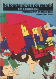
| 1 | 9 |
|
authors: Kidron, Michael ()/Segal, Ronald (1932-): - De toestand van de wereld; een politieke atlas (1981) [Uitgeverij Bert Bakker; Amsterdam; p.65 (maps)] -> - University Library Amsterdam ((English edition "The State of tyhe world")) : UB : Kaartenzl: I 2 C 14 - Erasmus University Library Rotterdam ((English edition "The State of tyhe world", 1981, there is also a revised 1995 edition)) : N 687 P 41 - Van Tijen Home/Amsterdam: |
22-04-2003 - 08-01-2004 tj.

| 1 | 12 |
|
authors: Kidron, Michael ()/Smith, Dan (): - -> - University Library Amsterdam (English edition: "The war atlas : armed conflict, armed peace", 1983; no lending.) : UB : Kaartenzl: V 1 C 17 - Mediatheek Hogeschool Rotterdam: WIJNHAVEN 399.22 KIDR - Van Tijen Home/Amsterdam: |
22-04-2003 - 08-01-2004 tj.
In this atlas, within the limits of available information, we have set out to depict the global reach of the international military order. We record the wars since 1945, nearly three hundred of them, and their outcomes. We show something of the preparations and potential of a future war. We show the distribution of military hardware and people, the networks of bases and communication stations, the political division of the world, the uses of armed force short of war. The atlas depicts the economic, industrial and commercial aspects of the international military order-military spending, production and trade - and the hierarchy of power which they reveal. We show something of the political and ecological effects of all this activity, and of the growing opposition to it. But the international military order is not just a dangerous and unstable equilibrium between states. It is based on conditions within states, where power devolves on those who translate its spirit of universal siege into domestic policies. It reinforces the most regressive aspects of each national society. Waste on a colossal scale, centralised power, inaccessible hierarchies and overblown bureaucracies are complemented by mutual fear and hostility, the glorification of violence, the disabling of dissent and the curtailing of freedom and human dignity. None of these is new. but all owe their contemporary severity to the international military order.
[p.2, introduction by the authors; Kidron ()]
Yet it is not possible to depict with any authority the effects of the international military order on the lives, behaviour and intentions of the mass of people who have no power within it. Little can be said in the format of an atlas about the way armed force is used to organise ethnic and class divisions, or about the way thos.e divisions are used to organise armed force. Still less is known about the lives of women, largely excluded from the military even as their gender stereotypes are included in its ideology. It is beyond our reach to map the relationship between state violence and the distancing of women from power, or men from routine childcare. The problem is that there is an information order serving social and international power. If knowledge is power, control of information enhances it. Ignorance is weakness, not bliss. That is why the majority of people are hidden from history. That is why the most revealing information is regularly the least available. The control, deployment and, ultimately, the content of information reflect the interests of those who control and deploy social resources. Military information is an extreme case. Invariably incomplete, it reflects the specialist view of specialised fighting machines as well as their secretiveness. What we show in this atlas is what is known, not what /s. As a result, the atlas very often depicts expressions of military power rather than its reality. -It is particularly striking that, for most wars since 1945, there is little reliable information on the numbers of people killed, injured and displaced.
[p.2, introduction by the authors; Kidron ()]
| 1 | 18 |
|
author: Neurath, Otto (1882-1945): - De moderne mensch onstaat. Een reportage van vreugde en vrees (1940) [N.V. Noord-Hollandsche Uitgevers Maatschappij; Amsterdam;p.159] -> - University Library Amsterdam (testen maar) : UBM: FG 386 - International Institute of Social History Amsterdam (IISG): 366/37 - Erasmus University Library Rotterdam: 427 B 20 - Koninklijke Bibliotheek (Royal Library) Den Haag ("Modern man in the making" English version 1939) : 875 A 62 - Van Tijen Home/Amsterdam: |
15-11-2003 - 08-01-2004 tj.

| 1 | 15 |
|
author: Rado, Alex (1899-1981): - Atlas fur Politik Wirtschaft Arbeiterbewegung : I der Imperialismus (1930) [Verlag fur Literatur und Politik; Wien/Brlin; p.168] -> - University Library Amsterdam (reprint from 1980; the original edition from 1930 should be available also but for some reason the catlogue says "not avaiolable") : � UB : Kaartenzl: Zl I 3 D 48 - University Library Amsterdam ("deckname Dora" an autobiographie of Rado about his time of a spy for the Soviet Union in the Second World War published in 1971, the Hungarian edition came out 5 years later. The book also describes why and how he started to be interested in cartography and be involved with the Bolsjewist party. The book has been publsihed during the Hungarina Kadar regime and bears many traces of self-censorhsip and party palavers.) : UBM: P 74-2732 - Van Tijen Home/Amsterdam: - 1spy, hosted by Angelfire (This is a website specialized in spy history and is a good on-line starting point for Rado's activity as a spy, which was enhanced by his great abilities as a cartographer) http://www.angelfire.com/... - Cartography.org (reminisences of an old cartographer about Rado) http://www.cartography.org.uk/... |
The style of this atlas, with fat lines, a few colors: black and red, hatched areas, and simple icons, made to visualize complex data for a general public, stems from a 'science and art movement' known under the name of 'Proletkult' (Proletcult). This movement began before the Russian Revolution of 1917 its chief inspirator was Alexander Bogdanov, who had a vision of the working together of a proletarian art and science, and has been influential in the early beginnings of the Bolsjewist party, with an "ultra-left" movement that wanted to break with all bourgeois culture. This radical novement soon was to be muffled by some manouvres of comrade Lenin and had to make way, slowly, for a different style that got to be known as 'social realism'. In hindsight we can see that the 'proletkult' movement was more the idea that left wing intellectuals had of what the proletariat should be than a genuine workers class initiative. The ideas of the unity of science Bogdanov and "proletarian" forms of culture do relate to similar ideas, in quiet a different context. This was in Vienna where Otto Neurath became an active propagator for a new 'unity of science' and also developed communication systems to help people in understanding society and thus become active actors in it. Neurath's statistcal schemes and maps, later named 'isotype', where meant as a start of a new visual language that would be the carrier of change and part of a new non-imperialistic internationalism. Neuarath has been working in Moscow for a short while in the thirties, being invited by the Communist Party. he helped setting up a bureau to map social changes and advances, but left soon enough, before Stalinist terror halted all such progressive ideas. if Rado and Neurath ever met is still something I like to research. It could well be, as both Neurath and Rado had been involved as young man in short lived Council republics in the year 1919. Neurath in the Republic. Both had at that time to fear for their lives.
The style of Rado's atlas pages (drawn by K. Metzler and with a binding designed by John Heartfield) was, in retrospect, not just typical for left-wing communists, but can be seen also in some of the popular map materials produced by Nazi and fascist organizations, or British and American "imperialists" of the time. These are maps that are strongly suggesting that there is only one way to read them, they tend not to have any level of multiple interpretation. These are iconic devices rather than analytical tools. I refrain here from using the word "propaganda" that would be too easy, because as we can read in other examples of mapping shown on these webpages, maps always have some sort of power function, maps can not be made without "a point of view".
I have added a few words from the introduction (in German) to the atlas by Th. Rothstein () written in 1929 in Moscow.
22-04-2003 - 08-01-2004 tj.
Geographie als wirtschaftspolitischen Disziplin
s vor mehr als hundert fahren Hegel den Satz von der Geograpme als Unterlage der Weltgeschichte pr�gte, ahnte er gewi� nicht, da der ersten H�lfte des zwanzigsten Jahrhunderts die geographische Wissenschaft noch immer einen rein beschreibenden Charakter tragen und dem Studierenden nicht viel mehrmals ein endloses Register ^on St�dten, Bergen, Fl�ssen usw. ohne irgendwelche geschichtlichen, wirtschaftlichen oder weltpolitischen Zusammenh�nge bieten wird. Jedoch ist dies der Fall. W�hrend selbst die Geschichtswissenschaft, in den H�nden der b�rgerliehen Gelehrten freilich noch immer ein recht kl�gliches Gesch�pf, schon weit �ber die reine Chronik mit ihrer naiven Aufz�hlung von allerlei Ereignissen hinaus ist und nach tieferen Zusammenh�ngen und philosophischen Verallgemeinerungen sucht, macht die Geographie Ausfl�ge in dieGebiete der Astronomie Geologie Meteorologie und gar des des Staatsrechts, bleibt aber immer an der blo�en Beschreibungsmethode kleben und wei� nicht einmal die Frage deutlich zu beantworten, wozu sie eigentlich diene. (...)
in letzter Zeit macht sich schon selbst unter den Geographen eine Bewegung gegen die Fruchtlosigkeit ihrer Wissenschaft bemerkbar, eine Bewegung, die Geographie und Geschichte unter dem Namen �Geopolitik" zusammenzukoppeln versucht. Die Bewegung ist zu begr��en, der aus ihr entstandene Versuch ist aber von zweifelhaftem Wert. Er f�hrt zu allerlei phantastischen Theorien und Auslegungen, weil das wirtschaftliche Mittelglied dabei ausgelassen und die alte Vorstellung von der unmittelbaren Einwirkung des Naturmilieus auf die menschliche Gesellschaft aufgefrischt wird. Indem sich diese Schule manchmal als eine dem Marxismus nahestehende ausgibt, ist sie in Wirklichkeit ihm so fremd wie nur eine. Eine wahrhaft wissenschaftliche Geographie wird sich unbedingt nur im engsten Zusammenhang mit dem Studium der Wirtschaft aufbauen lassen, und das bedeutet, da� sie sich nur dann zu einer Sozialwissenschaft entwickelt und als wirkliche wissenschaftliche Disziplin Fr�chte tr�gt, wenn sie marxistisch, also auf Grund des historischen Materialismus behandelt wird. Es ist daher kein Zufall, da� gerade in dem Lande, wo mit dem Proletariat auch seine marxistische Ideologie zur Herrschaft gelangt ist, die Geographie allm�hlich zu einer wirtschaftspolitischen Disziplin wird.
[p.5, Vorwort T.H. Rothstein; Rado (1930) Atlas fur Politik Wirtschaft Arbeiterbewegung]
sich ein anschauliches Bild des Imperialismus machen
So ist es ein �u�erst fruchtbarer und origineller Gedanke gewesen, von dem sich A. Rad�, ein vortrefflicher Geograph und Marxist, bei der Herausgabe des vorliegenden Atlasses leiten lie�. Ajlanten sind geographische Dinge und sollen nichts anderes sein. In diesem Falle aber haben wir eine neue Geographie, eine Geographie des Imperialismus, die f�r "die Arbeiterklasse unendlich belehrender und interessanter sein d�rfte als die �blichen Atlanten der "b�rgerlichen Wissenschaft". Auch f�r A. Rado ist die Geographie eine lebendige Unterlage der Geschichte, die er speziell f�r das Zeitalter des Imperialismus kartographisch veranschaulichen wollte. Wir glauben, der Versuch ist ihm gelungen. Der moderne Imperialismus, diese Verquickung von kapitalistischer Politik mit kapitalistischer, und zwar vom Finanzkapital be- herrschter Wirtschaft, beginnt erst ungef�hr um die Mitte der siebziger Jahre des vergangenen Jahrhunderts, aber schon bald nach der Jahrhundertwende umfa�t er die gesamte kapitalistische Welt und ruft tausend Gegens�tze hervor, die, sich um den deutsch-englischen Gegensatz knstallisierend, allm�hlich zum Weltkrieg und zu einer neuen Weltverteilung f�hren. Nach dem Weltkrieg, der den Krieg ein f�r allemal aus der Welt schaffen sollte, ist der Imperialismus erst recht die weltbeherrschende Macht geworden und hat neue, noch zahlreichere und noch tiefere Gegens�tze in der kapitalistischen Welt geschaffen, die mit elementarer Gewalt zu einer neuen, noch f�rchterlicheren Kriegsentladung treiben. Der tiefste und grunds�tzlichster mit keinen"Mitteln �berbr�ckbare Gegensatz ist nat�rlich der Gegensatz zwischen der gesamten kapitalistischen Welt, der Verk�rperung des Imperialismus, und der Sowjetunion, dem Staat, in dem das Proletariat herrscht, der die verk�rperte Verneinung des Kapitalismus und des Imperialismus ist. (...)
All diese Widerspr�che, die als potentielle Kriegsherde zu betrachten sind, hat Rado in seinen Karten dargestellt, und jeder Arbeiter kann sich dadurch von den verbrecherischen Treibereien des Imperialismus ein anschauliches Bild machen, um - nach dem ber�hmten Wort von Marx - die Geheimnisse der internationalen Staatskunst besser zu entr�tselnde, die diplomatischen Streiche der Regierungen leichter zu �berwachen und n�tigenfalls mit allen zu Gebote stehenden Mitteln ihnen entgegenzutreten.
[p.5-6, Vorwort T.H. Rothstein; Rado (1930) Atlas fur Politik Wirtschaft Arbeiterbewegung]
der Atlas den k�mpfenden Proletarier empfohlen
Endlich entschleiert Rado in einer Reihe von Karten die "Unterlage" der Geschichte, wie sie wirklich ist, und zwar als einen wirtschafliehen Faktor. Die St�dte, die Berge, die Fl�sse und selbst die L�nder haben keinen Sinn und kein Interesse f�r den Stidierenden, wenn sie nicht zur selben Zeit der Ausdruck von wirtschaftlichen Werten sind. Schaut man sich den Kaukasus mit seinem Oel und seinem Mangan an, so begreift man leicht warum Herr Deterding, das Haupt des Oeltrusts Shell, Aufst�nde in diesem Gebiet anstiftet. Oder man schaue sich die chinesisehen Kohlen- und Eisenfelder an: dann begreift man, warum Japan die sch�ne Landschaft und das Klima dieses Landes so sehr liebt. Diese wirtschaftsgeographischen Karten sind �u�erst wertvoll: H�rt man von einem neuen Vorsto� einer imperialistischen Macht in irgendeinem Weltteil, so schlage man den Atlas auf und studiere seine �konomischen Reicht�mer. Man wird dann schon begreifen, um welche �heiligen G�ter" es sich dabei handelt. Wir hoffen, der Atlas wird dazu beitragen, eine tiefere Einsicht in das Wesen und das Handeln des Imperialismus zu gew�hren, und in diesem Sinne wollen wir dieses Werk dem k�mpfenden Proletarier empfehlen.
Moskau, Dezember 1929. T H. ROTHSTEIN.
[p.6; Rado (1930) Atlas fur Politik Wirtschaft Arbeiterbewegung]
| 1 | 9 |
|
author: Tijen, Tjebbe van (1944-)/Baanders, bert ()/Bosshard, Antonia (): - Andere informatiebronnen over milieu, techniek en samenleving : van de eerste tot de vijfde wereld (1984) [Ekologische uitgeverij/Tool; Amsterdam; p.432; 18cm] -> - University Library Amsterdam: UB : Informatiecentrum: 304.20 R - Erasmus University Library Rotterdam: 603 C 34 - Erasmus University Library Rotterdam: 603 C 34 - Van Tijen Home/Amsterdam: |
A translation of the map captions in English will be available soon.
17-12-2003 - 08-01-2004

|
author: White, Matthew (): - Historical Atlas of the Twentieth Century (1998-2003) -> - Matthew White's Homepage http://users.erols.com/... |
The Short A: No one in particular, and never trust any information without double checking.
The Long A: My academic credentials are pretty slim -- a couple of years of college and that's about it. I'm not a university professor or anything like that, and I currently earn my living as a librarian.
On the other hand, most of the information here is public knowledge, and you can easily confirm most of my facts with a minimum of research.
Also, frankly, very little history is undisputed fact anyway. Most history is debatable interpretation of fact. On these pages, I'm offering you my interpretations, but obviously you should study other interpretations before you make up your own mind.
Basically, I'm not out to convince you of anything, so you don't have to believe me if you don't want to. I created this page for my own benifit. Maintaining an online atlas gives my research structure and direction. It brings up questions that I can then seek answers to, and let's face it, questions are always better than answers. I would hope that you come away from this site with fascinating questions rather than smug answers. It's the only way to learn.
White's interests are wide... which can be deducted from the impressive link page to other historical map sites that is part of this site.
08-01-2004 - 08-01-2004

| 1 | 25 |
|
authors: Rekacewicz, Philippe (1960-)/a.o.: - Le Monde Diplomatique : Cartographie/Maps (1990-2003) [Le Monde diplomatique; Paris; on-line collection of maps published in this monthly magazine] -> - Le Monde Diplomatique http://MondeDiplo.com/... - Global Resource Information Database, United Nations Environmental Programin Arendal Norway (GRID-Arendal/UNEP) (Philippe Rekacewicz works as a cartographer 8 years for GRID-Arendal and 15 years for Le Monde Diplomatique. here a short biography can be found and also links to the interesting cartography examples produced by this Norwegian organization.) http://www.grida.no/... |
10-12-2003 - 08-01-2004 tj.
maps are eminently political objects
�The cartographer lives at the ambiguous interface of exact science and art.� - Jean-Claude Groshens. A map, which is a minute representation of vast territories, is a truncated picture of reality. It is a lie by omission. Representation by symbols always means sacrificing information. Not everything that happens over an area of hundreds of thousands of square miles can be contained on a sheet of paper. The cartographer selects the items he wishes to represent on theoretical grounds. His job is to synthesise, simplify and omit, and his final product is a filtered document. Aspects that may be important - but are more usually considered secondary or superfluous - are removed. The map is simplified to make it legible. In so doing, the author imbues it with his own vision of the world and his own priorities. Maps are subject to all kinds of manipulation, from the crudest to the most subtle. They are eminently political objects, and governments rightly consider them an effective propaganda tool. A few examples from the Arab world will serve to illustrate this. The day after the invasion of Kuwait by Iraqi troops, Saddam Hussein appeared on television with a new official map on which Kuwait was shown as a province of Iraq. He claimed that geography proved he was right: Kuwait, situated at the mouth of the Tigris and Euphrates, was a �natural part� of Iraq. For many years the Moroccan government censured all publications containing maps that distinguished between Morocco and former Spanish Sahara. Even a dotted line between the two territories was enough for the publication to be banned. In Arab countries, the mere mention of the name �Israel� on a map was sufficient cause. Either the word was replaced by Palestine, and Israel disappeared from the index, or a graphic item was conveniently placed over the offending country. The matter was so sensitive that the commercial departments of French school publishing houses intervened directly with the editors of text-book series to impose an acceptable representation of Morocco and the Middle East and thus avoid the loss of valuable markets in the French-speaking countries of North Africa. The depiction of political frontiers is a risky business. It would be wrong to think there are �official� versions of the world�s political divisions. Even the cartography departments of certain United Nations agencies are careful to state on their maps that they bear no responsibility for the depiction of borders, which are indicative only. To avoid offence, the World Bank recently �advised� its cartographic department not to produce maps of the Indian sub-continent on which the Kashmir region figured too prominently. The varying national and international views of territory give the map-maker only too great a choice. China seen by the Chinese does not coincide with China seen by the Indians. But cartography is more than the tracing of borders. It is also a picture of the relations between people and territory. Maps enable us to comprehend at a glance how territory is organised and occupied, and the extent and consequences of conflicts. Not until a map was made of the Great Lakes region at the end of 1994 after the Rwandan genocide did we realise that terrified populations had fled hundreds of miles through the bush before being settled in refugee camps. The historical dimension also adds to our understanding. African issues cannot be grasped properly without maps of the colonial period. Similarly, the present division and spread of the major ethno-linguistic families can only be understood with the help of maps of the great empires of the past. This dual approach, geographical and historical, sharpens our understanding of the major issues of the present day. It can help us to be a little less mistaken when we come to assess their significance. Maps let us view territorial, economic and political developments from the necessary distance. They set the stage and position the actors, helping us to ask the right questions rather than giving us the answers. They require us not to jump to conclusions, since the connections between the phenomena shown on a map are rarely straightforward. A published map is a complex, subjective message offered by an author to his readers. It has to be read in a clear-headed and critical manner. Philippe.Rekacewicz@Monde-diplomatique.fr.

| 1 | 10 |
|
author: Attie, Shimon (): - The writing on the wall : projections in Berlin's Jewish quarter (1994) [Edition Braus; heidelberg; pnot paginated;; 24/30 cm] -> - Van Tijen Home/Amsterdam: |
27-08-2003 - 08-01-2004 tj.

| 1 | 18 |
|
author: Jaar, Alfredo (1956-): - Let there be light : the Rwanda project 1994-1998 (1998) [exhibition catalogue Centre d'Art Santa Monica, Barcelona & Koldo Mitxelena, San Sebastian; unpaginated (p.240)] -> - Koninklijke Bibliotheek (Royal Library) Den Haag (can be consulted only in the library) : 4134600 depotexemplaar - Van Tijen Home/Amsterdam: - Le Mois de la Photo Montreal (a short discourse by Alfredo Jaar during an exhbition in 2001 "Inferno and Paradiso"; French spoken; Quicktime movie) http://www.moisdelaphoto.com/... - Universes in Universe: international art processes (Documenta 11 -2002 - installation by Alfredo Jaar "Lament of the Images") http://www.universes-in-universe.de/... |
21-11-2003 - 08-01-2004 tj.
images that compel us to acceptance
Rwanda, Rwanda, Rwanda. The name now calls forth a flood of images: corpses clogging the Kagera River, bloated and bleached white, collected like driftwood at the base of a falls; dismembered bodies scattered in a churchyard, under a glowing white statue of Christ the Savior, lifting his arms in benediction; and the gray squalor of the refugee camps, with emaciated children turning their huge eyes to the cameras. These were the images that appeared in newspapers around the world as the genocide occurred in Rwanda. The images were put there to illustrate news stories, but in the end they acted independently. The truth is, no one read the news stories. If they had read them, they would have demanded that something be done to stop the killing. They didn't read them. But they did look at the images. Why didn't they respond to these images with outrage, and demand political action? It is partly because the politics of images, the way they are organized, has changed, and this has acted to erode their power and effectiveness. Filmmakers have been pointing to this erosion for years. So have the best photographers. But there has always been something about "real pictures" of real violence that undercuts their political effect, and separates them from experience. In his short essay "Shock-Photos," Roland Barthes addressed this lack of effect. "It is not enough for the photographer to 'signify' the horrible for us to experience it," he wrote. These images, intended to convey horror, fail to do so "because, as we look at them, we are in each case dispossessed of our judgement: someone has shuddered for us, reflected for us, judged for us; the photographer has left us nothing�except a simple right of intellectual acquiescence. . ." Such images do not compel us to action, but to acceptance. The action has already been taken, and we are not implicated. Our complicity is concealed, intact. "The perfect legibility of the scene, its formulation dispenses us from receiving the image in all its scandal; reduced to the state of pure language, the photograph does not disorganize us."(1) We are not disorganized because news images operate within a perfectly organized rhetoric of consumption, the pure language of the spectatorship under which we now live. Images of suffering and misery elsewhere in the world are used as reminders of what we are free from. They operate in the greater image environment of consumption to offset images of contentment, to provide the necessary contrast. Their use value, and their effect, is palliative. This effect is far-reaching, and one of the histories thus buried was that of Rwanda. 1 Roland Barthes, "Shock-Photos," In The Eiffsl Tower and Other Mythologies, translated by Richard Howard (New York: Hill and Wang, 1979), pp. 71-72.
[p.2 pf article at one third of the unpaginated catalogue by David Levi Strauss "A sea of griefs is not a proscenium, on the Rwanda project of Alfredo Jaar"; Jaar (1998) Let there be light]
a state-sponsered genocide just in a hundred days
The story of what happened in Rwanda in 1994 is one of massive criminality and complicity. It is the story of a state-sponsored genocide that took years to plan and direct, but only 100 days to carry out, as the rest of the world looked on. It constitutes the third genocide of this century, following that of the Armenians by the Turks of the Ottoman Empire in 1915 and 1916, and that of the Jews by the Nazis during the Second World War.
[p.2 ibid; Jaar (1998) Let there be light]
killed like cockroaches
Since it is often difficult to tell Hutu from Tutsi by sight, death lists had been prepared using the identity cards first issued during the colonialist period, listing the ethnicity of each bearer. Hutu youths were formed into militias, called the Interahamwe ("those who fight together"), and were armed. When Habyarimana's (the rwanda president tj.) plane was shot down on April 6, 1994, the Hutu leadership blamed the Tutsi-led RPF for his death (it has since been alleged that the President's plane was actually shot down by the Hutu extremists themselves, perhaps with the assistance of French soldiers (4), and unleashed the Interahamwe to begin slaughtering Tutsis. Using the identity lists, the militiamen began to pull Tutsis from their homes and stop them at roadblocks, and government officials in the provinces lured Tutsis into churches and community centers, where they were stabbed, clubbed, and hacked to death. One survivor of the Ntarama slaughter, a child of 12 named Mutaganzwa, said, "They told us we were inyenzi (cockroaches), and then they began to kill us." (5) Tutsi women were raped, tortured, and mutilated before being killed.
4 Raymond Bonner, "Behind Rwanda's Disaster: A Plot by Extremist Hutu?" The International Herald Tribune, November 14, 1994.
5 Donatella torch, "Children's Drawing* Tell Horror of Rwanda In Colors of Crayons," The New York Times, September 16, 1994.
[p.3 ibid; Jaar (1998) Let there be light]
refugee camps comtrolled by leaders of genocide
The genocide in Rwanda required extensive planning, organization, and single-minded execution. It also required the complicity of the world outside of Rwanda. Given the speed with which the genocide was conducted� 1 million people in 100 days; 10,000 murders per day� any response from outside would have saved thousands of lives. Two weeks into the slaughter, the Canadian commander of the U.N. forces in Rwanda said he could end the genocide with five to eight thousand troops. Most military leaders now agree that the genocide could have been stopped in two or three days with a few thousand properly armed troops (since the Hutu militias did not have heavy artillery, and were cowards) (6).
But when the U.N. began to mobilize an interdictory force to stop the killing, the U.S. and Belgium pressured the U.N. to instead 'reduce' the number of their troops in Rwanda, from 2500 to 270 men, who were then left in Kigali with no recourse but to stand around and watch it happen. And in May 1994, a U.N. plan to send 5000 African troops into Rwanda also collapsed because the U.S. opposed it. When it was finally authorized, the mobilization was held up for months while the U.S. dickered with the U.N. over the rental fee on U.S. armored personnel carriers needed for the intervention to proceed.(7)
The French government, which had supported and armed the Rwandan government troops, finally sent their troops in only after the genocide was over, and the invading RPF troops were driving the Hutu government army and militias out of Rwanda. The million massacred Tutsis were replaced nearly one-to-one by returning refugees. But the French ended up protecting and providing official sanctuary for the fleeing Hutus. When the killers fled, they led 2 million of their fellow Hutus out in a mass exodus. Fifty thousand of them died of disease, hunger, and lack of water. At that time, the international community, moved by pictures of refugees on the run, swung into action, providing massive humanitarian aid to the Hutus who had fled to Zaire. The refugee camps in Zaire were controlled by the political and military leaders of the genocide. Under international "humanitarian" protection, and with the support of Mobutu of Zaire, the Interahamwe began to regroup.
6 The commander of a French marine unit. Lieut. Col. Erik d. Stabenrath, said of the militias. They were very courageous when they were killing people who could not defend themselves." Raymond Bonner, "With French Exit Near, Rwandans Fear the Day," The New York Times, August 9, 1994.
7 Michael R. Gordon, "U.S. to Supply 60 Vehicles for U.N. Troops in Rwanda," The New York Times, June 16, 1994.
[p.4 ibid; Jaar (1998) Let there be light]
the capital city was completely devasted
The Rwanda Projects
In August 1994 Alfredo Jaar went to Rwanda to see with his own eyes what had happened there. Accompanied by his friend and assistant Carlos Vasquez, he flew from Paris to Kampala and, after spending two days in Uganda, proceeded overland to Kigali, Rwanda. The capital city of Kigali, the epicenter of the genocide, was completely devastated. There was no power, no water, no services, and little food. The Hutu militias had fled to the Zairean border. The RPF, formed mostly of Tutsi refugees returning from Uganda, was in control. The Tutsi dead far outnumbered the living in Kigali, and'the few survivors all bore the mark of the miraculous. With assistance from the U.N., Jaar and Vasquez began to meet people and to hear their stories. One day, Jaar came upon an inoperative post office and bought up the last of their postcards. The cards, which had been produced at some point bv the Rwandan Office of Tourism (and sponsored by the Belgian airline Sabena), all had the same slogan emblazoned across the top: "Rwanda� Decouvrez 1000 merveilles, au pays des 1000 collines" (Rwanda�Discover 1000 marvels in the land of 1000 hills). On the reverse they carried tourist pictures of the wildlife in Akagera National Park�impalas, zebras, eagles, and lions�and beautiful mountain vistas of Kibuye and Gisenyi or the serene skies over Lake Kivu. One postcard showed dancers in full regalia, with long white headdresses and beads. Jaar began to collect the names of the survivors he met in Kigali and write them on the postcards in this way;
JYAMIYA MUHAWENIMAWA IS STILL ALIVE!
EMMANUEL RUCOGOZA IS STILL ALIVE!
CARITAS NAMAZURU IS STILL ALIVE!
Then he addressed the postcards to his friends and colleagues in other parts of the world. Twentyfive to thirty people received over 200 postcards. Since there was no postal service left in Rwanda, he mailed the cards from Uganda on his way out.
[p.8 ibid; Jaar (1998) Let there be light]
futility of a gaze that arrives too late
Jaar took photographs wherever he went in Rwanda, and they numbered over 3000 by the the end of the trip. There were times when the camera acted as a welcome buffer, an intermediary between himself and the all too unmediated things he was looking at. At other times, it seemed superfluous and altogether inadequate, reminding him only of "the futility of a gaze that arrives too late." In a later interview, Jaar reflected back on this time:
For me, what was important was to record everything I saw around me, and to do this as methodically as possible. In these circumstances a 'good photograph' is a picture that comes as close asj)ossible to reality. But the camera never manages to record what your eyes see, or what you feel at the moment. The camera always creates a new reality. I have always been concerned with the disjunction between experience and what can be recorded photographically. In the case of Rwanda, the disjunction was enormous and the tragedy unrepresentable. This is why it was so important for me to speak with people, to record their words, their ideas, their feelings. I discovered that the truth of the tragedy was in the feelings, words, and ideas of those people, and not in the pictures." (25) When Jaar returned to New York, he found that he could not look at the photographs he had taken in Rwanda. It would be almost two years before he found a way to bring them into his work. 25 Ruben Gallo, "Representation of Violence, Violence of Representation," Trans 3/4, p. 57.
[p.9 ibid; Jaar (1998) Let there be light]

| 1 | 20 |
|
author: Young, James Edward (): - The texture of memory : Holocaust memorials and meaning (1993) [Yale University Press; New Haven , Conn ., etc.; p.389; 27 cm] -> - University Library Amsterdam: UBM: RON 3934 - Amazon.com product information with digital facsimile of: cover, colophon, chapters, intro-pages, excerpt, index, back-cover http://www.amazon.com/... |
01-12-2003 - 08-01-2004 tj.
i what might be called "biographies" of Holocaust memorial sites, I hope reinvigorate otherwise amnesiac stone settings with a record of their own lives in the public mirid, with our memory of their past, present, and future. All of which is meant to expand the texts of these memorials to include not only their conception and execution among historical realities, but also their current and changing lives, even their eventual destruction. This is to draw back into view he very process, the many complicated historical, political, and aesthetic axes, on which memory is being constructed. For neither memory nor Intention is ever lonolithic: each depends on the vast array of forces�material, aesthetic, spatial, deological�converging in one memorial site. By reinvesting these memorials with the memory of their origins, I hope to highiight the process of public art over its often statte result, the ever-changing life of the monument over its seemingly frozen face in the landscape.
[p.x; Young (1993) The texture of memory]
Counting sites throughout Germany, Austria, Holland, France, Poland, Israel, and America, it seems likely that �s many people now visit Holocaust memorials every year �s died during the Holocaust itself. Year in and year out, millions of Holocaust "pilgrims" have stood in these sites to remember, each one taking away a different experience of that moment, a unique memory. The estimated number of visitors per year at some of the best-known memorial sites include: 750,000 at Auschwitz; 900,000 at Dachau; 600,000 at the Anne Frank House in Amsterdam; 300,000 at Majdanek; 1,250,000 at Yad Vashem in Jerusalem; 200,000 at Lohamei Hagetta'ot in northern Israel.
[p.x; Young (1993) The texture of memory]
One of the problems with ascribing psychoanalytic terms to the memory of groups is the consequent tendency to see all the different kinds of memory in terms of memory-conflict and strategies for lenial. If memory of an event is repressed by an individual who lacks the context�either emotional or epistemological�to assimilate it, that is one thing. But to suggest that a society "represses" memory because it is not in its interest to remember, or because it is ashamed of this memory, is to lose sight of the many other social and political forces underpinning national memory. One might speak figuratively of Israel's early repression of traumatic memory too painfui to bear, or of Germany's denial of crimes inconsistent with its self-idealization. But ultimately, I believe it will be more fruitfui to examine the many other socially dynamic forces at play in the ways entire cultures, nations, and peoples publidy recall the Holocaust. act, one of my aims is to break down the notion of any memorial's "collective memory" altogether. Instead, I prefer to examine "collected memory," the many discrete memories that are gathered into common memorial spaces and assigned common meaning. A society's memory, in this context, might be regarded �s an aggregate collection of its members' many, often competing memories. If sociies remember, it is only insofar �s their institutions and rituals organize, shape, even inspire their constituents' memories. For a society's memory cannot exist outside of those people who do the remembering�even if such memory happens to be at the society's bidding, in its name. For even though groups share socially constructed assumptions and values at organize memory into roughiy similar patterns, individuals cannot share another's memory any more than they can share another's cortex. They share instead the forms of memory, even the meanings in memory generated by these forms, but an individual's memory remains hers alone. By maintaining a sense of collected memories, we remain aware of their disparate sources, of every individual's unique relation to a lived life, and of the ways our traditions and cultural forms continuously assign common meaning to disparate memories. It is the difference between unified memory and unified meaning for many different kinds of memory. We will not speak of the collective memory in these memorials, but of the collective meaning passed down from one generation to the next in our national traditions, rituals, and institutions.
[p.xi-xii, Preface by author; Young (1993) The texture of memory]
By themselves, monuments are of little value, mere stones in the landscape. But �s part of a nation's rites or the objects of a people's national pilgrimage, they are invested with national soul and memory. For traditionally, the state-sponsored memory of a national past aims to afnrm the righteousness of a nation's birth, even its divine election. The matrix of a nation's monuments emplots the story of ennobling events, of triumphs over barbarism, and recalls the martyrdom of those who gave their lives in the struggle for national existence�who, in the martyrological refrain, died so that a country might live. In assuming the idealized forms and meanings assigned this era by the state, memorials tend to concretize particular historical interpretations. They suggest themselves �s indigenous, even geological outcroppings in a national landscape; in time, such idealized memory grows �s natural to the eye �s the landscape in which it Stands. Indeed, for memorials to do otherwise would be to undermine the very foundations of national legitimacy, of the state's seemingly natural right to exist. The relationship between a state and its memorials is not one-sided, however. On the one hand, official agencies are in position to shape memory explicitly �s they see fit, memory that best serves a national interest. On the other hand, once created, memorials take on lives of their own, often stubbornly resistant to the state's original intentions. In some cases, memorials created in the Image of a state's ideals actually turn around to recast these ideals in the memorial's own Image. New generations visit memorials under new circumstances and invest them with new meanings. The result is an evolution in the memorial's signifi.nee, generated in the new times and Company in which it finds itself.
[p.2-3, Introduction by author; Young (1993) The texture of memory]
Public memorials, national days of commemoration, and shared calendars thus all work to create common loci around which national identity is forged. To the extent that all societies depend on the assumption of shared experience and memory for the very basis of their common relations, a society's institutions are automatically geared toward creating a shared memory�or at least the illusion of it. By creating the sense of a shared past, such institutions as national memorial days, for example, foster the sense of a common present and future, even a sense of shared national destiny. In this way, memorials provide the sites where groups of people gather to create a common past for themselves, places where they tell the constitutive narratives, their "shared" stories of the past. They become communities precisely by having shared (if only vicariously) the experiences of their neighbors. At some point, it may even be the activity of remembering together that becomes the shared memory; once ritualized, remembering together that becomes the shared memory; once ritualized, remembering :ogether becomes an event in itself that is to be shared and remembered.
[p.6-7, Introduction by author; Young (1993) The texture of memory]
In keeping with the bookish, iconoclastic side of lewish tradition, the first "memorials" to the Holocaust period came not in stone, glass, or steel�but in larrative. The Yizkor Bikher�memorial books�remembered both the lives and destruction of European Jewish communities according to the most ancient of Jewish memorial media: words on paper. For a murdered people without graves, without even corpses to inter, these memorial books often came to serve as symbolic tombstones: "The memorial book which will immortalize the memories of our relatives and friends, the Jews of Pshaytsk, will also serve as a substitute grave. Whenever we pick up the book we will feel we are standing next to their grave, because even that the murderers denied them."9 he scribes hoped that, when read, the Yizkor Bikher would turn the site of reading into memorial space. In need of cathartic ceremony, in response to what has been called "the missing gravestone syndrome," survivors thus created interior spaces, imagined grave sites, as the first sites for memory.10 Only later were physical spaces created.
[p.7, Introduction by author; Young (1993) The texture of memory]
While contemporary designs are welcomed by the artists and architects, critics and curators, however, they often run up against a wall not only of public bewilderment but also of survivor outrage. For many survivors believe that the searing reality of their experiences demands as literal a memorial expression as possible. "We weren't tortured and our families weren't murdered in the abstract," the urvivors complain, "it was real." In reference to his Warsaw Ghetto Monument, for example, the sculptor Nathan Rapoport once asked plaintively, "Could I have made a rock with a hole in it and said, 'Voila! The heroism of the Jewish people'?" Probably not. All of which raises the question of the dual roles of public and memory in public art: for, as becomes clear, not every work of public art is a monument, not every memorial a work of public art.
[p.9, Introduction by author; Young (1993) The texture of memory]
The fundamental dilemma facing contemporary monument makers is thus twosided and recalls that facing prospective witnesses in any medium: first, how oes one refer to events in a medium doomed to refer only to itself? And second, if the aim is to remember�that is, to refer to�a specinc person, defeat, or victory, how can it be done abstractly? For many who survived solely to testify to the Holocaust, memory and testimony are one: witness for these survivors entails the most literal transmission possible of what they saw and experienced. Since few survivors would regard themselves as witness to form alone, as became clear in the art recovered from the ghettos and camps, even artists of the avantgarde redefined their aesthetic task as testimonial realists.15 What has come to be regarded as "documentary" art and literature seemed to them the only mode in which evidence or witness could be delivered. But as historians and literary critics have come to accept the impulse in writers to testify in narrative, even they look beyond witness to the kinds of knowledge created in such writing, so might critical viewers of Holocaust memorials accept the parallel impulse in Holocaust memorial makers to testify through literal figuration�before turning to the ways that public memory is organized in such figures, In referring to the general condition of the world, an inner state of mind, broken trust in humankind, or even art's inability to represent the real, abstract forms still offer artists the widest possible variety of expression. Maya Lin's succinctly abstract Vietnam Veterans Memorial, for example, commemorates the nation's ambivalence toward the Vietnam War and its veterans in ways altogether unavailable in figuration.17 Instead of merely condemning the figurative mode as archaic and out of touch, however, we might acknowledge the need in public audiences for figuration, even as we recall the constructed nature of figurative iconography. In this way, we can keep monumental figuration from naturalizing itself, from putting a finish on its significance.
[p.11; Young (1993) The texture of memory]
People do not come to Holocaust memorials because they are new, cutting-edge, or fashionable; as the critics are quick to note, most of these memorials are none of these. Where contemporary art is produced as self- or medium-reflexive, public Holocaust monuments are produced specifically to be historically referential, to lead viewers beyond themselves to an understanding or evocation of events. As public monuments, these memorials generally avoid referring hermetically to the processes that brought them into being. Where contemporary art invites viewers and critics to contemplate its own materiality, or its relationship to other works before and after itself, the aim of memorials is not to call attention to their own presence so much as to past events because they are no longer present. In this sense, Holocaust memorials attempt to point immediately beyond themselves. In their fusion of public art and popular culture, historical memory and political consequences, therefore, these monuments demand an alternative critique that goes beyond questions of high and low art, tastefulness and vulgarity. Rather than merely identifying the movements and forms on which public memory is borne, or asking whether or not these monuments reflect past history accurately or fashionably, we turn to the many ways this art suggests itself as a basis for political and social action. That is, we might ask not only how the monument maker's era and training shaped memory at the time, and how the monument reflects past history, but, most important, what role the monument plays in current history. We might now concern ourselves less with whether this is good or bad art, and more with what the consequences of public memorial art are for the people. This to propose that, like any public art space, Holocaust memorials are neither benign nor irrelevant, but suggest themselves as the basis for political and communal action.
[p.12-13; Young (1993) The texture of memory]
On a more general level, we might ask of all memorials what meanings are generated when the temporal realm is converted to material form, when time ollapses into space, a trope by which it is then measured and grasped. How do memorials emplot time and memory? How do they impose borders on time, a facade on memory? What is the relationship of time to place, place to memory, memory to time? Finally, two fundamentally interrelated questions: How does a particular place shape our memory of a particular time? And how does this ;mory of a past time shape our understanding of the present moment? Through this attention to the activity of memorialization, we might also remind ourselves that public memory is constructed, that understanding of events depends on memory's construction, and that there are worldly consequences in the kinds of historical understanding generated by monuments. Instead of allowing the past to rigidity in its monumental forms, we would vivify memory through :he memory-work itself�whereby events, their recollection, and the role monulents play in our lives remain animate, never completed. In this light, we find that the performance of Holocaust memorials depends not on some measured distance between history and its monumental representations, but on the conation of private and public memory, in the memorial activity by which minds reflecting on the past inevitably precipitate in the present historical moment.
[p.15; Young (1993) The texture of memory]

| 1 | 25 |
|
editor: Young, James Edward ()/ Baigell, Matthew()//Golan, Romy () : - The art of memory : Holocaust memorials in history (1994) [Prestel; New York; p.194; 30 cm ; Publication on the occasion of the exhibition "The art of memory: Holocaust memorials in history ", held at The Jewish Museum, New York, March 13-July 31, 1994] -> - University Library Amsterdam (use within library only) : UBM ROG 528 - University Amsterdam: Institute 128 (can be lended) : CS 720 YOJ 1 - Van Tijen Home/Amsterdam (German version (Mahnmale des Holocaust, Motive, Rituale und Statten des gedenkens) : |
01-12-2003 - 08-01-2004 tj.
each memory depends on distance and forgetting
Monument and Memory in a Postmodern Age
Remembrance as a vital human activity shapes our links to the past, and the ways we remember define us in the present. As individuals and societies, we need the past to construct and to anchor our identities and to nurture a vision of the future. As readers of Freud and Nietzsche, however, we know how slippery and unreliable personal memory can be, always affected by forgetting and denial, repression and trauma, and, more often than not, serving the need to rationalize and to maintain power. But a society's collective memory is no less contingent, no less unstable, its shape by no means permanent and always subject to subtle and not so subtle reconstruction.
A society's memory is negotiated in the social body's beliefs and values, rituals and institutions, and in the case of modern societies in particular, it is shaped by such public sites of memory as the museum, the memorial, and the monument. Yet the promise of permanence a monument in stone will suggest is always built on quicksand. Some monuments are joyously toppled at times of social upheaval; others preserve memory in its most ossified form, either as myth or as cliche. Yet others stand simply as figures of forgetting, their meaning and original purpose eroded by the passage of time. Does it even make sense, however, to oppose memory to forgetting, as we so often do, with forgetting, at best, being acknowledged as the inevitable flaw and deficiency of memory itself? Is it not rather that, paradoxically, each and every memory inevitably depends both on distance and forgetting, the very things that undermine its desired stability and reliability but which, at the same time, are essential for the vitality of memory itself? Is it not a constitutive strength of memory that it can be contested from new perspectives, with novel evidence, from the very spaces it had blocked out? Given this selective and permanently shifting dialogue between present and past, we have come to recognize that our present will inevitably have an impact on what and how we remember. The point is to understand that process, not to regret it in the mistaken belief in some ultimately pure, complete, and transcendent memory. It follows that the strongly remembered past will always be inscribed into our present, from feeding our subconscious desires to guiding our most conscious actions. At the same time, this strongly remembered past may turn into mythic memory. It is not immune to ossification and may become a stumbling block to the needs of the present rather than an opening in the continuum of history.
[p.9, opening sentence of the introductory essay by Andreas Huyssen; Young (1994) The art of memory]
we suffer from an overload of memories
ow, then, do the technological media affect the structure of memory, the ways we perceive and live our temporality? As the visual media invade ever more aspects of political, cultural, and personal life, we may well want to ask what a postmodern memory would look like, memory ar a time in which the basic parameters of an earHer self-confident Western modernity have increasingly come under attack, in which :he question of tradition poses itself anew precisely because the tradition of moderlity itself is lacking in answers for our predicament. What of the institutions and sites h.at organize our social memory in the age of television? If we look at memory in the postmodern i98os, we are immediately struck not by signs of amnesia but, rather, by a veritable obsession with the past. Indeed, one might even speak of a memorial, or museal, sensibility that seems to occupy ever larger parts of everyday culture and experience. Liibbe has diagnosed this expansive historicism of our contemporary culture, claiming that never before has a cultural present been obsessed with the past to the same extent as Western culture was in the 1970s and i98os, when museums and memorials were being built as though there were no tomorrow. If you add to that the historicizing restoration of old urban centers; the :reation of whole museum villages and landscapes; the boom of flea markets, "retro" Fashions, and nostalgia waves; the obsessive self-memorialization through the camcorder, memoir writing, and confessional literature; and even the widespread artistic practice of quoting and citing, then the museum, in a broad sense, can be said to function as the key paradigm in contemporary postmodern culture. Far from suffering from amnesia, it seems, we suffer from an overload of memories and have too many museums. Even the monument, which after its nineteenth-century excesses in poor aesthetics and shamelessly legitimizing politics and which fell on hard times vith the advent of modernism (despite Gropius or Tadin), is experiencing a revival of sorts, clearly benefiting from the intensity of our memorial culture.
Critics who focus only on the loss of history, of course, would claim that the new museum and memorial culture of recent years betrays any real sense of history and as instead turned to spectacle and entertainment, thus giving only a postmodern gloss and destroying any real sense of time past, present, and future rather than nurairing it. Perhaps the fascination with the past is actually more than merely the compensatory, even fraudulent, side effect of a new, postmodern temporality which overs between the need for remembering and the fast track of forgetting. Perhaps it is to be taken seriously as a way of slowing down the speed of modernization, as an attempt, however fragile and fraught with contradiction, to cast lifelines back toward the past and to counteract our culture's undisputed tendency toward amnesia motivated by immediate profit and political expediency. The museum, the monument, and the memorial have, indeed, taken on new life after having been declared dead many times during the history of modernism. Their newly acquired prominence in the publics mind and their success in contemporary culture beg for an explanation. It is simply no longer enough to denounce the museum as an elitist bastion ofknowledge and power, nor is an older modernist critique of the monument exactly persuasive when monument artists have incorporated that very critique into their creative practices. Boundaries between museum, memorial, and monument have indeed become fluid in the past decade in ways that make the old interpretation of the museum as fortress for the few and of the monument as medium ofreification and forgetting strangely obsolete.
[p.11-12, opening sentence of the introductory essay by Andreas Huyssen; Young (1994) The art of memory]
a culture dominated by the fleeting image
One reason for the new-found strength of the museum and the monument in the public sphere may have something to do with the fact that both offer something that the television screen denies: the material quality of the object. The permanence of the monument and of the museum object, formerly criticized as deadening reification, takes on a different role in a culture dominated by the fleeting image on the screen and the immateriality of communications. I would like to suggest that it is the material reality of the object in the museum as it shapes and structures memory, the permanence of the monument in a reclaimed public space in pedestrian zones, in restored urban centers, or in preexisting memorial spaces that attracts a public dissatisfied with simulation and television channel switching.
[p.12, opening sentence of the introductory essay by Andreas Huyssen; Young (1994) The art of memory]
dialogical quality of memorial space
What, then, of the monument in this larger field of Holocaust representations and discourses? Clearly, the Holocaust monument is not part of the tradition of the monument as heroic celebration and figure of triumph. Even in the case of the monument to the Warsaw Ghetto Uprising, we face a memorial to suffering, an indictment of crimes against humanity. In contrast to the tradition of the legitimizing, identity-nurturing monument, the Holocaust monument must be considered, rather, as a kind of countermonument. The traditional critique of the monument as burying memory and ossifying the past has often been voiced against the Holocaust monument as well. Holocaust monuments have been accused oftopolatry," especially those constructed the sites of extermination. They have been reproached as betraying memory, with memory thought of as only internal and thus incompatible with the public externality of the monument. As a variation on Adorno, who, rightfully, was wary of the effects of aestheticizing the unspeakable suffering of the victims, it has been claimed that to build a monument to the Holocaust was itself a barbaric proposition: no monument after Auschwitz. Furthermore, in light of Fascist excesses with monumentalization, some have suggested that Fascist tendencies are inherent in all monuments.
All these critiques of the medium itself focus on the monument as object, as permanent reality in stone, as aesthetic sculpture. They do not, however, recognize the public dimension of the monument, what James Young has described as the "dialogical quality of memorial space." Certainly, we would nor be well served by the Holocaust monument as death mask or by an aestheticizing of terror. On the other hand, in the absence of tombstones to the victims, the monument can function as a substitute site of mourning and remembrance. How, after all, are we to guarantee the survival of memory if our culture does not provide memorial spaces that can help construct and nurture some collective memory of the Shoah? Only if we focus on the public function of the monument, embedding it in public discourses of collective memory, can danger of monumental ossification be avoided. The great opportunity of the Holocaust monument today lies in its intertextuality as but one part of our memorial culture. As the traditional boundaries of the museum, the monument, and historiography have become more fluid, the monument itself has lost much of its nature of permanence and fixity. The criteria for its success could therefore be the ways it allows for a crossing of boundaries toward other discourses of the Holocaust, the way it pushes us toward reading other texts, other stories.
[p.16, opening sentence of the introductory essay by Andreas Huyssen; Young (1994) The art of memory]
in frozen memory, the past is nothing but the past
No matter how fractured by media, geography, or subject position representations of the Holocaust are, ultimately, it all comes back to this core: unimaginable, unspeakable, and unrepresentable horror. Post-Holocaust generitions, it seems to me, can only approach that core by what I would call mimetic approximation, a mnemonic strategy which recognizes the event in its otherness and beyond identification or therapeutic empathy but which physically relieves some of the horror and the pain in the slow and persistent labor of remembrance. Such mimetic approximation can only be achieved if we sustain the tension between the numbing totality of the Holocaust and the stories of the individual victims, families, and communities. Exclusive focus on the former may lead to the numbing abstracon of statistics and the repression of what these statistics mean; exclusive focus on the latter may provide facile, cathartic empathy and may forget the frightening conelusion that the Holocaust as historical event resulted, as Adi Ophir has suggested, from an exceptional combination of normal processes. The ultimate success of a Holocaust monument would be to trigger such a mimetic approximation, but it can achieve that goal only in conjunction with other related discourses operating within the spectator and in the public sphere. (...)
But perhaps the dichotomy of forgetting and remembering again misses the mark. Perhaps postmodern culture in the West is itself caught in a traumatic fixation on an event which goes to the heart of our identity and political culture. In that case, the Holocaust monument, memorial, and museum could be the tool Franz Kafka wanted literature to be when he said that the book must be the ax for the frozen sea within us." We need the book and the monument to keep the sea from freezing. In frozen memory, the past is nothing but the past. The inner temporality and the politics of Holocaust memory, however, even where they speak of the past, must be the future.
[p.16-17, opening sentence of the introductory essay by Andreas Huyssen; Young (1994) The art of memory]
a verbal iconography of different words
For our purposes, the Holocaust is defined as the calculated mass murder and internment of Jews and other groups (including Poles, the tribes of Sinti and Rom, Soviet prisoners of war, political prisoners, and homosexuals) by the German Nazi state during World War II. Because every nation, every culture, recalls events according to its own traditions, experiences, and political understanding, however, we have opened this exhibition with a comparative look at the very names by which this period is remembered in different lands. That is, before recalling events, national groups had to call events something: what is remembered as Shoah Vegvurah (catastrophe and heroism) in Israel was remembered in the Soviet Union as the Great Patriotic War what is called the Nazi-Zeit in Germany is recalled as an era of national martyrdom in Poland. By highlighting differences among the literal, plastic shapes of the words themselves, we introduce a verbal iconography of Holocaust memory that is as disparate and various as the memorials themselves.
[p21, The Art of memory, James E. Young; Young (1994) The art of memory]